Raglesville, Indiana facts for kids
Quick facts for kids
Raglesville, Indiana
|
|
|---|---|

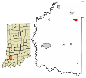
Location of Raglesville in Daviess County, Indiana.
|
|
| Country | United States |
| State | Indiana |
| County | Daviess |
| Township | Van Buren |
| Area | |
| • Total | 0.86 sq mi (2.22 km2) |
| • Land | 0.85 sq mi (2.21 km2) |
| • Water | 0.00 sq mi (0.01 km2) |
| Elevation | 600 ft (200 m) |
| Population
(2020)
|
|
| • Total | 115 |
| • Density | 134.66/sq mi (51.99/km2) |
| ZIP code |
47562
|
| FIPS code | 18-62712 |
| GNIS feature ID | 2583466 |
Raglesville is a small community located in Indiana, United States. It is an "unincorporated community," which means it does not have its own local government like a city or town. It is also a "census-designated place" (CDP). This is an area the government defines for counting people during a census. Raglesville is found within Van Buren Township in Daviess County. In 2010, about 141 people lived there.
Contents
A Look at Raglesville's Past
Raglesville was officially started in the year 1837. This is when the community was "laid out," meaning its streets and lots were planned.
The First Post Office
A post office was opened in Raglesville in 1849. This office helped people send and receive mail. The very first person in charge of the post office was named John Ragle. The post office stayed open for many years. However, it eventually closed down in 1923.
Where is Raglesville Located?
Raglesville is in the northeastern part of Daviess County. You can find it at coordinates 38°48′12″N 86°57′41″W.
Nearby Towns and Area Size
The community is about 4 miles (6.4 km) southeast of a town called Odon. It is also about 21 miles (34 km) northeast of Washington. Washington is the main town, or "county seat," for Daviess County. The U.S. Census Bureau says that Raglesville covers an area of about 2.2 square kilometers (0.85 sq mi). All of this area is land.
How Many People Live in Raglesville?
The number of people living in Raglesville changes over time. The government counts the population every ten years in a process called the U.S. Decennial Census.
Population Numbers
In the year 2020, the census showed that 115 people lived in Raglesville. This number helps us understand how the community has grown or changed over the years.
| Historical population | |||
|---|---|---|---|
| Census | Pop. | %± | |
| 2020 | 115 | — | |
| U.S. Decennial Census | |||
See also
 In Spanish: Raglesville (Indiana) para niños
 | Jackie Robinson |
 | Jack Johnson |
 | Althea Gibson |
 | Arthur Ashe |
 | Muhammad Ali |


