
Rangiriri railway station facts for kids
Quick facts for kids
Rangiriri Railway Station
|
|
|---|---|

Rangiriri Railway Station
Auckland Weekly News 7 May 1914 |
|
| Location | Rangiriri New Zealand |
| Coordinates | 37°25′59″S 175°09′00″E / 37.433023°S 175.150008°E |
| Owned by | KiwiRail Network |
| Line(s) | North Island Main Trunk |
| Tracks | double track from 14 December 1958 |
| History | |
| Opened | 13 August 1877 |
| Closed | 21 July 1957 |
Rangiriri was a small train stop located about 2 kilometers (1.2 miles) south-east of the town of Rangiriri in New Zealand. It was part of the important North Island Main Trunk railway line. This line connects many places in the Waikato District, including Auckland and Wellington. The station was about 56 miles (90 kilometers) south of Auckland.
Contents
History of Rangiriri Station
Early Days of the Station
The Rangiriri train station first opened on 13 August 1877. In its early days, trains traveled quite slowly. A trip to Auckland from Rangiriri would take about 4 hours and 30 minutes. Shorter trips to nearby towns like Ohinewai took about 15 minutes.
Station Improvements Over Time
Over the years, the Rangiriri station saw many upgrades. By 1918, it became a "tablet station." This meant trains used a special token system to make sure only one train was on a section of track at a time. This helped prevent accidents.
In 1925, a special area for cattle was built at the station. This allowed farmers to easily load and unload their animals for transport by train. Later, in 1930, modern automatic color light signals were installed. These signals helped control train movements more safely and efficiently. Electric lighting was added to the station in 1938, making it brighter and safer at night.
Doubling the Tracks
To help more trains run smoothly, plans were made in 1914 to add a second set of tracks. This process is called "track doubling." However, this work was delayed because of World War I. The second track finally opened on 14 December 1958. This made it easier for trains to pass each other and reduced delays.
Firth Concrete Works
From 1925, a company called Firth’s had a concrete factory near the station. They made many different concrete items, like garden rollers, water troughs, and pipes. The factory was located next to the Te Onetea Stream. Around 1934, the factory moved to Frankton, Hamilton. However, Firth’s still had an interest in using the Rangiriri station for transporting their goods.
Rangiriri Railway Station closed its doors on 21 July 1957.
Images for kids
-
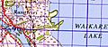
Rangiriri railway station on a 1942 map

