Ratanakiri Province facts for kids
Quick facts for kids
Ratanakiri Province
រតនគិរី
|
|
|---|---|

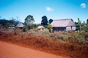
Ratanakiri countryside
|
|

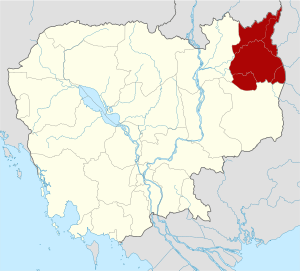
Location of Ratanakiri in Cambodia
|
|
| Country | |
| Established | 17 February 1959 |
| Named for | Khmer: រតនៈ (gem) + គិរី (mountain) |
| Capital | Banlung Municipality |
| Area | |
| • Total | 10,782 km2 (4,163 sq mi) |
| Population
(2019)
|
|
| • Total | |
| • Density | 19/km2 (50/sq mi) |
| Time zone | UTC+7 (ICT) |
Ratanakiri is a province in Cambodia. It is located in the northeast part of the country. The name Ratanakiri means "gem mountain" in the Khmer language. This province was created in 1959. Its capital city is Banlung.
Contents
Geography and Nature
Ratanakiri is known for its beautiful natural areas. The Annamite Range of mountains runs through the northern part of the province. Two important rivers, the Tonle San and Tonle Srepok, also flow here.
The province is home to important protected areas. These include Lomphat Wildlife Sanctuary and Virachey National Park. These places help protect the unique plants and animals of the region.
Yak Loum Lake
One of the most famous natural spots is Yak Loum. This is a beautiful crater lake near Banlung. It was formed a very long time ago by a volcano. The lake is a popular place for swimming and relaxing.
Districts and Towns
Ratanakiri Province is divided into several smaller areas. These are called districts and one municipality. The capital city, Banlung, is also a municipality.
Here are the 8 districts and 1 municipality:
- Andoung Meas
- Banlung Municipality
- Bar Kaev
- Koun Mom
- Lumphat
- Ou Chum
- Ou Ya Dav
- Ta Veaeng
- Veun Sai
People and Culture
Many different groups of people live in Ratanakiri. They have their own unique cultures and traditions. You can often see local markets in towns like Banlung. These markets are busy places where people buy and sell goods.
Some of the local communities have special meeting houses. For example, the Kreung people build unique meeting houses in their villages. These are important places for their community life.
Images for kids
See also
 In Spanish: Provincia de Ratanak Kirí para niños
 | Bessie Coleman |
 | Spann Watson |
 | Jill E. Brown |
 | Sherman W. White |


