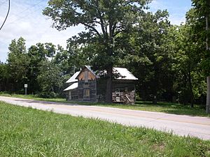
The old Richville store on Route W
Richville is a small, quiet place in southeastern Douglas County, Missouri, in the United States. It's not a big city, but rather an unincorporated community, which means it doesn't have its own local government like a town or city does. Richville is located where two roads meet: Missouri State Route 14 and State Route W. It's also not far from where Route 14 meets Missouri State Route 181. This area sits on a high ridge, about 1,191 feet (363 meters) above sea level. A taller spot called Sauls Knob, which is about 1,339 feet (408 meters) high, is just a little to the southeast of Richville.
What is the History of Richville?
Richville has a simple but interesting history. A long time ago, in 1870, a post office was opened there. This means people could send and receive letters and packages right in their community. The post office stayed open for many years, helping the local people connect with the outside world, until it closed in 1933. The community got its name from a local family called Rich, who were important in the area's early days.


