River Sem facts for kids
Quick facts for kids River Sem |
|
|---|---|
|
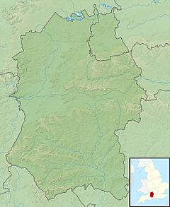
Location of the mouth within Wiltshire
|
|
| Country | United Kingdom |
| Region | Wiltshire |
| Physical characteristics | |
| Main source | East Knoyle, Wiltshire, England 51°04′25″N 2°10′04″W / 51.0737°N 2.1678°W |
| River mouth | Wardour, Wiltshire, England 98 m (322 ft) 51°02′45″N 2°06′37″W / 51.045790°N 2.110142°W |
| Length | 7.03 km (4.37 mi) |
| Basin features | |
| Basin size | 25.6 km2 (9.9 sq mi) |
The River Sem is a natural waterway in Wiltshire, England. It flows for about 7 kilometers (or 4 and a quarter miles). The river starts near a village called East Knoyle. It then flows until it meets the River Nadder near Wardour.
The Journey of the River Sem
The River Sem begins its journey at Summerleaze Pond. This pond is located near East Knoyle. It is just east of the main A350 highway.
The river first flows towards the southeast. It passes through a wooded area called Pondhead Copse. After this, it flows into two larger ponds. These ponds are named Brach Pond and Eeelstage Pond.
Next, the river turns and flows east. It goes under Savage Bridge and Share Lane. Finally, the River Sem reaches the River Nadder. This meeting point is northwest of Wardour.
Streams Joining the River
The River Sem gets water from several smaller streams. These smaller waterways are called tributaries.
One stream joins the Sem from its south bank. This stream starts near Whitebridge Farm. Whitebridge Farm is southeast of Sedgehill, close to the A350 road. This stream flows east. It joins the River Sem near Billhay Farm. This meeting point is just before Pondhead Copse.
Another stream also joins the Sem from the south. This stream begins in Bennet's Copse. Bennet's Copse is near Hart Hill Stud Farm. This stream flows northeast. It passes through Sem Hill and Billhay Pond. It then joins the River Sem at Pondhead Copse.
How the River Gets Its Water
The ground beneath the River Sem is made of two main types of rock. The top layer is called Kimmeridge Clay. Below this clay is a layer of Limestone.
There are cracks or breaks between these two rock layers. These breaks are called faults. Water from underground can push through these faults. This creates natural springs. These springs are the main source of water for the River Sem and its surrounding area.
 | Toni Morrison |
 | Barack Obama |
 | Martin Luther King Jr. |
 | Ralph Bunche |


