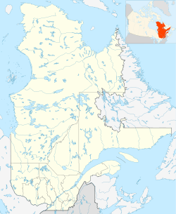
Rivière aux Éclairs facts for kids
Quick facts for kids Rivière aux Éclairs |
|
|---|---|
| Native name | Old name: "Rivière du lac Batiscan" |
| Country | Canada |
| Province | Quebec |
| Region | Capitale-Nationale |
| Regional County Municipality | Portneuf Regional County Municipality |
| Unorganized territory and a municipality | Linton |
| Physical characteristics | |
| Main source | Batiscan Lake Lac-Croche 389 units? 47°21′36″N 71°55′04″E / 47.36°N 71.91778°E |
| River mouth | Batiscan River Linton 310 km (190 mi) 47°23′11″N 72°09′39″E / 47.38639°N 72.16084°E |
| Length | 12 km (7.5 mi) |
| Basin features | |
| Basin size | 294 km2 (114 sq mi) |
| Tributaries |
|
The Rivière aux Éclairs, also known as the Lightning River, is a 12-kilometer (about 7.5 miles) long river in Quebec, Canada. It flows southwest through a beautiful area called Upper Batiscanie. This river is part of the Zec de la Rivière-Blanche wildlife area. It flows into the Batiscan River from its left side. The area drained by the Lightning River is 294 square kilometers (about 113.5 square miles). This makes it the fifth largest river basin in Batiscanie.
Contents
Discovering the Lightning River's Path
The Lightning River starts from Batiscan Lake. It then flows into the Batiscan River about 147 kilometers (91 miles) from the Batiscan River's mouth. This spot is at the end of a section called "Hell's Gates." The river has many twists and turns. It also forms a natural border between two regions: the Portneuf Regional County Municipality and the La Jacques-Cartier Regional County Municipality. These regions are both in the Capitale-Nationale area of Quebec.
Mountains and Cliffs Along the River
The Lightning River is surrounded by tall mountains and steep cliffs. One notable mountain is Mount View. It stands on the left side of the river. These high walls create a dramatic landscape around the river.
River Conditions and Activities
The river usually freezes over every year from November until April. The amount of water in the river changes with the seasons and how much rain falls. The best times to go boating on the river are in the spring or early summer. You can also boat after heavy rain, which makes the river flow faster.
The Lightning River has many rapids. These rapids are rated R2, R2-3, R3, and R3-4. These ratings tell you how difficult the rapids are for boats. For example, R2 rapids are easy, while R3-4 rapids are more challenging. If you want to boat down the river, you usually start at Batiscan Lake. You can even go further upstream, about 6 kilometers (3.7 miles) up the Moïse River. This adds about 15 kilometers (9.3 miles) to your trip.
How to Visit the River Area
To reach the area, you can start from Rivière-à-Pierre. Take road number 2 through the Portneuf Wildlife Reserve. All visitors must sign in at the reception desk. If you plan to stay overnight, you also need to register with the Zec de la Rivière-Blanche.
Continue on Highway 2, then turn right onto Highway 27. Just follow the signs that say "Zec de la Rivière-Blanche." Green road signs will guide you to the path leading to Batiscan Lake. You will leave road 27 at the 44-kilometer mark. It's important to know that the dirt roads in this area are closed during the spring thaw. This is when the ice melts and the ground becomes very soft.
The Name: Why "Lightning River"?
The French name for the river is "Rivière aux Éclairs." This means "Lightning River" in English. This name was officially recognized on December 5, 1968. Before that, the river was sometimes called "rivière du Lac Batiscan," meaning "river of Batiscan Lake."
In 1918, the Geographic Board of Quebec confirmed the name "Rivière aux Éclairs." They noted that this name was used even before "rivière du Lac Batiscan." Some maps from the 1920s also showed the name "Rivière aux Éclairs." This name was even mentioned in a 1914 dictionary of Quebec's rivers and lakes. However, no one knows for sure why it was given this name.
The River's Connection to Thunderstorms
The name "Lightning River" seems to fit the area well. The tall mountains around the river might make lightning strikes more likely. Also, the river, Batiscan Lake, and the Moïse River are all tucked between steep mountain walls. When thunderstorms happen, the sound of thunder echoes loudly off these walls. This makes it feel like the storms are even more powerful in this area.
 | Aurelia Browder |
 | Nannie Helen Burroughs |
 | Michelle Alexander |


