Rivière aux Bluets Sud facts for kids
Quick facts for kids Rivière aux Bluets Sud |
|
|---|---|

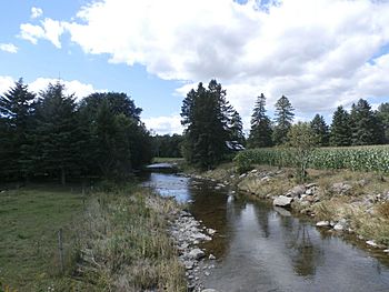
Rivière aux Bluets Sud près du village de Courcelles.
|
|
| Other name(s) | Old name: "Rivière aux Bleuets Sud" |
| Country | Canada |
| Province | Quebec |
| Region | Chaudière-Appalaches |
| MRC | Le Granit Regional County Municipality |
| Municipality | Saint-Sébastien, Courcelles |
| Physical characteristics | |
| Main source | Forest streams Saint-Sébastien 577 m (1,893 ft) 45°45′44″N 70°56′17″W / 45.762258°N 70.938057°W |
| River mouth | Grand lac Saint François Courcelles 305 m (1,001 ft) 45°52′10″N 70°59′25″W / 45.86944°N 70.99028°W |
| Length | 17.3 km (10.7 mi) |
| Basin features | |
| Progression | Grand lac Saint François, Saint-François River, St. Lawrence River |
| Tributaries |
|
The Rivière aux Bluets Sud is a river in Quebec, Canada. Its name means "Blueberries South River" in English. This river flows into the rivière aux Bluets. The rivière aux Bluets then empties into the Grand lac Saint François. This big lake is where the Saint-François River begins.
The Rivière aux Bluets Sud flows through two towns: Saint-Sébastien and Courcelles. Both towns are in the Le Granit Regional County Municipality. This area is part of the Estrie region in Quebec, which is on the South Shore of the St. Lawrence River.
Where Does the River Flow?
The Rivière aux Bluets Sud starts high up on the northern side of a hill called "Morne de Saint-Sébastien." The top of this hill is about 805 metres (2,641 ft) (2,641 feet) high. The river's source is about 1.2 kilometres (0.75 mi) (0.75 miles) from the hill's peak. It is also about 3.5 kilometres (2.2 mi) (2.2 miles) east of an important road crossing in the village of Saint-Sébastien.
The River's Journey
From its start, the river flows for about 17.3 kilometres (10.7 mi) (10.75 miles). Here's how its journey goes:
- It flows about 1.2 kilometres (0.75 mi) (0.75 miles) northwest. It crosses the rang 10 road.
- Then, it goes about 1.4 kilometres (0.87 mi) (0.87 miles) northwest. Here, two small streams join it.
- Next, it flows 2.3 kilometres (1.4 mi) (1.4 miles) northeast to the 4th rang road.
- It continues 1.8 kilometres (1.1 mi) (1.1 miles) northwest to the Route du Domaine.
- The river then travels 3.3 kilometres (2.1 mi) (2.05 miles) north to a rural road.
- It flows about 4.6 kilometres (2.9 mi) (2.86 miles) northwest through Courcelles. Here, the Castonguay stream joins it.
- Finally, it flows about 2.7 kilometres (1.7 mi) (1.68 miles) northwest. It picks up water from the Champagne stream and passes southwest of Courcelles. This is where it reaches its mouth.
Where the River Ends
The Rivière aux Bluets Sud empties into the south shore of the rivière aux Bluets. The rivière aux Bluets then flows northwest to join the Grand lac Saint François.
What's in a Name?
The name "Rivière aux Bluets Sud" was officially recorded on December 5, 1968. This was done by the Commission de toponymie du Québec, which is a group that names places in Quebec.
 | Leon Lynch |
 | Milton P. Webster |
 | Ferdinand Smith |

