Rivière du Sault au Mouton facts for kids
Quick facts for kids Rivière du Sault au Mouton |
|
|---|---|

Rivière du Sault au Mouton
|
|
| Country | Canada |
| Province | Quebec |
| Region | Côte-Nord |
| RCM | La Haute-Côte-Nord Regional County Municipality |
| Physical characteristics | |
| Main source | 494 metres (1,621 ft) |
| 2nd source | Lac de la petite montagne 48°40′22″N 69°47′02″E / 48.672855°N 69.783859°E |
| River mouth | Estuary of Saint Lawrence Longue-Rive 0 metres (0 ft) 48°32′20″N 69°15′09″W / 48.53889°N 69.2525°W |
| Length | 60.2 kilometres (37.4 mi) |
| Basin features | |
| Basin size | 1,946 square kilometres (751 sq mi) |
| Tributaries |
|
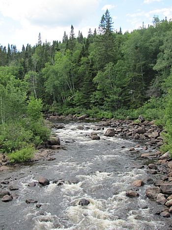
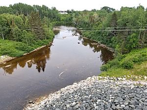
The Rivière du Sault au Mouton is a river in Quebec, Canada. It flows south on the north shore of the St. Lawrence River. The river runs through the unorganized territory of Lac-au-Brochet and the town of Longue-Rive. These areas are part of the La Haute-Côte-Nord Regional County Municipality in the Côte-Nord region. The river eventually empties into the St. Lawrence Estuary at Longue-Rive.
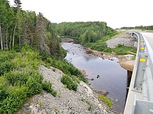
A main road, Route 138, crosses the river close to where it meets the St. Lawrence. From the village of Sault-au-Mouton, a forest path follows the river valley. This path goes up to Lake Vaillancourt, passing east of Lake Kergus and Lake Trente Milles. Another forest road extends further up the valley from Lake Trente Milles.
The main activity in this area is forestry, which means cutting down trees for wood. Tourism, like visiting for fun and outdoor activities, is also important. The river usually freezes over from late November to early April. It is generally safe to walk or travel on the ice from mid-December to late March.
Contents
River's Location and Nearby Waters
The Sault au Mouton River is surrounded by other rivers and bodies of water. Knowing these helps us understand its place in the larger water system.
- To the North: You'll find the Éperlan River, Truite River, Cèdres River, Gros Ruisseau, Castors River, Roussel River, and Portneuf River.
- To the East: The mighty St. Lawrence River is located here.
- To the South: There are the Red stream, Trout stream, La Petite Romaine, Rivière des Petits Escoumins, and Rivière des Escoumins.
Where the River Starts
The Sault au Mouton River begins at a place called "Grand-Mère lake." This lake is about 0.6 kilometres (0.37 mi) long and sits at an elevation of 494 metres (1,621 ft) above sea level. It is located in a forest area within the unorganized territory of Lac-au-Brochet.
From Grand-Mère lake, the river flows mostly through forest. It travels for about 60.2 kilometres (37.4 mi) before reaching its mouth.
The River's Journey
The Sault au Mouton River's journey can be split into two main parts: its upper course and its lower course.
Upper Course of the River
The first part of the river's journey covers about 30.7 kilometres (19.1 mi).
- It flows southeast, passing through an unnamed lake.
- Then it turns south, collecting water from Lake Michel and Lake Marcel.
- It continues south, flowing through the entire length of "Lac de la Petite Montagne."
- After that, it heads east, crossing Lac des Trente Milles.
- The river keeps flowing east, crossing a forest road.
- Finally, it reaches a bend where the Roussel River joins it from the north.
Lower Course of the River
The second part of the river's journey is about 29.5 kilometres (18.3 mi) long.
- It flows southeast, passing through Lac des Piliers.
- Then it turns east to another bend.
- It flows northeast into Longue-Rive, crossing Lac Thibault.
- The river then winds east through mountains in Longue-Rive. It collects water from the Truite stream, Black stream, and the Castors River (rivière du Sault au Mouton).
- It continues southeast, passing under large Hydro-Québec power lines.
- The river then flows south, mostly parallel to the St. Lawrence Estuary shore. It forms two loops to the east.
- Finally, it flows eastward, crossing Route 138, until it reaches its mouth.
Where the River Ends
The Sault au Mouton River flows over a sandy area at low tide for about 2.5 kilometres (1.6 mi). It empties into the west bank of the Saint Lawrence River in the Sault-au-Mouton area of Longue-Rive. This area is part of the "Hauts-Fonds de Mille-Vaches" bay.
The mouth of the river is located:
- About 40.9 kilometres (25.4 mi) east from where the river starts at Lac de la Grand-Mère.
- About 12.7 kilometres (7.9 mi) north of the mouth of the rivière des Petits Escoumins.
- About 24.1 kilometres (15.0 mi) north of the bridge over the mouth of the rivière des Escoumins in the village of Les Escoumins.
- About 56.5 kilometres (35.1 mi) northeast of the center of the village of Tadoussac.
- About 25.4 kilometres (15.8 mi) south of downtown Forestville.
Name of the River
The name "Rivière du Sault au Mouton" was officially recognized on December 5, 1968. This was done by the Commission de toponymie du Québec, which is a group that names places in Quebec.


