Rogers, New Mexico facts for kids
Quick facts for kids
Rogers
|
|
|---|---|
| Country | United States |
| State | New Mexico |
| County | Roosevelt |
| Elevation | 4,226 ft (1,288 m) |
| Time zone | UTC-7 (Mountain (MST)) |
| • Summer (DST) | UTC-6 (MDT) |
| ZIP codes |
88132
|
| Area code(s) | 575 |
| GNIS feature ID | 894127 |
Rogers is a small, quiet place in Roosevelt County, New Mexico, in the United States. It's known as an unincorporated community. This means it's a group of homes and businesses that isn't officially a town or city with its own local government.
Contents
Discovering Rogers, New Mexico
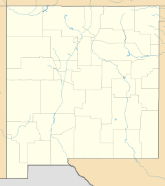
Rogers is located in the eastern part of New Mexico. It sits at an elevation of about 4,226 feet (1,288 meters) above sea level. This community is found along New Mexico State Road 235. It's about 6.8 miles (10.9 kilometers) east-northeast of a nearby place called Dora.
What Does "Unincorporated" Mean?
When a place is "unincorporated," it means it doesn't have its own city government. Instead, it's usually managed by the county it's in. For Rogers, that's Roosevelt County. People living in unincorporated communities still get services like roads and law enforcement. These services come from the county or state.
Rogers' Post Office
Even though Rogers is a small community, it has its own post office. This post office helps people send and receive mail. It uses the ZIP code 88132. A ZIP code is a special number that helps the postal service sort mail quickly.
Finding Rogers on a Map
You can find Rogers on a map using its special coordinates. These are like an address for a spot on Earth. Rogers is located at 33 degrees, 58 minutes, 54 seconds North latitude and 103 degrees, 13 minutes, 50 seconds West longitude.
 | Janet Taylor Pickett |
 | Synthia Saint James |
 | Howardena Pindell |
 | Faith Ringgold |


