Rogers, Virginia facts for kids
Quick facts for kids
Rogers
|
|
|---|---|
| Country | United States |
| State | Virginia |
| County | Montgomery |
| Elevation | 1,824 ft (556 m) |
| Time zone | UTC−5 (Eastern (EST)) |
| • Summer (DST) | UTC−4 (EDT) |
| GNIS feature ID | 1473503 |
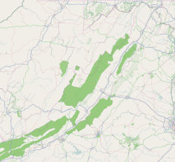
Rogers is a small, unincorporated community in Montgomery County, Virginia. It is located south of Christiansburg, which is the main town of the county. Being "unincorporated" means it's a community without its own local government, and it's managed by the county.
Rogers is part of a larger area called the Blacksburg–Christiansburg Metropolitan Statistical Area. This area includes all of Montgomery County and the nearby city of Radford. It helps describe how different towns and communities are connected.
About Rogers
Rogers is a quiet community in Virginia. It is known for its location at important road crossings. This makes it a recognizable spot for people traveling through the area.
Where is Rogers Located?
Rogers is found where two roads meet: Pilot Road (also known as VA 615) and Elliot's Creek Road (VA 675). Another important meeting point in Rogers is where Nolley Road crosses Pilot Road.
Elliot's Creek Road (VA 675) is a very old road. It used to connect two other towns, Shawsville and Riner, in the southern part of Montgomery County.
Historic Roads in Rogers
The old road that linked Shawsville to Riner has changed over time. Today, parts of that historic path are known by different names. These include Allegheny Springs Road, Split Rail Road, Elliot's Creek Road, Nolley Road, and Union Valley Road. These roads help us trace the history of travel in the area.
 | Kyle Baker |
 | Joseph Yoakum |
 | Laura Wheeler Waring |
 | Henry Ossawa Tanner |


