
Montgomery County, Virginia facts for kids
Quick facts for kids
Montgomery County
|
||
|---|---|---|

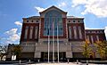
Montgomery County Courthouse
|
||
|
||
| Motto(s):
Freedom Increases Responsibility
|
||

Location within the U.S. state of Virginia
|
||
 Virginia's location within the U.S. |
||
| Country | ||
| State | ||
| Founded | 1772 | |
| Named for | Richard Montgomery | |
| Seat | Christiansburg | |
| Largest town | Blacksburg | |
| Area | ||
| • Total | 389 sq mi (1,010 km2) | |
| • Land | 387 sq mi (1,000 km2) | |
| • Water | 2.2 sq mi (6 km2) 0.6% | |
| Population
(2020)
|
||
| • Total | 99,721 |
|
| • Density | 256/sq mi (99/km2) | |
| Time zone | UTC−5 (Eastern) | |
| • Summer (DST) | UTC−4 (EDT) | |
| Congressional district | 9th | |

Montgomery County is a special area in the U.S. state of Virginia. It is located in the Valley and Ridge area, which has lots of mountains and valleys.
The county was created in 1777. It was formed from parts of Fincastle County. As of the 2020 census, about 99,721 people live here. The main town, or county seat, is Christiansburg. The biggest town is Blacksburg.
Montgomery County is part of the Blacksburg-Christiansburg metropolitan area. A very important part of the county's economy is Virginia Tech. This is one of Virginia's largest public universities. It is also the biggest employer in the county.
Contents
How Montgomery County is Governed
The Montgomery County Board of Supervisors helps run the county. They decide on the yearly budget and how much people pay in taxes. They also make rules for the county and its citizens.
There are seven supervisors on the board. Each one is chosen from a different area, called a geographic district. They serve for four years. Every two years, some of the seats are up for re-election.
| Supervisor | District |
|---|---|
| Sara Bohn | A |
| Derek Kitts | B |
| Steve Fijalkowski | C |
| Todd King | D |
| Anthony Grafsky | E |
| Mary Biggs | F |
| April DeMotts | G |
History of Montgomery County
Montgomery County was officially started on December 31, 1776. It was made from parts of Fincastle County. Fincastle County was then split into Montgomery, Washington, and Kentucky counties.
Over time, Montgomery County gave up some of its land. This land was used to create other counties that are now its neighbors. Some of this land even became part of West Virginia.
The county is named after Richard Montgomery. He was an American Revolutionary War general. He died in 1775 while trying to capture Quebec City, Canada.
Geography and Nature
Montgomery County covers about 389 square miles. Most of this is land, with a small amount of water. The western part of the county has the New River.
Montgomery County is also part of the Appalachian Regional Commission. This group helps with economic development in the Appalachian region.
Neighboring Areas
Montgomery County shares borders with several other counties and one city:
- Craig County - To the northeast
- Giles County - To the northwest
- City of Radford - To the west
- Pulaski County - To the southwest
- Floyd County - To the south
- Roanoke County - To the east
Protected Natural Areas
Part of the Jefferson National Forest is located in Montgomery County. This is a large protected area.
Main Roads
Many important roads run through Montgomery County:
 Future I-73
 I-81
I-81 US 11
US 11 US 460
 SR 8
SR 8 SR 111
 SR 114
 SR 177
 SR 232
 SR 314
 SR 412
Bicycle Routes
The ![]() USBR 76 bicycle route goes through Montgomery County. It enters from Radford and crosses the county for about 27.9 miles. It then continues into Roanoke County.
USBR 76 bicycle route goes through Montgomery County. It enters from Radford and crosses the county for about 27.9 miles. It then continues into Roanoke County.
Population and People
The population of Montgomery County has grown a lot over the years. Here's how it has changed:
| Historical population | |||
|---|---|---|---|
| Census | Pop. | %± | |
| 1790 | 13,228 | — | |
| 1800 | 9,044 | −31.6% | |
| 1810 | 8,409 | −7.0% | |
| 1820 | 8,733 | 3.9% | |
| 1830 | 12,306 | 40.9% | |
| 1840 | 7,405 | −39.8% | |
| 1850 | 8,359 | 12.9% | |
| 1860 | 10,617 | 27.0% | |
| 1870 | 12,556 | 18.3% | |
| 1880 | 16,693 | 32.9% | |
| 1890 | 17,742 | 6.3% | |
| 1900 | 15,852 | −10.7% | |
| 1910 | 17,268 | 8.9% | |
| 1920 | 18,595 | 7.7% | |
| 1930 | 19,605 | 5.4% | |
| 1940 | 21,206 | 8.2% | |
| 1950 | 29,780 | 40.4% | |
| 1960 | 32,923 | 10.6% | |
| 1970 | 47,157 | 43.2% | |
| 1980 | 63,516 | 34.7% | |
| 1990 | 73,913 | 16.4% | |
| 2000 | 83,629 | 13.1% | |
| 2010 | 94,392 | 12.9% | |
| 2020 | 99,721 | 5.6% | |
| U.S. Decennial Census 1790-1960 1900-1990 1990-2000 2010-2015 2020 |
|||
2020 Census Information
In 2020, there were 99,721 people living in Montgomery County. The county had about 257.8 people per square mile.
This table shows the different groups of people living in Montgomery County in 2010 and 2020:
| Race / Ethnicity (NH = Non-Hispanic) | Pop 2010 | Pop 2020 | % 2010 | % 2020 |
|---|---|---|---|---|
| White alone (NH) | 81,091 | 77,918 | 85.91% | 78.14% |
| Black or African American alone (NH) | 3,631 | 4,054 | 3.85% | 4.07% |
| Native American or Alaska Native alone (NH) | 154 | 126 | 0.16% | 0.13% |
| Asian alone (NH) | 5,089 | 8,310 | 5.39% | 8.33% |
| Pacific Islander alone (NH) | 21 | 45 | 0.02% | 0.05% |
| Some Other Race alone (NH) | 117 | 307 | 0.12% | 0.31% |
| Mixed Race or Multi-Racial (NH) | 1,753 | 4,310 | 1.86% | 4.32% |
| Hispanic or Latino (any race) | 2,536 | 4,651 | 2.69% | 4.66% |
| Total | 94,392 | 99,721 | 100.00% | 100.00% |
Climate in Montgomery County
The weather in Montgomery County changes with the seasons. Here's a look at the average temperatures and rainfall in Blacksburg:
| Climate data for Blacksburg | |||||||||||||
|---|---|---|---|---|---|---|---|---|---|---|---|---|---|
| Month | Jan | Feb | Mar | Apr | May | Jun | Jul | Aug | Sep | Oct | Nov | Dec | Year |
| Mean daily maximum °F (°C) | 42 (6) |
45 (7) |
53 (12) |
63 (17) |
71 (22) |
79 (26) |
82 (28) |
81 (27) |
75 (24) |
65 (18) |
56 (13) |
44 (7) |
63 (17) |
| Mean daily minimum °F (°C) | 21 (−6) |
24 (−4) |
30 (−1) |
38 (3) |
47 (8) |
56 (13) |
60 (16) |
59 (15) |
51 (11) |
39 (4) |
31 (−1) |
24 (−4) |
40 (5) |
| Average precipitation inches (mm) | 3.08 (78) |
2.81 (71) |
3.64 (92) |
3.48 (88) |
4.33 (110) |
4.00 (102) |
4.26 (108) |
3.59 (91) |
3.10 (79) |
2.78 (71) |
2.87 (73) |
2.95 (75) |
40.89 (1,038) |
| Source: U.S. Climate Data | |||||||||||||
Education in Montgomery County
Montgomery County has many schools and colleges. They help students learn and grow.
Colleges and Universities
- Virginia Polytechnic Institute and State University (Virginia Tech)
- Via College of Osteopathic Medicine
- New River Community College
Public High Schools
- Blacksburg High School
- Christiansburg High School
- Auburn High School
- Eastern Montgomery High School
Private High Schools
- Pathway Christian Academy
- Dayspring Christian Academy
Communities in Montgomery County
Montgomery County has several towns and smaller communities.
Towns
Census-Designated Places
These are areas that are like towns but are not officially incorporated.
Other Communities
These are smaller, unincorporated communities in the county.
- Alleghany Springs
- Bradshaw
- Belmont
- Childress
- Ellett
- Graysontown
- Ironto
- Long Shop
- Lusters Gate
- McCoy
- McDonalds Mill
- New Ellett
- Pilot
- Rogers
- Sowers
- Sugar Grove
- Toms Creek
- Vicker
- Walton
- Yellow Sulphur Springs
Images for kids
-
Montgomery County Courthouse
See also
 In Spanish: Condado de Montgomery (Virginia) para niños
