Rolling Prairie, Indiana facts for kids
Quick facts for kids
Rolling Prairie, Indiana
|
|
|---|---|

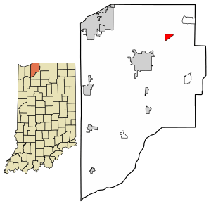
Location in LaPorte County, Indiana
|
|
| Country | United States |
| State | Indiana |
| County | LaPorte |
| Township | Kankakee |
| Area | |
| • Total | 1.07 sq mi (2.77 km2) |
| • Land | 1.06 sq mi (2.74 km2) |
| • Water | 0.01 sq mi (0.04 km2) |
| Elevation | 820 ft (250 m) |
| Population
(2020)
|
|
| • Total | 562 |
| • Density | 532.20/sq mi (205.48/km2) |
| ZIP code |
46371
|
| FIPS code | 18-65736 |
| GNIS feature ID | 2629775 |
Rolling Prairie is a small community in Indiana, United States. It is located in LaPorte County. This area is called a "census-designated place" (CDP). This means it's a special area defined by the government for counting people. In 2020, about 562 people lived here.
Contents
A Look Back in Time
The first home in Rolling Prairie was built in 1831. A person named Ezekiel Provolt built this cabin. More people soon came to live there. They first called the settlement "Nauvoo".
Later, on November 26, 1853, the village was officially mapped out. It was named "Portland" by J. W. Walker. The name "Rolling Prairie" was chosen later. This name describes the gently rolling hills and open land in the area. A railroad company that passed through the town adopted this name.
Rolling Prairie used to have a stop for the South Shore Line train. This train stop closed in 1994. It was one of several stops that closed because not many people were using them.
Where is Rolling Prairie?
Rolling Prairie is found in the northeastern part of LaPorte County. It is in the northeast section of Kankakee Township.
U.S. Route 20 goes through the southern part of the community. This road leads east about 19 miles (31 km) to South Bend. It goes west about 15 miles (24 km) to Michigan City. Indiana State Road 2 also passes just south of Rolling Prairie. This road goes southwest about 7 miles (11 km) to La Porte. La Porte is the main city of the county.
The U.S. Census Bureau says that Rolling Prairie covers an area of about 1.1 square miles (2.8 km2). A very small part of this, about 0.02 square miles (0.04 km2), is water.
Schools and Learning
Rolling Prairie has a public library. It is a part of the La Porte County Public Library system.
The community also has Rolling Prairie Elementary School. This school is in the building that used to be Rolling Prairie High School. The high school joined with New Carlisle High School to form New Prairie High School. Rolling Prairie Elementary is one of three elementary schools in the New Prairie United School Corporation.
Population Facts
| Historical population | |||
|---|---|---|---|
| Census | Pop. | %± | |
| 2020 | 562 | — | |
| U.S. Decennial Census | |||
As of the 2020 census, the population of Rolling Prairie was 562 people.
See also
 In Spanish: Rolling Prairie (Indiana) para niños
 | William L. Dawson |
 | W. E. B. Du Bois |
 | Harry Belafonte |


