Rongé Island facts for kids
 |
|
|
Location in Antarctica
|
|
| Geography | |
|---|---|
| Location | Antarctica |
| Coordinates | 64°43′S 62°41′W / 64.717°S 62.683°W |
| Length | 8 km (5 mi) |
| Highest elevation | 1,158 m (3,799 ft) |
| Highest point | Mount Britannia |
| Administration | |
| Administered under the Antarctic Treaty System | |
| Demographics | |
| Population | Uninhabited |
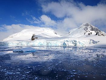
Rongé Island is a large, rocky island located off the coast of Antarctica. It is about 8 kilometers (5 miles) long. This island is the biggest in a group that forms the western side of the Errera Channel. This channel is found near the west coast of Graham Land, which is a part of the Antarctic continent.
Rongé Island is also known by other names like Curville Island or De Rongé Island. It was first discovered by explorers from Belgium.
Contents
Discovering Rongé Island
Rongé Island was found during the Belgian Antarctic Expedition (BAE). This expedition took place between 1897 and 1899. The leader of this journey was a man named Adrien de Gerlache.
He decided to name the island after Madame de Rongé. She was a cousin of Johannes Ronge and had helped to fund the expedition. This means she gave money to support the trip.
Exploring Rongé Island's Geography
Rongé Island has some interesting geographical features. Two important points on the island are Ketley Point and Sherlac Point.
Ketley Point
Ketley Point is located at the western end of Rongé Island. It was mapped by the Belgian Antarctic Expedition. Later, the UK Antarctic Place-Names Committee officially named it in 1960.
This point was named after John Ketley. He was a surveyor who worked for the Falkland Islands Dependencies Survey (FIDS). He helped map areas in Antarctica in 1956 and 1957.
Sherlac Point
Sherlac Point marks the southeastern tip of Rongé Island. Like Ketley Point, it was first mapped by Gerlache's expedition. Gerlache initially called it "Cap Charles."
However, to avoid confusion with another place called Charles Point in Hughes Bay, its name was changed. "Sherlac" is an anagram of Charles. An anagram is a word or phrase made by rearranging the letters of another word or phrase.
See also
In Spanish: Isla Rongé para niños
 | Anna J. Cooper |
 | Mary McLeod Bethune |
 | Lillie Mae Bradford |


