Rosewood, Ohio facts for kids
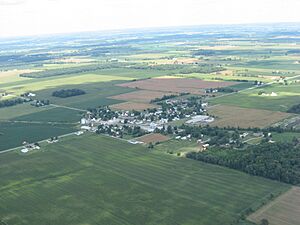
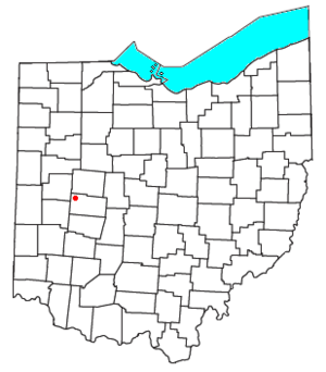
Rosewood is a small community in Ohio, United States. It's located in the northwestern part of Champaign County, within Adams Township. Even though it's a recognized place, it's called an unincorporated community. This means it doesn't have its own local government like a city or town. Instead, it's governed by the county or township.
Rosewood is also known as a census-designated place (CDP). This is a special area defined by the U.S. Census Bureau just for counting people. In the year 2020, about 224 people lived in Rosewood. The community has its own post office, and its special mail code, or ZIP code, is 43070. You can find Rosewood along State Route 29, which is a main road that goes from east to west.
A Look at Rosewood's History
Rosewood began to grow in 1893. This was when a railroad line was built and extended to this area. The people who planned the community created a map, or plat, showing where streets and buildings would go.
The First Post Office
Soon after the railroad arrived, a post office was opened in Rosewood. This happened in 1894. A post office is a very important part of a community, helping people send and receive letters and packages.
See also
 In Spanish: Rosewood (Ohio) para niños
 | Percy Lavon Julian |
 | Katherine Johnson |
 | George Washington Carver |
 | Annie Easley |


