Roslyn, Dunedin facts for kids
Quick facts for kids
Roslyn
|
|
|---|---|
|
Suburb
|
|
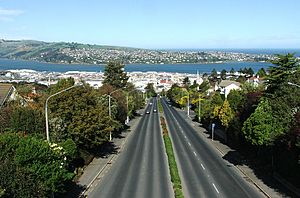
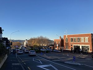
Looking from the Roslyn Overbridge, toward Dunedin city centre
|
|
| Country | New Zealand |
| Local authority | Dunedin |
| Area | |
| • Land | 129 ha (319 acre) |
| Population
(June 2023)
|
|
| • Total | 3,040 |
|
|
||
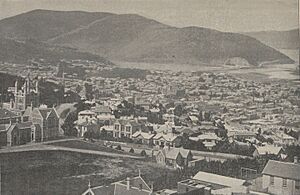
Roslyn is a busy neighbourhood in Dunedin, New Zealand. It's mostly a place where people live and shop. Roslyn sits about 150 metres (490 feet) above the city centre. It's located on a ridge that curves around the western side of the central city. Roslyn is about 2.5 kilometres (1.6 miles) northwest of the city centre. It is right above the Town Belt, which is a green space around the city.
Roslyn is connected to Dunedin's main shopping area (the CBD) by two roads. These are Stuart Street and City Road. Stuart Street goes under Roslyn, and you can get to the suburb using a special road system. West of Roslyn, Stuart Street leads to other suburbs like Kaikorai and Wakari. It then becomes Taieri Road, which goes over Three Mile Hill to the Taieri Plains. City Road goes through Belleknowes and then down to the central city.
Roslyn is mostly homes, but it also has a shopping area. This area is called Roslyn Village and is on Highgate, the main road. One of Dunedin's well-known girls' schools, Columba College, is also near Roslyn.
The local football (soccer) team is called Roslyn-Wakari. It gets its name from Roslyn and the nearby suburb of Wakari. Their home field is actually at Ellis Park in Kaikorai. The old Roslyn Woollen Mills building is also in Kaikorai. This company made products that were famous all over New Zealand.
Contents
Exploring Roslyn's Past
Roslyn was named after a place called Roslin in Scotland. Many street names in Dunedin come from places in Edinburgh, Scotland. A man named James Kilgour reportedly named Roslyn. He divided his land here and gave it the name.
The very first house in Roslyn was built in 1858. It was made in Australia and then put together here. This house is now number eight Lundie Street.
Roslyn was once its own town, separate from Dunedin. This was from 1877 until 1912. In 1912, Roslyn joined Dunedin City. During this time, Roslyn had 14 mayors who led the town.
Kaikorai Primary School is in Roslyn. It can be reached from Wright Street. The school used to be in an old stone building. It had special arches at the entrance on Tyne Street. These arches were taken down in 1981 to keep people safe. Wright Street was once called Linden Street. It was named after a big linden tree that still stands there.
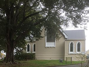
Across from the school is St John's Anglican Church. This church was built in 1880.
Nearby Places: Littlebourne
The area called Littlebourne is sometimes seen as a separate neighbourhood. It is located in the Town Belt. This area is on the slopes just below Roslyn.
Some important places in Littlebourne include Otago Boys' High School. This school has a sports field called the Littlebourne Ground. The city's main swimming pool, Moana Pool, is also here.
On Melrose Street, you can see a special house called Claremont House. It was built by the important Glendining family.
Roberts Park is a sports field above Moana Pool. This park was once the site of a very large house called Littlebourne House. It had 30 rooms and big gardens. After the owner, Mayor John Roberts, passed away, the house was given to the city. It was used by the military during World War II. Later, it was a student hostel, but it was taken down in 1947.
Roslyn's Cable Cars
In the past, Roslyn had two different cable car lines. These were like special trams pulled by a moving cable.
One cable car line started in The Octagon in the city centre. It went up Stuart Street. Then it went through a part of the Town Belt. It passed Otago Boys' High School and went up to Highgate. This line then went down to Kaikorai. The route of this cable car line was later changed into a four-lane highway.
The other cable car line went up Rattray Street. It also cut through the Town Belt. You can still see where the cutting was. This line went up Ross Street and then down to a valley near Frasers Road. Until 1900, this cable car stopped at the bottom of Ross Street. It was then extended to Kaikorai. This part of the line used Falcon Street. Falcon Street was called James Street until 1912.
On June 1, 1942, a 13-year-old girl was hurt falling from a runaway tram. She later died from her injuries. Because of this, that part of the line was closed. The Roslyn cable car system ran from 1906 to 1951.
When the cable cars stopped running, trolleybuses took their place. These buses used the existing City Road instead of the steep cable car route.
Education in Roslyn
Kaikorai Primary School is a public school for students in Year 1 to 6. It has about 285 students. The school first opened in 1884. It replaced an older school that had been on the same site since 1869.
Columba College is a school for students in Year 1 to 13. It is a state-integrated school, meaning it gets government funding but keeps its special character. It has about 585 students. Columba College opened in 1915 as a private Presbyterian school. It became part of the state school system in 1994.
Rolls are as of February 2024. .
 | John T. Biggers |
 | Thomas Blackshear |
 | Mark Bradford |
 | Beverly Buchanan |


