Roughton Scrubs facts for kids
Quick facts for kids Roughton Scrubs |
|
|---|---|
| Geography | |
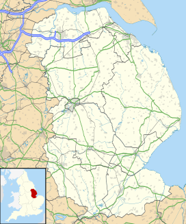
| Location | Lincolnshire, England |
| Coordinates | 53°10′15″N 0°9′36″W / 53.17083°N 0.16000°W |
Roughton Scrubs is a small area of trees, also known as a woodland. It is located in Lincolnshire, England. You can find it next to the B1191 road, which is also called Horncastle Road. This woodland is to the northeast of the village of Woodhall Spa. It sits on a piece of land known as Roughton Moor.
What's Around Roughton Scrubs?
Roughton Scrubs has some interesting neighbors. To its southwest, you'll find another wooded area called Big Rous Holt. If you cross Horncastle Road to the north, you enter an area known as The Wilderness.
The Wilderness and Old Farms
The Wilderness holds clues about how people farmed a long time ago. You can see signs of something called Ridge and Furrow farming there. This was a way farmers shaped their fields in the Middle Ages. They created raised strips (ridges) and sunken channels (furrows) to help with drainage and planting.
The Old Railway Line
Also in The Wilderness, you can spot the raised ground where an old railway used to run. This was part of the Horncastle Railway, which connected Woodhall Spa to Horncastle. The railway line has been abandoned for a long time, but its path is still visible today.


