Roxa facts for kids

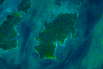
Satellite view
|
|
 |
|
| Geography | |
|---|---|
| Location | Atlantic Ocean |
| Coordinates | 11°14′40″N 15°43′25″W / 11.24441°N 15.72349°W |
| Archipelago | Bissagos Islands |
| Area | 111 km2 (43 sq mi) |
| Length | 20 km (12 mi) |
| Width | 11 km (6.8 mi) |
| Administration | |
|
Guinea-Bissau
|
|
| Demographics | |
| Population | 2,478 (2009) |
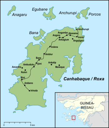
Roxa (also called Canhabaque) is a beautiful island located in the Bissagos Islands. This group of islands is part of Guinea-Bissau, a country in West Africa. Roxa is part of the Bubaque area.
About Roxa Island
Roxa is a good-sized island. It covers an area of 111 square kilometers (about 43 square miles). The island is about 20 kilometers (12 miles) long and 11 kilometers (7 miles) wide.
People and Villages
In 2009, 2,478 people lived on Roxa island. They live in many different villages spread across the island. Some of these villages include Ambuduco, Ampucute, Ancanhozinho, and Indenazinho. Other villages are Ancaguine, Ancatipe, Angaura, and Indena Grande. You can also find Ga-Cote, Inore, Ambena, Bine, Inhoda, Idjoue, Eboco, Meneque, Ancanam, Anghudjiga, Anghumba, and Antchurupe.
The Lighthouse
On the east side of Roxa island, there is a lighthouse. Lighthouses are important buildings that help ships find their way. The light from this lighthouse is 26 meters (85 feet) above the sea. This helps sailors see it from far away.
See also
 In Spanish: Canhabaque para niños


