Roxbury, Kansas facts for kids
Quick facts for kids
Roxbury, Kansas
|
|
|---|---|

|
|
| Country | United States |
| State | Kansas |
| County | McPherson |
| Elevation | 1,339 ft (408 m) |
| Population
(2020)
|
|
| • Total | 70 |
| Time zone | UTC-6 (CST) |
| • Summer (DST) | UTC-5 (CDT) |
| Area code | 620 |
| FIPS code | 20-61550 |
| GNIS ID | 477097 |
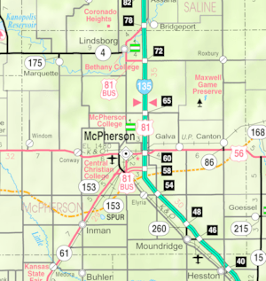
Roxbury is a small community in McPherson County, Kansas, United States. It is called a census-designated place (CDP). This means it's a special area the government uses for counting people.
In 2020, about 70 people lived in Roxbury. You can find it about 10.5 miles east of Interstate 135.
History of Roxbury
Kansas has a long history. In 1854, the area was known as the Kansas Territory. Later, in 1861, Kansas officially became the 34th U.S. state.
McPherson County was created in 1867. The community we now call Roxbury started in 1871. Its first name was Colfax, and it began with a trading post.
On March 4, 1875, the community's name was changed to Roxbury. This change happened because of a new law. Today, Roxbury has a post office, a bank, and a large place to store grain.
Education in Roxbury
Students in Roxbury go to schools in the Smoky Valley USD 400 public school district. This district serves several communities.
Roxbury used to have its own schools. However, these schools closed in 1965. This happened because of a process called school unification. This means smaller school districts joined together. The high school team in Roxbury was known as the Roxbury Lions.
Notable People from Roxbury
- Wendell Johnson, a famous psychologist. He studied how people learn to speak and think.
See also

- In Spanish: Roxbury (Kansas) para niños


