Sainte-Mélanie, Quebec facts for kids
Quick facts for kids
Sainte-Mélanie
|
|
|---|---|
|
Municipality
|
|

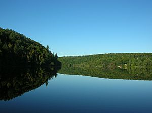
Rocher Lake, largest lake within the municipality
|
|
| Country | |
| Province | |
| Region | Lanaudière |
| RCM | Joliette |
| Constituted | July 1, 1855 |
| Area | |
| • Total | 78.30 km2 (30.23 sq mi) |
| • Land | 75.84 km2 (29.28 sq mi) |
| Population
(2011)
|
|
| • Total | 2,892 |
| • Density | 38.1/km2 (99/sq mi) |
| • Change (2006–11) | |
| • Dwellings | 1,404 |
| Time zone | UTC−5 (EST) |
| • Summer (DST) | UTC−4 (EDT) |
| Postal code(s) |
J0K 3A0
|
| Area code(s) | 450 and 579 |
Sainte-Mélanie is a small town, also called a municipality, in the Lanaudière area of Quebec, Canada. It is part of the Joliette Regional County Municipality, which is a group of towns working together. You can find Sainte-Mélanie along the western side of the L'Assomption River.
The Story of Sainte-Mélanie
Sainte-Mélanie has a long history! It was once part of a large piece of land called the Ailleboust Seignory. This land was given to a person named Jean d'Ailleboust d'Argenteuil way back in 1736.
How Sainte-Mélanie Got Its Name
Later, around the year 1800, Pierre-Louis Panet became the owner of the Ailleboust land. His daughter was named Charlotte-Mélanie Panet. Many people think the town of Sainte-Mélanie was named after her! The name also refers to Melania the Younger, a famous person from history.
Building the Community
In 1814, Charlotte-Mélanie's husband, Marc-Antoine-Louis Lévesque, gave land for a church. A chapel was built there in 1830. Just two years later, in 1832, the area officially became the Parish of Sainte-Mélanie. A few years after that, in 1836, a post office opened. It was called Daillebout at first.
 | Anna J. Cooper |
 | Mary McLeod Bethune |
 | Lillie Mae Bradford |

