
San Bartolomé de Tirajana facts for kids
Quick facts for kids
San Bartolomé de Tirajana
|
|||
|---|---|---|---|

San Bartolomé de Tirajana
|
|||
|
|||

Municipal location in Gran Canaria
|
|||

San Bartolomé de Tirajana
Location in Province of Las Palmas

San Bartolomé de Tirajana
Location in Canary Islands

San Bartolomé de Tirajana
Location in Spain, Canary Islands
|
|||
| Country | |||
| Autonomous Community | |||
| Province | Las Palmas | ||
| Island | Gran Canaria | ||
| Area | |||
| • Total | 333.13 km2 (128.62 sq mi) | ||
| Population
(2018)
|
|||
| • Total | 53,588 | ||
| • Density | 160.862/km2 (416.631/sq mi) | ||
| Time zone | UTC+0 (CET) | ||
| • Summer (DST) | UTC+1 (CEST (GMT +1)) | ||
| Postal code |
35290
|
||
| Area code(s) | 928 & 828 | ||
| Website | www.maspalomas.com | ||

.svg)
San Bartolomé de Tirajana is a village and a municipality in the south-eastern part of Gran Canaria island. This island is part of the Canary Islands in Spain. With an area of 333.13 square kilometers, it is the largest municipality on Gran Canaria. In 2018, about 53,588 people lived here.
The municipality is home to popular beach resorts like Maspalomas, Playa del Inglés, and San Agustín. It also includes the beautiful Pilancones natural park. The main village, San Bartolomé de Tirajana (also called Tunte), is located in the mountains. It is about 17 kilometers from the coast and 27 kilometers south-west of Las Palmas. Most people in the municipality live closer to the Atlantic coastline. The GC-1 motorway runs through the southern part, connecting it to Las Palmas and the Gran Canaria Airport.
Contents
Exploring San Bartolomé de Tirajana
This municipality is located in the south of Gran Canaria. It is about 54.5 kilometers from the island's capital. San Bartolomé de Tirajana has a unique triangular shape. Its wide base covers a large part of the southern coast.
It is the biggest municipality on the island. It covers more than one-fifth of Gran Canaria's total area. The village of Tunte, which is the municipal capital, sits 850 meters above sea level. The highest point in the municipality is Morro de la Agujereada, reaching 1,957.3 meters.
Coastal Features and Landscape
The central coast of San Bartolomé de Tirajana is famous for its long, wide, golden sand beaches. It also features the amazing dune field of Maspalomas and a saltwater pool. The northern part of the coast is rocky. The southern end has steep cliffs.
Above the coast, there is a wide, developed plain. This land slowly rises and is cut by deep ravines. These ravines lead up towards the mountains in the center of the island.
Weather in San Bartolomé de Tirajana
The weather here is usually very pleasant. This is because the island is protected from the humid winds coming from the northeast. This means there is not much rain, and it mostly falls in the winter. Temperatures are nice almost all year round.
The average yearly temperature is 15.8 degrees Celsius. January is the coolest month, with an average of 12.1 degrees Celsius. August is the warmest, averaging 20.5 degrees Celsius. The area gets about 307 millimeters of rain each year. Because of these mild temperatures, many tourists visit from September to April.
Nature and Protected Areas
A large part of San Bartolomé de Tirajana is protected. These areas are part of the Canary Islands Network of Natural Protected Areas. Some of these include:
- Riscos de Tirajana Natural Monument
- Pilancones Natural Park
- Fataga Protected Landscape
- Maspalomas Dunes Special Nature Reserve
- Juncalillo del Sur Site of Scientific Interest
The municipality also shares other protected areas with nearby towns. These are the Nublo Rural Park and the Los Marteles Special Nature Reserve. All these places are also part of the Natura 2000 Network. This network helps protect important habitats and species.
Economy and Tourism
Tourism is the main industry along the coast. As you move inland, the weather gets cooler and the land becomes more fertile. This allows for more farming.
Tourism in the municipality is currently changing. New plans are being put into action to make the area even better for visitors. These plans involve local universities, the City Hall, and the regional government. They aim to highlight the unique identity and value of the municipality.
The plans also focus on updating hotels and other places where tourists stay. Since San Bartolomé de Tirajana was one of the first tourist spots, some buildings are older. The goal is to keep their artistic value while modernizing what is outdated.
New projects are also planned. These include a multi-adventure theme park and a high-performance sports center. These will be built in Punta de Tarajalillo. Another project there is the Wake Park Feliz, which will offer water sports.
Population Over Time
| Historical population | ||||||||||||||||||||||||||||
|---|---|---|---|---|---|---|---|---|---|---|---|---|---|---|---|---|---|---|---|---|---|---|---|---|---|---|---|---|
|
|
|||||||||||||||||||||||||||
Towns and Villages

A
- Agualatente
- Aldea Blanca
- Arteara
- Ayacata
- Ayagaures
B
- Bahia Feliz
- Berriel
C
- Calderin
- Campo Internacional
- El Canalizo
- Casas Blancas
- Los Caserones de Fataga
- Castillo del Romeral
- Los Cercados
- Cercados de Araña
- Cercados de Espino
- Chira
- Ciudad de Lima
- La Culata
F
- Fataga
- Las Filipinas
- La Florida
H
- Hoya Gercia
- Hoya Grande
- Hoya de Tunte
- Los Hortigones
- Huesa Bermeja
- La Humbria
J
- Juan Grande
L
- Lomito de Taidía
- Lomo de la Palma
M
- Maspalomas
- El Matorral
- Media Fanega
- Los Meloneras
- La Mimbre
- La Montaña
- Montaña La Data
- Montaña de Rosiana
- Monteleon
- El Moral
P
- El Pajar
- Los Palmitos
- Pasito Blanco
- Pedrazo
- Perera
- La Plata
- Playa del Aguila
- Playa del Inglés
R
- Risco Blanco
- Risco la Candelilla
- Los Rodeos
S
- El Salobre
- San Agustín
- San Fernando
- Santa Águeda
- El Sequero
- Los Sitios
- Sonnenland
T
- El Tablero
- Taidía
- Tarajalillo
- Las Tederas
- Trejo
- Tunte (San Bartolomé de Tirajana)
Education
The British School of Gran Canaria has its South Campus located in this municipality.
Sister Cities
San Bartolomé de Tirajana has special friendships with other cities around the world. These are called "sister cities."
- Alajuela, Costa Rica
- Elche, Spain
- Segovia, Spain
Images for kids
-
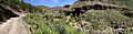
Barranco de Ayagaures
See also
 In Spanish: San Bartolomé de Tirajana para niños
