San Fidel, New Mexico facts for kids
Quick facts for kids
San Fidel, New Mexico
|
|
|---|---|
 |
|
| Country | United States |
| State | New Mexico |
| County | Cibola |
| Area | |
| • Total | 4.21 sq mi (10.90 km2) |
| • Land | 4.21 sq mi (10.90 km2) |
| • Water | 0.00 sq mi (0.00 km2) |
| Elevation | 6,296 ft (1,919 m) |
| Population
(2020)
|
|
| • Total | 124 |
| • Density | 29.47/sq mi (11.38/km2) |
| Time zone | UTC-7 (Mountain (MST)) |
| • Summer (DST) | UTC-6 (MDT) |
| ZIP code |
87049
|
| Area code(s) | 505 |
| GNIS feature ID | 2584205 |
San Fidel is a small community in Cibola County, New Mexico, United States. It's called a census-designated place, which means it's a special area the government counts for population, but it's not a city or town with its own local government.
About San Fidel
San Fidel is a quiet place with a small population. In 2010, about 138 people lived there. By 2020, the population was 124.
Mail and Roads
San Fidel has its own post office. It opened a long time ago, on December 24, 1910. The ZIP code for San Fidel is 87049.
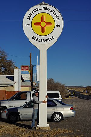
A very important road passes through San Fidel. It's called New Mexico State Road 124. This road was once part of the famous Route 66, which people sometimes call the "Old Road."
Historic Places
One special building in San Fidel is the Acoma Curio Shop. A curio shop sells interesting and unusual items. This shop is so important that it's listed on the National Register of Historic Places. This means it's a place with a lot of history that should be protected.
See also
 In Spanish: San Fidel (Nuevo México) para niños
 | Roy Wilkins |
 | John Lewis |
 | Linda Carol Brown |


