San Javier, Sonora facts for kids
Quick facts for kids
San Javier
|
|
|---|---|

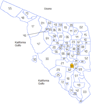
Sonora locator map with San Javier village at 54
|
|
| Country | |
| State | Sonora |
| Municipality | San Javier |
| Founded | 1706 |
| Time zone | UTC-7 (Pacific (US Mountain)) |
| • Summer (DST) | UTC-7 (No DST) |
San Javier is a small town located in the San Javier Municipality. This municipality is part of the Mexican state of Sonora. The town sits at an elevation of 650 meters (about 2,132 feet) above sea level.
Contents
Where is San Javier Located?
The municipality of San Javier is found in the far southwest part of the Sierra El Aliso mountain range. It is about 25 kilometers (15.5 miles) west of the Yaqui River. This river is one of the most important in the state of Sonora.
What Do People Do in San Javier?
Most people living in San Javier are involved in two main activities:
- Animal Raising: Many families raise animals like cattle, goats, or sheep. This helps them get food and other products.
- Subsistence Farming: This means they grow crops mostly to feed themselves and their families. They might grow corn, beans, or other vegetables. It's a way of life where people produce what they need to survive.
History of San Javier
San Javier was founded a long time ago, in the year 1706. This makes it a place with a rich history in the region of Sonora.
See also
 In Spanish: San Javier (Sonora) para niños

All content from Kiddle encyclopedia articles (including the article images and facts) can be freely used under Attribution-ShareAlike license, unless stated otherwise. Cite this article:
San Javier, Sonora Facts for Kids. Kiddle Encyclopedia.
