
Santo Tomás District, Santo Domingo facts for kids
Quick facts for kids
Santo Tomás
|
|
|---|---|
|
District
|
|

Santo Tomás
Location in Costa Rica
|
|
| Country | |
| Province | Heredia |
| Canton | Santo Domingo |
| Area | |
| • Total | 3.51 km2 (1.36 sq mi) |
| Elevation | 1,200 m (3,900 ft) |
| Population | |
| • Total | 6,267 |
| • Density | 1,785.5/km2 (4,624/sq mi) |
| Time zone | UTC−06:00 |
| Postal code |
40305
|
Santo Tomás is a small area called a district in Costa Rica. It's part of the Santo Domingo canton, which is like a county. This canton is located in the Heredia province, one of Costa Rica's main regions.
Contents
Where is Santo Tomás?
Santo Tomás covers an area of about 3.51 square kilometers. That's roughly the size of 350 football fields! It sits at an elevation of 1,200 meters above sea level. This means it's quite high up, which can affect its climate and scenery.
Who Lives in Santo Tomás?
The word "demographics" tells us about the people living in a place. This includes how many people there are and how that number has changed over time.
| Historical population | |||
|---|---|---|---|
| Census | Pop. | %± | |
| 1883 | 710 | — | |
| 1892 | 810 | 14.1% | |
| 1927 | 758 | −6.4% | |
| 1950 | 1,163 | 53.4% | |
| 1963 | 1,542 | 32.6% | |
| 1973 | 2,257 | 46.4% | |
| 1984 | 3,171 | 40.5% | |
| 2000 | 5,222 | 64.7% | |
| 2011 | 6,267 | 20.0% | |
|
Instituto Nacional de Estadística y Censos |
|||
According to the 2011 census, Santo Tomás had a population of 6,267 people. This shows how the number of residents has grown over many years.
Getting Around Santo Tomás
Transportation is all about how people and goods move from one place to another.
Road Connections
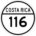
The district is connected by important roads. One of these is National Route 116. This road helps people travel to and from Santo Tomás, connecting it to other areas.
See also
 In Spanish: Santo Tomás de Santo Domingo para niños
Images for kids
-
National Route 116 sign

