Schulte, Kansas facts for kids
Quick facts for kids
Schulte, Kansas
|
|
|---|---|

|
|
| Country | United States |
| State | Kansas |
| County | Sedgwick |
| Elevation | 1,335 ft (407 m) |
| Time zone | UTC-6 (CST) |
| • Summer (DST) | UTC-5 (CDT) |
| Area code | 316 |
| FIPS code | 20-63450 |
| GNIS ID | 474320 |
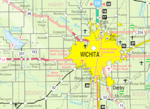
Schulte is a small, quiet place in Sedgwick County, Kansas, United States. It's known as an unincorporated community. This means it's a group of homes and businesses that isn't officially a city or town with its own local government. You can find Schulte where K-42 (also called Southwest Boulevard) meets MacArthur Road.
History of Schulte
Schulte began to grow when the Orient Railway built its tracks through this area. Railways were very important back then for travel and moving goods. They helped new communities like Schulte start up. Schulte even had its own post office for many years, from 1906 until 1934. This was a central spot for people to send and receive mail.
Schools in Schulte
Students living in Schulte attend schools in the Goddard USD 265 public school district. This district provides education for many communities in the area.
 | Bessie Coleman |
 | Spann Watson |
 | Jill E. Brown |
 | Sherman W. White |


