Shepherd, Indiana facts for kids
Quick facts for kids
Shepherd, Indiana
|
|
|---|---|

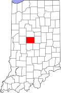
Boone County's location in Indiana
|
|
| Country | United States |
| State | Indiana |
| County | Boone |
| Township | Perry |
| Elevation | 968 ft (295 m) |
| Time zone | UTC-5 (Eastern (EST)) |
| • Summer (DST) | UTC-4 (EDT) |
| ZIP code |
46052
|
| Area code(s) | 765 |
| FIPS code | 18-69345 |
| GNIS feature ID | 443358 |
Shepherd is a small, quiet place in Boone County, Indiana. It is known as an unincorporated community. This means it's a group of homes and businesses that isn't officially a town or city. It is part of Perry Township in the state of Indiana.
What is an Unincorporated Community?
An unincorporated community is a place where people live close together. However, it does not have its own local government. Instead, it is governed by the larger county or township it is in.
This is different from a city or town, which has its own mayor and council. Shepherd gets its services from Boone County.
History of Shepherd
Shepherd has a short but interesting history. A post office was opened here in 1886. This means people could send and receive letters and packages right in Shepherd.
The post office helped the community connect with other places. However, it did not stay open for very long. The post office closed down in 1901.
Where is Shepherd Located?
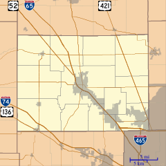
Shepherd is found in the central part of Indiana. It is located at specific geographic coordinates: 39 degrees, 58 minutes, 2 seconds North and 86 degrees, 25 minutes, 53 seconds West.
This location places Shepherd within Boone County. It is also part of the larger Indianapolis metropolitan area. This area includes the big city of Indianapolis and its surrounding communities.


