Snoqualmie Valley Regional Trail facts for kids
The Snoqualmie Valley Regional Trail is a fun path in King County, Washington, USA. It's a special kind of trail called a rail trail. This means it used to be a railroad!
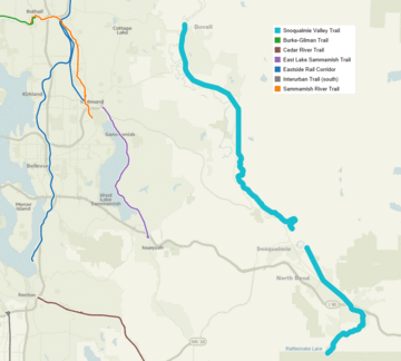
The trail is about 29 miles long. It follows the old tracks of the Milwaukee Road railway. This railway was built in 1911. It stopped being used in 1973. The trail starts at Rattlesnake Lake near North Bend. It finishes at McCormick Park in Duvall.
Contents
Trail History: From Trains to Trails
The Milwaukee Road company built its railway line here in 1911. Trains started carrying passengers on April 21, 1912. Years later, the railway was no longer needed. So, the tracks were removed. The old railway path was then turned into the trail we see today. It's a great example of how old things can get a new life!
Exploring the Snoqualmie Valley Trail
This trail takes you through many different landscapes. You'll see forests, rivers, and open areas. It's a wonderful way to explore the Snoqualmie Valley.
North Bend to Reinig Bridge
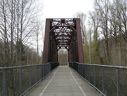
The trail starts near Cedar Falls Road. It then goes east past Rainbow Lake. You'll travel through the Boxley Creek area. Here, a cool trestle bridge crosses a small stream. A trestle bridge is a bridge built on a framework of beams.
Next, the trail reaches the edge of the Riverbend neighborhood. It crosses the South Fork of the Snoqualmie River. The path then goes under the I-90 highway. It crosses North Bend Way and goes through the town of North Bend. You'll pass the Mt. Si Golf Course. Finally, you'll reach the Reinig Bridge at SE Reinig Road.
Reinig Bridge Details
The Reinig Bridge crosses the Snoqualmie River. After the bridge, you go down 15 steps. These steps lead to Meadowbrook Way SE. There are two ways to get back onto the main trail from here. One way is via 396th Drive SE. The other is on Mill Pond Road.
Tokul Creek to Duvall
From Tokul Creek Road, the trail heads west. About a mile west, you'll cross the Tokul Creek Trestle. This bridge goes over the deep Tokul Creek gorge. It's a really cool spot to see!
After that, the trail follows Fall City Road. It goes through the town of Carnation. The trail then continues all the way to the city of Duvall. It ends at McCormick Park in Duvall.
Where to Join the Trail: Access Points
You can get onto the Snoqualmie Valley Regional Trail at many places. Here are some of the main access points:
- Rattlesnake Lake, North Bend
- SE North Bend Way & SE Tanner Road, North Bend
- NE 4th & Ballarat Avenue, North Bend
- Three Forks Off-leash Dog Park, Snoqualmie
- Tokul Creek SE, near Snoqualmie
- 356th Place SE, near Fall City
- Nick Loutsis Park, Carnation
- McCormick Park, Duvall
 | Precious Adams |
 | Lauren Anderson |
 | Janet Collins |


