
King County, Washington facts for kids
Quick facts for kids
King County
|
|||
|---|---|---|---|

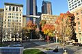
City Hall Park and King County Courthouse in downtown Seattle
|
|||
|
|||

Location within the U.S. state of Washington
|
|||
 Washington's location within the U.S. |
|||
| Country | |||
| State | |||
| Founded | December 22, 1852 | ||
| Named for |
|
||
| Seat | Seattle | ||
| Largest city | Seattle | ||
| Area | |||
| • Total | 2,307 sq mi (5,980 km2) | ||
| • Land | 2,116 sq mi (5,480 km2) | ||
| • Water | 191 sq mi (490 km2) 8.3% | ||
| Population
(2020)
|
|||
| • Total | 2,269,675 | ||
| • Estimate
(2023)
|
2,271,380 |
||
| • Density | 983.82/sq mi (379.86/km2) | ||
| Time zone | UTC−8 (Pacific) | ||
| • Summer (DST) | UTC−7 (PDT) | ||
| Congressional districts | 1st, 7th, 8th, 9th | ||


King County is a large area in the U.S. state of Washington. It is like a big district with its own government. In 2020, over 2.2 million people lived here. This makes it the most populated county in Washington.
The main city and government center of King County is Seattle. Seattle is also the biggest city in Washington.
King County was first named in 1852 after William R. King. He was a US Vice President. But in 1986, the county decided to honor Martin Luther King Jr. instead. He was a famous leader in the civil rights movement. The state government officially approved this change in 2005.
King County is part of a larger area called the Seattle metropolitan area. This area includes Snohomish County to the north and Pierce County to the south. Many people in King County live in suburbs around Seattle. These areas have grown a lot, especially with many tech companies moving in.
Contents
History of King County
Who lived here first?
When Europeans first came to this area, several Native American groups lived here. These groups were part of the Coast Salish people. The Duwamish people lived around what is now Seattle. The Snoqualmie Indian Tribe lived in the eastern part of the county. The Muckleshoot tribes lived near the Green River and White River.
When the first European settlers arrived, Native Americans helped them. They provided labor for building and helped with daily life.
How King County Started
On December 22, 1852, King County was officially created. It was formed from part of Thurston County. This was when the area was still the Oregon Territory. The county was named after William R. King. He was about to become the Vice President of the United States.
Seattle became the county seat on January 11, 1853. Later that year, the area became part of the new Washington Territory.
King County used to be even bigger. It stretched all the way to the Olympic Peninsula. But a part of it, now called Kitsap County, became its own area.
Coal Mining in the Past
Coal was found in King County in 1853. Over the years, many companies started mining coal. They dug for coal around Lake Washington. Then they shipped it to Seattle. By 1880, King County produced a lot of coal. It made up 22% of all the coal mined on the West Coast.
Why the Name Changed
.svg)
On February 24, 1986, the King County Council decided to change the county's namesake. They wanted to honor Martin Luther King Jr. instead of William R. King. William R. King had owned slaves. Martin Luther King Jr. was a champion for human rights. The council felt his values better represented the county.
The state government made the name change official on April 19, 2005. Governor Christine Gregoire signed a bill to do this.
In 2006, the County Council changed the county's logo. It used to be a crown. Now it shows an image of Martin Luther King Jr. This new logo was unveiled in 2007. Martin Luther King Jr. had visited King County once, in 1961.
Geography of King County

King County is very large. It covers about 2,307 square miles. About 2,116 square miles are land. The rest, 191 square miles, is water. This means about 8.3% of the county is water. King County is almost twice the size of the state of Rhode Island.
The highest point in King County is Mount Daniel. It stands at 7,959 feet (2,426 meters) above sea level.
King County shares borders with several other counties. These include Snohomish County to the north and Pierce County to the south. It also borders Kitsap County to the west and Kittitas County to the east.
The county includes two islands in Puget Sound: Vashon Island and Maury Island. King County has many bodies of water. There are 760 lakes and 3,000 miles of streams and rivers.
Mountains and Islands

- Cascade Range
- Issaquah Alps
- Mount Baker-Snoqualmie National Forest
- Mount Daniel (the highest point)
- Mount Si
- Harbor Island
- Maury Island
- Mercer Island
- Sammamish Plateau
- Vashon Island
Rivers and Lakes
- Cedar River
- Green/Duwamish River
- Elliott Bay
- Lake Sammamish
- Lake Union
- Lake Washington
- Puget Sound
- Snoqualmie Falls
- Snoqualmie River
- White River
Protected Areas
- Klondike Gold Rush National Historical Park (part of it)
- Snoqualmie National Forest (part of it)
Climate Change Effects
King County has many waterways. This makes it more likely to experience flooding due to climate change. The county's ocean areas might face harmful chemical changes. Mountain areas could see less ice and snow. Since the mid-2000s, the county has worked to reduce carbon emissions. They also try to lessen the effects of climate change.
Transportation in King County
Main Roads
 Interstate 5
 Interstate 90
 Interstate 405
 U.S. Route 2
 State Route 18
 State Route 99
 State Route 167
 State Route 520
 State Route 522
Public Transport Options
King County Metro provides many ways to get around. They have local buses, vanpools, and rideshare services. They also run electric trolleybuses and streetcars in Seattle. Metro is one of the largest bus agencies in the US.
Sound Transit helps people travel between counties. They operate the Link light rail, Sounder commuter rail, and express buses. Most public transport in the county uses the ORCA card. This is a smart card for paying fares.
King County also has major ferry terminals. Washington State Ferries connects Seattle to islands like Bainbridge Island and Vashon Island. The county also has its own King County Water Taxi. This passenger ferry connects Downtown Seattle to West Seattle and Vashon Island.
People and Population
| Historical population | |||
|---|---|---|---|
| Census | Pop. | %± | |
| 1860 | 302 | — | |
| 1870 | 2,120 | 602.0% | |
| 1880 | 6,910 | 225.9% | |
| 1890 | 63,989 | 826.0% | |
| 1900 | 110,053 | 72.0% | |
| 1910 | 284,638 | 158.6% | |
| 1920 | 389,273 | 36.8% | |
| 1930 | 463,517 | 19.1% | |
| 1940 | 504,980 | 8.9% | |
| 1950 | 732,992 | 45.2% | |
| 1960 | 935,014 | 27.6% | |
| 1970 | 1,156,633 | 23.7% | |
| 1980 | 1,269,749 | 9.8% | |
| 1990 | 1,507,319 | 18.7% | |
| 2000 | 1,737,034 | 15.2% | |
| 2010 | 1,931,249 | 11.2% | |
| 2020 | 2,269,675 | 17.5% | |
| 2023 (est.) | 2,271,380 | 17.6% | |
| U.S. Decennial Census 1790–1960 1900–1990 1990–2000 2010–2020 |
|||
In 2020, King County had 2,269,675 people living in it. The population density was about 1,073 people per square mile. The county's population grew steadily for many years. However, in 2021, it saw its first small decrease in 50 years.
Different Backgrounds
King County is a very diverse place. People from many different backgrounds live here.
| Racial composition | 2020 | 2010 | 2000 | 1990 | 1980 | 1970 | 1960 |
|---|---|---|---|---|---|---|---|
| White (non-Hispanic) | 54.2% | 64.8% | 73.4% | 83.2% | 87.2% | – | – |
| Asian (non-Hispanic) | 19.8% | 14.5% | 10.8% | 7.8% | – | – | 2.0% |
| Hispanic or Latino | 10.7% | 8.9% | 5.4% | 2.9% | 2.1% | 1.8% | – |
| Black or African American (non-Hispanic) | 6.5% | 6.0% | 5.4% | 5.0% | 4.4% | 3.5% | 2.9% |
| Pacific Islander (non-Hispanic) | 0.9% | 0.7% | 0.5% | – | – | – | – |
| Native American (non-Hispanic) | 0.5% | 0.7% | 0.9% | 1.1% | – | – | 0.3% |
| Mixed (non-Hispanic) | 6.8% | 4.1% | 4.0% | – | – | – | – |

Native American Tribes
King County is home to two tribes recognized by the US government. These are the Muckleshoot tribe and the Snoqualmie Indian Tribe. The Muckleshoot Indian Reservation is located southeast of Auburn.
Education in King County
Schools for Kids
King County has many school districts. Here are some of them:
- Auburn School District
- Bellevue School District
- Federal Way Public Schools
- Highline School District
- Issaquah School District
- Kent School District
- Lake Washington School District
- Mercer Island School District
- Northshore School District
- Renton School District
- Seattle Public Schools
- Shoreline School District
- Snoqualmie Valley School District
- Tahoma School District
- Vashon Island School District
Public Libraries
Most of King County uses the King County Library System. This system has 49 locations. The city of Seattle has its own library system. The Seattle Public Library has 27 branches.
Communities in King County
Cities in King County
- Algona
- Auburn
- Bellevue
- Black Diamond
- Bothell
- Burien
- Carnation
- Covington
- Des Moines
- Duvall
- Enumclaw
- Federal Way
- Issaquah
- Kenmore
- Kent
- Kirkland
- Lake Forest Park
- Maple Valley
- Medina
- Mercer Island
- Newcastle
- North Bend
- Redmond
- Renton
- Sammamish
- SeaTac
- Seattle (county seat)
- Shoreline
- Snoqualmie
- Tukwila
- Woodinville
Towns in King County
Other Communities (CDPs)
These are areas that are not officially cities or towns, but are recognized for census purposes.
- Ames Lake
- Baring
- Boulevard Park
- Bryn Mawr-Skyway
- Cottage Lake
- East Renton Highlands
- Fairwood
- Fall City
- Hobart
- Lake Holm
- Lake Marcel-Stillwater
- Lake Morton-Berrydale
- Lakeland North
- Lakeland South
- Maple Heights-Lake Desire
- Mirrormont
- Ravensdale
- Shadow Lake
- Vashon
- White Center
- Wilderness Rim
Unincorporated Communities
These are smaller places that are not part of any city or town.
- Cedar Falls
- Cumberland
- Denny Creek
- Grotto
- Kanaskat
- Kangley
- Lake Joy
- Novelty
- Palmer
- Preston
- Selleck
- Spring Glen
Ghost Towns
These are places where people used to live but are now abandoned.
- Bayne
- Cedar Falls (aka Moncton)
- Edgewick
- Franklin
- Hot Springs
- Lester
- Monohon
- Nagrom
- O'Brien
- Osceola
- Taylor
- Wellington
- Weston
Images for kids
-
City Hall Park and King County Courthouse in downtown Seattle
See also
 In Spanish: Condado de King (Washington) para niños
