
Shoreline, Washington facts for kids
Quick facts for kids
Shoreline, Washington
|
|
|---|---|

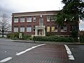
Shoreline City Hall
|
|

Location of Shoreline, Washington
|
|
| Country | United States |
| State | Washington |
| County | King |
| City | August 31, 1995 |
| Government | |
| • Type | Council–manager |
| Area | |
| • Total | 12.44 sq mi (32.21 km2) |
| • Land | 11.63 sq mi (30.13 km2) |
| • Water | 0.80 sq mi (2.08 km2) |
| Elevation | 476 ft (145 m) |
| Population
(2020)
|
|
| • Total | 58,608 |
| • Estimate
(2023)
|
61,353 |
| • Rank | US: 683rd WA: 22nd |
| • Density | 4,901.33/sq mi (1,892.46/km2) |
| Time zone | UTC-8 (Pacific (PST)) |
| • Summer (DST) | UTC-7 (PDT) |
| ZIP codes |
98133, 98155, 98177
|
| Area code(s) | 206 |
| FIPS code | 53-63960 |
| GNIS feature ID | 1699810 |
Shoreline is a city located in King County, Washington, USA. It's found just north of Seattle, right on the border with Snohomish County. The city is about 9 miles (14.5 km) north of downtown Seattle.
In 2020, about 58,608 people lived in Shoreline. This made it the 22nd largest city in Washington state. Shoreline is known as a comfortable place to live.
Contents
History of Shoreline
Shoreline has a rich history, from its first inhabitants to how it became a city.
Early Native American Life
Long ago, the area we now call Shoreline was home to local Coast Salish peoples. These groups are now part of the Duwamish tribe. They lived off the land and water, following ancient trails.
Trails and Resources
One important trail went from Salmon Bay to Green Lake. It continued north through areas with Licton Springs and the start of Thornton Creek. This trail then led to Haller Lake.
People gathered lots of cranberries in bogs (wetlands) where Twin Ponds and Ronald Bog Parks are today. They also found salmonberries and skunk cabbage along Thornton Creek. People from Lake Union came here to collect cranberries.
Hunting and Gathering Areas
The trail went further north to Echo Lake. There was a large burned area from Echo Lake down to Bitter Lake. This was probably done on purpose to help grow plants like bracken fern and camas. It also made good hunting grounds.
At Echo Lake, the trail split. One path went west to Richmond Beach, and another continued north to Lake Ballinger. People had seasonal camps at Richmond Beach and Boeing Creek. These spots were good for finding kinnikinnick, a plant used for smoking.
How Shoreline Became a City
Modern Shoreline started to form in 1890. This was when the Richmond Beach neighborhood was planned out. People expected the Great Northern Railway to arrive the next year.
Growing Connections
Over the next 20 years, Shoreline became more connected to Seattle. An Interurban streetcar line (like a light rail) started running in 1906. Then, North Trunk Road (now State Route 99) was built in 1913. These connections helped the area grow.
The Name "Shoreline"
The name "Shoreline" was first used in 1944 for the local school district. Its boundaries stretched from "Shore to Shore" (from Puget Sound to Lake Washington) and "Line to Line" (from Seattle's old city limit at 85th Street to the Snohomish County line). Even though the city's borders don't reach Lake Washington today, the name stuck.
Becoming an Official City
From 1950 to 1957, Shoreline was one of the fastest-growing areas near Seattle. Its population grew by 64 percent! In 1995, Shoreline officially became a city. This happened on August 31, 1995. The city decided to use a council–manager system. This means a city council makes decisions, and a city manager handles the day-to-day operations.
City Services and Geography
Shoreline provides services to its residents and has many natural features.
Police Services
Shoreline gets its police services from the King County Sheriff's Office. Police officers assigned to Shoreline wear city uniforms and drive cars with the city's logo. In 2012, there were 52 full-time police employees working for Shoreline. They have special units for things like burglaries, traffic, and street crimes.
Where is Shoreline Located?
Shoreline is located at 47°45′23″N 122°20′23″W / 47.75639°N 122.33972°W.
The city covers about 11.70 square miles (30.30 square kilometers). Most of this is land, with a small amount of water. Shoreline also includes a special neighborhood called The Highlands. This community manages its own utilities separately. The Richmond Beach neighborhood is in the northwest part of the city.
Parks and Natural Areas
Shoreline has 25 parks, covering a total of 330 acres (130 ha). These parks offer great places for outdoor activities.
Boeing Creek and Shoreview Park is next to Shoreline Community College. It has Boeing Creek flowing through it, which eventually reaches Hidden Lake and Puget Sound. Echo Lake is also within the city limits and has its own park.
People of Shoreline
Shoreline is home to a diverse group of people.
Population Growth
| Historical population | |||
|---|---|---|---|
| Census | Pop. | %± | |
| 1990 | 52,109 | — | |
| 2000 | 53,025 | 1.8% | |
| 2010 | 53,007 | 0.0% | |
| 2020 | 58,608 | 10.6% | |
| 2023 (est.) | 61,353 | 15.7% | |
| U.S. Decennial Census 2020 Census |
|||
In 2010, there were 53,007 people living in Shoreline. There were 21,561 households and 13,168 families. The city had about 4,542 people per square mile (1,754 per square kilometer).
Diversity in Shoreline
The people in Shoreline come from many different backgrounds. In 2010, the racial makeup was:
- 71.4% White
- 5.0% African American
- 0.8% Native American
- 15.2% Asian
- 0.3% Pacific Islander
- 2.2% from other races
- 5.1% from two or more races
About 6.6% of the population was Hispanic or Latino.
Households and Age
About 27.9% of households had children under 18 living with them. Many households (46.4%) were married couples living together. The average household had 2.39 people, and the average family had 2.96 people.
The average age in Shoreline was 42.1 years. About 19.1% of residents were under 18. And 15.2% were 65 years or older.
Neighborhoods and Landmarks
Shoreline is made up of several distinct neighborhoods and has important landmarks.
City Neighborhoods
Shoreline is divided into 14 neighborhoods. These areas are mostly laid out in a rectangular shape based on street maps.
The city has a council of neighborhoods. This group brings together community leaders from each area. They discuss and coordinate city programs that affect the neighborhoods.
Important City Landmarks
The City of Shoreline has officially named several places as landmarks. These are buildings or sites that are important to the city's history.
| Landmark | Built | Listed | Address |
|---|---|---|---|
| William E. Boeing House | 1914 | 1994 | The Highlands |
| Crawford Store (Godfrey Building) | 1922 | 1985 | 2411 NW 195th Place |
The city also recognizes a "community landmark":
| Landmark | Built | Listed | Address | Photo |
|---|---|---|---|---|
| Ronald Grade School | 1912 | 1995 | 749 N 175th Street |

Economy and Points of Interest
Shoreline has various businesses and fun places to visit.
Local Economy
Some companies and organizations are based in Shoreline. One example is Crista Ministries.
Fun Places to Visit
Shoreline offers several interesting places to explore:
- Hamlin Park
- Kruckeberg Botanic Garden
- Boeing Creek and Shoreview Park
- Shoreline Community College
- Echo Lake
Sister City
Shoreline has a special connection with a city in another country.
 Boryeong, South Chungcheong, South Korea (since 2002)
Education in Shoreline
Shoreline has a strong focus on education, with various schools and colleges.
School Districts
The main school district serving the area is the Shoreline School District. It includes:
- Shorecrest High School
- Shorewood High School
Some schools, like Kellogg Middle School, have an exchange student program. Students can visit junior high students from Nichinan, Japan.
A third high school, Shoreline High School, closed in 1986. Its students went to Shorecrest and Shorewood. The old campus is now used as the school district's headquarters and has a public gym, theater, and stadium.
Private Schools
Shoreline also has several private schools:
- King's Schools
- Shoreline Christian School
- The Evergreen School
Colleges
For higher education, students can attend Shoreline Community College.
Transportation in Shoreline
Getting around Shoreline is easy with its major roads and public transport options.
Major Highways
Two main north-south highways pass through Shoreline:
- Interstate 5: This is a major freeway in Western Washington.
- State Route 99 (Aurora Avenue): This road goes south to Seattle and north to Everett.
State Route 523 (145th Street) forms the southern border of the city. It connects Interstate 5, State Route 99, and State Route 522. The Interurban Trail runs along State Route 99. It follows the path of an old railway and connects Seattle with Everett. The part in Shoreline was finished in 2007.
Public Transportation
Shoreline has two Link light rail stations near Interstate 5. These are part of Sound Transit's 1 Line:
- Shoreline South/148th station
- Shoreline North/185th station
Both stations have parking garages with space for 1,000 cars. They will also be stops for new bus rapid transit lines. King County Metro provides local bus service in Shoreline. This includes the RapidRide E Line on Aurora Avenue.
Bike and Scooter Sharing
In August 2024, Shoreline started a pilot program for bike-sharing and scooter-sharing with Lime. This makes it easier for people to get around without a car.
Images for kids
-
Ronald Grade School, a community landmark.
See also
 In Spanish: Shoreline (Washington) para niños
