List of counties in Washington facts for kids
Quick facts for kids Counties of Washington |
|
|---|---|
 |
|
| Location | State of Washington |
| Number | 39 |
| Populations | 2,363 (Garfield) – 2,271,380 (King) |
| Areas | 175 square miles (450 km2) (San Juan) – 5,268 square miles (13,640 km2) (Okanogan) |
| Government | County government |
| Subdivisions | cities, towns, townships, Indian reservations |
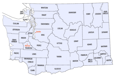
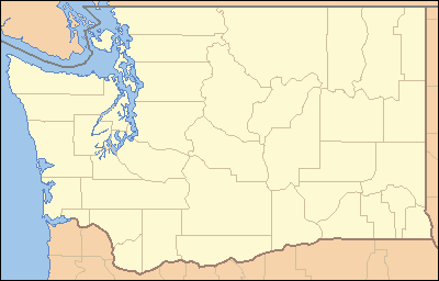
The U.S. state of Washington has 39 counties. Counties are like smaller areas within a state. They help organize local government and services.
The first counties, Clark (originally Vancouver) and Lewis, were created in 1845. This was when the area was part of the Oregon Country. More counties were added as the region grew. By 1889, when Washington became a state, 34 counties existed. The last five were formed by 1911.
The rules for counties are in the Washington State Constitution. A new county must have at least 2,000 people. Also, an old county cannot lose so many people that its population drops below 4,000. To change a county's borders, most registered voters in that area must agree. The last big change was in 1911.
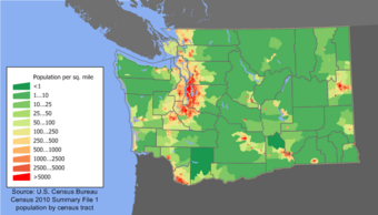
King County, where Seattle is, has the most people. About 30% of Washington's population lives there. It also has the most people per square mile. On the other hand, Garfield County has the fewest people.
Some counties have special features. For example, San Juan and Island counties are made up only of islands. Many county names come from Native American words. Others are named after important political figures or geographic places.
Contents
How Washington Counties Are Governed
Counties in Washington provide many important services. These include running courts, managing parks, and operating libraries. They also handle elections, collect trash, and maintain roads. Counties are responsible for planning how land is used.
Unlike some other states, Washington counties do not have smaller divisions called townships. Instead, local government happens in cities and towns. There are also 29 Indian reservations in the state. Areas outside of cities and towns are managed directly by the county.
Most counties are run by a group of elected commissioners. These commissioners act as both the lawmakers and the leaders. Some larger counties have a different system called a "charter" government. These counties can make their own rules, different from state law.
For example, King, Whatcom, Snohomish, and Pierce counties elect a county executive. This person is like a mayor for the whole county. In other charter counties, a manager is hired to run the government. People also vote for other important county officials. These include the sheriff, treasurer, and prosecuting attorney.
List of Counties in Washington
| County |
FIPS code | County seat | Est. | Formed from | Etymology | Population (2023) | Land area | Map |
|---|---|---|---|---|---|---|---|---|
| Adams County | 001 | Ritzville | 1883 | Whitman County | John Adams (1735–1826), 2nd U.S. President | 20,820 | 1,925 sq mi (4,986 km2) |
 |
| Asotin County | 003 | Asotin | 1883 | Garfield County | The Nez Percé name for Eel Creek | 22,549 | 636 sq mi (1,647 km2) |
 |
| Benton County | 005 | Prosser | 1905 | Yakima and Klickitat Counties | Thomas Hart Benton (1782–1858), a U.S. Senator from Missouri | 215,219 | 1,700 sq mi (4,403 km2) |
 |
| Chelan County | 007 | Wenatchee | 1899 | Okanogan and Kittitas Counties | A Native American word meaning "deep water", referring to Lake Chelan | 79,997 | 2,920 sq mi (7,563 km2) |
 |
| Clallam County | 009 | Port Angeles | 1854 | Jefferson County | A Klallam word meaning "brave people" or "the strong people" | 77,616 | 1,738 sq mi (4,501 km2) |
 |
| Clark County | 011 | Vancouver | 1845 | Original County | William Clark (1770–1838), the co-captain of the Lewis and Clark Expedition | 521,150 | 629 sq mi (1,629 km2) |
 |
| Columbia County | 013 | Dayton | 1875 | Walla Walla County | The Columbia River | 4,053 | 869 sq mi (2,251 km2) |
 |
| Cowlitz County | 015 | Kelso | 1854 | Lewis County | Cowlitz, an Indian tribe | 112,864 | 1,139 sq mi (2,950 km2) |
 |
| Douglas County | 017 | Waterville | 1883 | Lincoln County | Stephen A. Douglas (1813–1861), U.S. Senator from Illinois | 44,798 | 1,819 sq mi (4,711 km2) |
 |
| Ferry County | 019 | Republic | 1899 | Stevens County | Elisha P. Ferry (1825–1895), 1st Governor of Washington | 7,497 | 2,204 sq mi (5,708 km2) |
 |
| Franklin County | 021 | Pasco | 1883 | Whitman County | Benjamin Franklin (1706–1790), writer, orator, inventor, and U.S. Founding Father | 99,034 | 1,242 sq mi (3,217 km2) |
 |
| Garfield County | 023 | Pomeroy | 1881 | Columbia County | James A. Garfield (1831–1881), 20th U.S. President | 2,363 | 710 sq mi (1,839 km2) |
 |
| Grant County | 025 | Ephrata | 1909 | Douglas County | Ulysses S. Grant (1822–1885), 18th U.S. President | 102,678 | 2,680 sq mi (6,941 km2) |
 |
| Grays Harbor County | 027 | Montesano | 1854 | Thurston County | Grays Harbor, a body of water named after explorer and merchant Robert Gray (1755–1806) | 77,290 | 1,902 sq mi (4,926 km2) |
 |
| Island County | 029 | Coupeville | 1852 | Thurston County | Consists solely of islands, including Whidbey and Camano islands | 86,267 | 209 sq mi (541 km2) |
 |
| Jefferson County | 031 | Port Townsend | 1852 | Thurston County | Thomas Jefferson (1743–1826), 3rd U.S. President and principal author of the Declaration of Independence | 33,714 | 1,804 sq mi (4,672 km2) |
 |
| King County | 033 | Seattle | 1852 | Thurston County | William R. King (1786–1853), U.S. Vice President under Franklin Pierce; officially renamed in 2005 after civil rights leader Martin Luther King Jr. (no relation) (1929–1968) | 2,271,380 | 2,115 sq mi (5,478 km2) |
 |
| Kitsap County | 035 | Port Orchard | 1857 | King and Jefferson Counties | Chief Kitsap (d. 1860), leader of the Suquamish tribe | 277,658 | 395 sq mi (1,023 km2) |
 |
| Kittitas County | 037 | Ellensburg | 1883 | Yakima County | Yakama word of uncertain meaning, with popular translations ranging from "white chalk" to "land of the plenty" | 45,508 | 2,297 sq mi (5,949 km2) |
 |
| Klickitat County | 039 | Goldendale | 1859 | Walla Walla County | Klickitat tribe, also meaning "robber" and "beyond" | 23,589 | 1,872 sq mi (4,848 km2) |
 |
| Lewis County | 041 | Chehalis | 1845 | Clark County | Meriwether Lewis (1774–1809), the co-captain of the Lewis and Clark Expedition | 86,154 | 2,403 sq mi (6,224 km2) |
 |
| Lincoln County | 043 | Davenport | 1883 | Whitman County | Abraham Lincoln (1809–1865), 16th U.S. President | 11,738 | 2,311 sq mi (5,985 km2) |
 |
| Mason County | 045 | Shelton | 1854 | King County | Charles H. Mason (1830–1859), 1st Secretary of Washington Territory | 68,389 | 959 sq mi (2,484 km2) |
 |
| Okanogan County | 047 | Okanogan | 1888 | Stevens County | A Salish word meaning "rendezvous" | 43,712 | 5,268 sq mi (13,644 km2) |
 |
| Pacific County | 049 | South Bend | 1851 | Lewis County | The Pacific Ocean | 24,200 | 933 sq mi (2,416 km2) |
 |
| Pend Oreille County | 051 | Newport | 1911 | Stevens County | The Pend d'Oreille tribe, named by French traders for their "ear bobs" | 14,361 | 1,400 sq mi (3,626 km2) |
 |
| Pierce County | 053 | Tacoma | 1852 | Thurston County | Franklin Pierce (1804–1869), 14th U.S. President | 928,696 | 1,670 sq mi (4,325 km2) |
 |
| San Juan County | 055 | Friday Harbor | 1873 | Whatcom County | San Juan Islands, itself derived from Juan Vicente de Güemes | 18,566 | 174 sq mi (451 km2) |
 |
| Skagit County | 057 | Mount Vernon | 1883 | Whatcom County | The Skagit tribe | 131,417 | 1,731 sq mi (4,483 km2) |
 |
| Skamania County | 059 | Stevenson | 1854 | Clark County | A Chinookan word meaning "swift water" | 12,640 | 1,656 sq mi (4,289 km2) |
 |
| Snohomish County | 061 | Everett | 1861 | Island and King Counties | The Snohomish tribe, word origin disputed | 844,761 | 2,087 sq mi (5,405 km2) |
 |
| Spokane County | 063 | Spokane | 1879 | Stevens County | The Spokane tribe | 551,455 | 1,764 sq mi (4,569 km2) |
 |
| Stevens County | 065 | Colville | 1863 | Walla Walla County | Isaac Stevens (1818–1862), 1st Governor of the Washington Territory | 48,837 | 2,478 sq mi (6,418 km2) |
 |
| Thurston County | 067 | Olympia | 1852 | Lewis County | Samuel Thurston (1815–1851), the Oregon Territory's first delegate to U.S. Congress | 299,003 | 722 sq mi (1,870 km2) |
 |
| Wahkiakum County | 069 | Cathlamet | 1854 | Cowlitz County | Wakaiakam, chief of the Kathlamet tribe | 4,765 | 264 sq mi (684 km2) |
 |
| Walla Walla County | 071 | Walla Walla | 1854 | Skamania County | The Walla Walla tribe, also a Nez Percé name for running water | 61,568 | 1,270 sq mi (3,289 km2) |
 |
| Whatcom County | 073 | Bellingham | 1854 | Island County | Whatcom, chief of the Nooksack tribe and named for a Nooksack word meaning "noisy water" | 231,919 | 2,107 sq mi (5,457 km2) |
 |
| Whitman County | 075 | Colfax | 1871 | Stevens County | Marcus Whitman (1802–1847), a Methodist missionary | 48,012 | 2,159 sq mi (5,592 km2) |
 |
| Yakima County | 077 | Yakima | 1865 | Ferguson County (defunct) | The Yakama tribe, meaning "runaway [waters]" or "big belly" | 256,643 | 4,296 sq mi (11,127 km2) |
 |
Counties That Changed Their Names
Four counties in Washington changed their names over time:
- Chehalis County was named after the Chehalis people. It became Grays Harbor County in 1915.
- Sawamish County was named for the Sahewamish Native American tribe. It was renamed Mason County in 1864.
- Slaughter County was named for Lieutenant William A. Slaughter. He was killed during the Indian Wars. It was renamed Kitsap County soon after it was formed in 1857.
- Vancouver County was named after George Vancouver. It was renamed Clarke County in 1849. The spelling was corrected to Clark in 1925.
Counties That No Longer Exist
Several counties were formed but later disappeared or became part of other territories:
- Clackamas County, Oregon was created in 1844. It included land that later became part of Washington. When Washington Territory was formed in 1853, this area was no longer a county.
- Spokane County was created in Washington Territory in 1858. It later merged into Stevens County in 1864. But it was created again in 1879.
- Some counties like Missoula, Shoshone, Idaho, Nez Perce, and Boise were once part of Washington Territory. They later became part of the Idaho Territory in 1863.
- Ferguson County was created in 1863 from Walla Walla County. It was dissolved in 1865. Yakima County was created in its place.
- Quillehuyte County was split from Jefferson and Clallam counties in 1868. It returned to those counties a year later before it was fully organized.
Ideas for New Counties
Over the years, people have suggested creating new counties in Washington. However, none of these ideas have become real counties.
- In 1851, there was a discussion about forming a "Columbia Territory." This plan included several new counties. Only Thurston County was actually created from these ideas.
- In 1856, a new county called Buchanan County was suggested to be split from Clark County.
- After Washington became a state, more new counties were proposed. These included Big Bend (1891), Palouse (1891 and 1903), Sherman (1891), Washington (1891), Wenatchee (1893), McKinley (1903), Steptoe (1903), and Coulee (1905). None of these were ever established.
- More recently, in the 1990s, some rural areas wanted to separate from larger counties. They suggested creating counties like Cedar, Freedom, and Skykomish. These ideas had some support but did not pass.
See also
 In Spanish: Anexo:Condados de Washington para niños
- List of United States counties and county equivalents
- Government of Washington
 | Dorothy Vaughan |
 | Charles Henry Turner |
 | Hildrus Poindexter |
 | Henry Cecil McBay |


