Jefferson County, Washington facts for kids
Quick facts for kids
Jefferson County
|
|
|---|---|
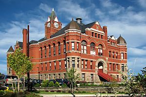
Jefferson County Courthouse in Port Townsend
|
|
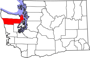
Location within the U.S. state of Washington
|
|
 Washington's location within the U.S. |
|
| Country | |
| State | |
| Founded | December 22, 1852 |
| Named for | Thomas Jefferson |
| Seat | Port Townsend |
| Largest city | Port Townsend |
| Area | |
| • Total | 2,183 sq mi (5,650 km2) |
| • Land | 1,804 sq mi (4,670 km2) |
| • Water | 379 sq mi (980 km2) 17%% |
| Population
(2020)
|
|
| • Total | 32,977 |
| • Estimate
(2023)
|
33,714 |
| • Density | 17/sq mi (7/km2) |
| Time zone | UTC−8 (Pacific) |
| • Summer (DST) | UTC−7 (PDT) |
| Congressional district | 6th |
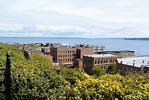
Jefferson County is a place in the U.S. state of Washington. It's called a county, which is like a smaller area within a state. In 2020, about 32,977 people lived here. The main town and only city is Port Townsend. The county is named after Thomas Jefferson, who was an important leader in American history.
Jefferson County was created on December 22, 1852. It was part of the Oregon Territory back then. At first, it covered a large northern part of the Olympic Peninsula. Later, in 1854, Clallam County was formed from a part of Jefferson County.
The Hood Canal Bridge connects Jefferson County to Kitsap County, Washington. This bridge makes it easier to travel between the two counties. Also, the Washington State Ferries have a route from Coupeville to Port Townsend. This ferry connects the county to Whidley Island in Island County, Washington.
Contents
Exploring Jefferson County's Geography
Jefferson County covers a total area of about 2,183 square miles. Most of this area, about 1,804 square miles, is land. The rest, about 379 square miles (17%), is water.
The county is divided into three main parts by its natural landscape:
- The eastern part is along the Strait of Juan de Fuca, Admiralty Inlet, Puget Sound, and the Hood Canal.
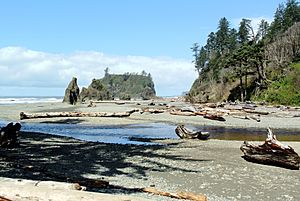
- The central part is mostly empty and lies within the Olympic Mountains. This area is part of Olympic National Park and Olympic National Forest.
- The western part is along the Pacific Ocean.
Because of the tall Olympic Mountains, there isn't a road that goes all the way through Jefferson County. To get from the eastern to the western side, you have to drive about 100 miles. This route goes through U.S. Route 101 in nearby Clallam County. The mountains also block wet winds, making the western part much wetter. The eastern side is drier and is sometimes called the "banana belt" because it's in a "rain shadow."
Key Natural Features
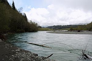
Here are some important natural places in Jefferson County:
- Admiralty Inlet
- Bolton Peninsula
- Destruction Island
- Discovery Bay
- Hood Canal
- Mount Olympus, the highest point on the Olympic Peninsula
- Olympic Mountains
- Olympic Peninsula
- Pacific Ocean
- Point Wilson
- Port Townsend Bay
- Protection Island
- Puget Sound
- Queets River
- Quimper Peninsula
- Strait of Juan de Fuca
- Toandos (Coyle) Peninsula
Main Roads
Neighboring Counties
Jefferson County shares borders with these other counties:
- Island County – to the northeast
- Kitsap County – to the southeast
- Mason County – to the south and southeast
- Grays Harbor County – to the south and southwest
- Clallam County – to the northwest
- San Juan County – to the northeast
Protected Natural Areas
Parts of these special natural areas are found in Jefferson County:
- Olympic National Forest
- Olympic National Park
- Protection Island National Wildlife Refuge
- Quillayute Needles National Wildlife Refuge
- Pacific Northwest National Scenic Trail
People of Jefferson County
| Historical population | |||
|---|---|---|---|
| Census | Pop. | %± | |
| 1860 | 531 | — | |
| 1870 | 1,268 | 138.8% | |
| 1880 | 1,712 | 35.0% | |
| 1890 | 8,368 | 388.8% | |
| 1900 | 5,712 | −31.7% | |
| 1910 | 8,337 | 46.0% | |
| 1920 | 6,557 | −21.4% | |
| 1930 | 8,346 | 27.3% | |
| 1940 | 8,918 | 6.9% | |
| 1950 | 11,618 | 30.3% | |
| 1960 | 9,639 | −17.0% | |
| 1970 | 10,661 | 10.6% | |
| 1980 | 15,965 | 49.8% | |
| 1990 | 20,146 | 26.2% | |
| 2000 | 25,953 | 28.8% | |
| 2010 | 29,872 | 15.1% | |
| 2020 | 32,977 | 10.4% | |
| 2023 (est.) | 33,714 | 12.9% | |
| U.S. Decennial Census 1790–1960 1900–1990 1990–2000 2010–2020 |
|||
Jefferson County is also known as the Port Townsend micropolitan statistical area. This is a term used by the U.S. Census Bureau for smaller city areas. In 2023, the average age of people in the county was 60.8 years old. This makes it one of the oldest areas in the country.
What the 2010 Census Showed
In 2010, there were 29,872 people living in Jefferson County. There were 14,049 households, which are groups of people living together. About 8,394 of these were families. The county had about 16.6 people per square mile.
Most people in the county were white (91.0%). Other groups included American Indian (2.3%), Asian (1.6%), and Black or African American (0.8%). About 2.8% of the people were of Hispanic or Latino background. Many people had ancestors from England (20.8%), Germany (20.3%), or Ireland (13.9%).
About 18.2% of households had children under 18. Nearly half (49.1%) were married couples. The average household had 2.08 people. The average age of people in the county was 53.9 years.
The average income for a household was $46,048. For families, it was $59,964. About 13.5% of all people in the county lived below the poverty line. This included 20.8% of those under 18.
Jefferson County's Economy
The biggest private employer in Jefferson County is the Port Townsend Paper Mill. This mill provides many jobs for people in the area. The largest employer overall, including both private and public jobs, is Jefferson Healthcare. This organization runs the Jefferson Healthcare Hospital.
Towns and Communities
City
- Port Townsend (This is the main town, also called the county seat)
Census-Designated Places
These are areas that are like towns but are not officially incorporated as cities:
Unincorporated Communities
These are smaller communities that are not officially part of a city or census-designated place:
- Adelma Beach
- Beckett Point
- Cape George
- Center
- Chimacum
- Clearwater
- Coyle
- Crocker Lake
- Dabob
- Discovery Bay
- East Quilcene
- Gardiner
- Glen Cove
- Irondale
- Kala Point
- Kalaloch
- Leland
- Mats Mats
- Oak Bay
- Swansonville
See also
 In Spanish: Condado de Jefferson (Washington) para niños
 | John T. Biggers |
 | Thomas Blackshear |
 | Mark Bradford |
 | Beverly Buchanan |


