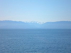
Strait of Juan de Fuca facts for kids
Quick facts for kids Strait of Juan de Fuca |
|
|---|---|
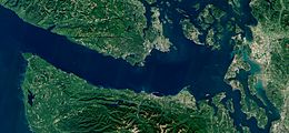
Sentinel-2 image of the Strait of Juan de Fuca
|
|
| Location | British Columbia and Washington |
| Coordinates | 48°13′30″N 123°33′30″W / 48.22500°N 123.55833°W |
| Type | Strait |
| Part of | Salish Sea |
| Basin countries | Canada and United States |
| Max. length | 96 mi (83 nmi; 154 km) |
| Max. width | 12 to 25 mi (10 to 22 nmi; 19 to 40 km) |
| Average depth | 100 m (330 ft) |
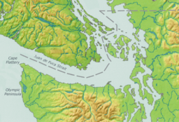
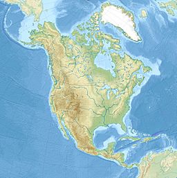
The Strait of Juan de Fuca is a large body of water, about 96 miles (155 km) long. It acts as the main connection between the Salish Sea and the huge Pacific Ocean. This important strait forms part of the border between two countries: Canada and the United States. The official name in Canada is Juan de Fuca Strait.
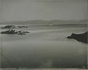
The strait was named in 1787 by a fur trader named Charles William Barkley. He named it after Juan de Fuca, a Greek sailor who explored the area in 1592. Juan de Fuca was looking for a legendary waterway called the Strait of Anián. Barkley was the first person to officially record finding the strait, unless Juan de Fuca's earlier story was true.
Some historians, like Samuel Bawlf, think Juan de Fuca's story might have been made up. They suggest it was based on earlier explorations by Francis Drake in 1579. Drake might have been the first European to see and even sail through the strait.
Contents
What is the Strait of Juan de Fuca?
The United States Geological Survey describes the Strait of Juan de Fuca as a long, narrow channel. It stretches from the Pacific Ocean in the west to several other waterways in the east. These eastern waterways include Haro Strait, San Juan Channel, Rosario Strait, and Puget Sound.
The strait is located between Vancouver Island in British Columbia, Canada, and the Olympic Peninsula in Washington, USA. Its western edge is marked by a line between Cape Flattery and Tatoosh Island in Washington, and Carmanah Point on Vancouver Island.
The northern border follows the coast of Vancouver Island. The southern border is the northern coast of the Olympic Peninsula. In the eastern part of the strait, you'll find the Race Rocks Archipelago. This area has strong currents and is located between Port Angeles, Washington, and Victoria, British Columbia.
Weather and Climate in the Strait
The climate around the Strait of Juan de Fuca is a bit unique. Some experts classify it as a Mediterranean climate, which means it has dry summers. However, many local weather scientists prefer to call it an oceanic climate, which is generally mild and wet.
The amount of rainfall changes a lot across the strait. The western end can get over 100 inches (250 cm) of rain, like a temperate rainforest. But the eastern end, near Sequim, gets much less, sometimes as little as 16 inches (41 cm).
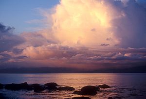
Because the strait is open to the Pacific Ocean, it often experiences strong winds and waves. This means the waters can be rougher here than in more protected areas further inland. Sailors often hear small-craft advisories, gale warnings, and storm warnings for the strait.
Ferry Services Across the Strait
Many people travel across the Strait of Juan de Fuca using ferries.
- The MV Coho is an international vehicle ferry. It carries cars and passengers between Port Angeles, Washington, and Victoria, British Columbia. This ferry has been running since 1959 and is still privately owned. In 2018, the Coho carried nearly half a million passengers!
- Another ferry, the Victoria Clipper, carries only passengers. It travels between Seattle and Victoria.
- During certain seasons, the Washington State Ferries system also has a route that connects Sidney (near Victoria) with the San Juan Islands and Anacortes, Washington.
Border Challenges in the Strait
The border within the Strait of Juan de Fuca itself is clear. However, there is a disagreement between Canada and the United States about the maritime (sea) border that extends west from the strait into the Pacific Ocean. This disputed area stretches about 200 nautical miles (370 km) out to sea.
Both countries suggest a border based on the principle of equidistance, which means the line is equally far from both coastlines. But they pick slightly different starting points, which causes small differences in the proposed border line.
The province of British Columbia in Canada has a different idea. They believe the Juan de Fuca Canyon, a deep underwater valley, should be the natural border. This disagreement is complicated because it could affect other border issues between Canada and the United States.
The Salish Sea Name
In 2008, the Chemainus First Nation, an Indigenous group in British Columbia, suggested renaming the strait the "Salish Sea". This idea gained support.
Later, in 2009, geographic boards in both Canada and the United States officially approved the name Salish Sea. This name doesn't replace the names of the Strait of Juan de Fuca, Puget Sound, or the Strait of Georgia. Instead, it's a larger, collective name for all these connected waterways. It helps recognize the shared history and culture of the Coast Salish peoples who have lived in this region for thousands of years.
Areas Along the Strait
The Strait of Juan de Fuca is bordered by different counties and regional districts in both the United States and Canada.
In the United States (Washington State), these include:
- Clallam County, Washington
- Jefferson County, Washington
- Island County, Washington
- Skagit County, Washington
- San Juan County, Washington
- Whatcom County, Washington
In Canada (British Columbia), these include:
Amazing Animals of the Strait
The Strait of Juan de Fuca is home to many interesting marine animals.
- Common Murres: These seabirds migrate north by swimming! Some murres from the Pacific Coast paddle into the strait's calm bays to eat herring and other small fish.
- Humpback Whales: You can often see Humpback whales near the western end of the strait, especially from June to November. They are often found near Neah Bay and La Push.
- Killer Whales: There are two types of killer whales in the strait. Some live there all the time and eat Chinook salmon. Others are "transient" (traveling) killer whales. They often hunt California sea lions, Steller's sea lions, and even gray whales.
- Gray Whales: Migrating gray whales travel between Baja California and Alaska every year. They often stop in the Strait of Juan de Fuca to feed on small creatures on the seafloor. It's like a rest stop on their long journey! They also meet and socialize with the local gray whales. This helps them find new mates and keep their populations healthy. The best time to see these migrating whales is between March and May.
See also
 In Spanish: Estrecho de Juan de Fuca para niños
- Graveyard of the Pacific
- Juan de Fuca Canyon
- List of areas disputed by the United States and Canada
- Marilyn Bell
- Oregon boundary dispute
- Race Rocks Marine Protected Area
- Pig War (San Juan Islands Dispute)
- Swinomish Channel
- Strait of Juan de Fuca laser incident
 | James B. Knighten |
 | Azellia White |
 | Willa Brown |


