Queets River facts for kids
Quick facts for kids Queets River |
|
|---|---|
 |
|
 |
|
|
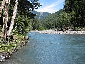
Mouth of the Queets River in Washington
|
|
| Country | United States |
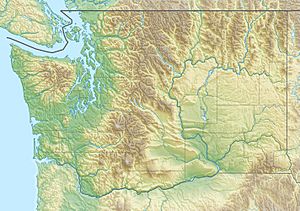
| State | Washington |
| County | Jefferson |
| Physical characteristics | |
| Main source | Humes Glacier, Mount Olympus Olympic Mountains 4,230 ft (1,290 m) 47°47′21″N 123°36′28″W / 47.78917°N 123.60778°W |
| River mouth | Pacific Ocean Near Queets, Washington 0 ft (0 m) 47°32′40″N 124°21′22″W / 47.54444°N 124.35611°W |
| Length | 52.8 mi (85.0 km) |
| Basin features | |
| Basin size | 204 sq mi (530 km2) |
| Tributaries |
|
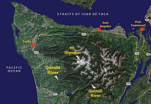
The Queets River is a beautiful river in the state of Washington, United States. It flows through the amazing Olympic Peninsula. Most of the river is inside the famous Olympic National Park. Finally, it flows into the Pacific Ocean.
The Queets River is about 52.8 miles (85.0 km) long. The area of land that drains into it, called its drainage basin, is about 204 square miles (530 km2). Many smaller rivers and streams flow into the Queets. These include the Clearwater River, Salmon River, and Sams River.
Contents
River History: What's in a Name?
The Legend of the Queets River Name
The Queets and Quinault tribes have a special legend about the river's name. They say it was first called K'witzqu or quitzqu. This means "out of the dirt of the skin."
The legend tells of Kwate, a powerful spirit also known as the Great Spirit. Kwate came to the mouth of the Queets River. After crossing the cold river, he rubbed his legs to warm them up. Small bits of dirt formed under his hand. He threw these bits into the water. From them, a man and a woman appeared. These two became the first ancestors of the Queets people.
Kwate told them they would live by the river. He said they would be known as K'witzqu. This was because they were made from the dirt of his skin.
How the Name "Queets" Came to Be
The name "Queets River" first appeared on maps of Washington Territory. The word "Queets" comes from the name of the Quai'tso tribe (Queets).
Even though "Queets River" was on official maps, early settlers called it "Big River." They did this to tell it apart from its smaller helper river, the Clearwater River. They called the Clearwater River the "Little River."
River Journey: Where Does the Queets River Flow?
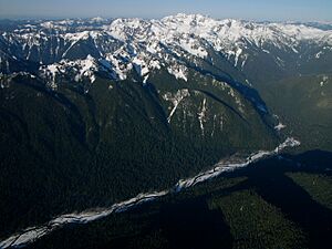
The Queets River starts high up in the Olympic Mountains. It begins at the bottom of the Humes Glacier on Mount Olympus. Other glaciers, like Jeffers Glacier and Queets Glacier, also feed the river.
The river first flows through a narrow canyon. It tumbles over a waterfall called Service Falls. After a while, the valley opens up a bit. The Queets River then flows generally west, then south. The valley gets wider, forming a typical U-shaped valley. This shape is common for valleys carved by glaciers.
The Queets River then flows southwest. It collects water from many smaller rivers. These include the Clearwater River, Salmon River, and Sams River. Finally, it empties into the Pacific Ocean. This happens near the small community of Queets.
Where is the River Located?
Almost all of the Queets River is inside Olympic National Park. The last 4 miles (6.4 km) of the river are outside the park. This part is within the Quinault Indian reservation. A small part of the river near its mouth is in Grays Harbor County. The rest of the river is in Jefferson County.
Nature's Wonders: The Queets River Ecosystem
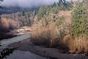
The Queets River is special because it's a large river flowing through a mostly flat, heavily forested valley. The forests on the west side of the Olympic Mountains grow very quickly. They have some of the highest amounts of plant life in North America.
River Flow and Log Jams
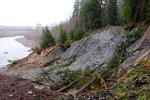
In winter, the river's water flow can be very high. Sometimes it surges to over 100,000 cubic feet per second (2,800 m3/s). This strong flow, combined with many trees, often creates huge log jams. These are piles of trees and branches that block the river. The river is not cleared of this woody debris. This makes it one of the few large rivers in North America where big log jams are common. These jams create unique habitats for fish and other wildlife.
The USGS measures the river's flow. They have a special station 4.6 miles (7.4 km) from the river's mouth. The average flow measured there is 4,347 cubic feet per second (123.1 m3/s). The highest flow ever recorded was 133,000 cubic feet per second (3,800 m3/s) on December 15, 1999. The lowest flow was 281 cubic feet per second (8.0 m3/s) from September 25–28, 2005.
Fun Activities: Exploring the Queets River
There is a simple National Park Service campground and a ranger station at the end of the Queets River Road. The ranger station is no longer staffed.
Hiking and Camping
The Queets River Trail starts on the north side of the river, across from the campground. This trail follows the river for about 16 miles (26 km) upstream. To reach the start of the trail, you need to cross the Queets River. This can be tricky and should only be done when the water is low and safe.
There are basic campsites along the trail. You can find them at the Lower Crossing Way Trail junction and at Spruce Bottom. These are great spots for a wilderness camping adventure.
Boating Adventures
You can explore the river by kayak or canoe. The journey goes from the campground to the Highway 101 bridge, which is about 19 miles (31 km) long. However, this trip has many challenges. The biggest ones are the large log jams. These can block the river and make it hard to pass. Boaters need to be very careful and experienced.
 | Chris Smalls |
 | Fred Hampton |
 | Ralph Abernathy |


