
Brinnon, Washington facts for kids
Quick facts for kids
Brinnon, Washington
|
|
|---|---|

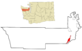
Location of Brinnon, Washington
|
|
| Country | United States |
| State | Washington |
| County | Jefferson |
| Area | |
| • Total | 9.86 sq mi (25.54 km2) |
| • Land | 9.61 sq mi (24.89 km2) |
| • Water | 0.25 sq mi (0.66 km2) |
| Elevation | 56 ft (17 m) |
| Population
(2020)
|
|
| • Total | 907 |
| • Density | 91.98/sq mi (35.513/km2) |
| Time zone | UTC-8 (Pacific (PST)) |
| • Summer (DST) | UTC-7 (PDT) |
| ZIP code |
98320
|
| Area code(s) | 360 |
| FIPS code | 53-08080 |
| GNIS feature ID | 1516959 |
Brinnon is a small community in Jefferson County, Washington, United States. It's called a census-designated place (CDP) because it's a settled area that the government counts for population, but it's not officially a city or town. In 2020, about 907 people lived there.
The community got its name from Ewell P. Brinnon. He claimed land at the mouth of the Duckabush River way back in 1860. Brinnon is known for its beautiful natural spots like Dosewallips State Park and Black Point Marina. Just outside Brinnon, you'll find Camp Parsons, which started in 1919. It's the oldest Boy Scout camp west of the Mississippi River!
Contents
Exploring Brinnon's Location
Brinnon is located in a scenic part of Washington state. It's about 61 miles north of Olympia, which is the state capital. You can find Brinnon on the eastern side of the Olympic Peninsula. It sits right on the western shore of Hood Canal, which is a long, narrow arm of the Pacific Ocean. The community is also on the edge of the huge Olympic National Forest.
Roads and Rivers in Brinnon
The main road through Brinnon is U.S. Route 101. This highway runs all the way through the community. If you head south on it, you'll reach Olympia. If you go north, you'll get to Port Angeles, which is about 59 miles away.
Brinnon covers an area of about 25.5 square kilometers (about 9.8 square miles). Most of this area is land, but about 0.7 square kilometers (0.27 square miles) is water. The community stretches from Wawa Point in the north down to the Mason County line in the south. It includes smaller areas like Seal Rock, Brinnon itself, and Duckabush. Two important rivers flow through Brinnon:
- The Dosewallips River flows through the northern part and enters Hood Canal.
- The Duckabush River flows through the southern part and also enters Hood Canal.
Brinnon's Weather and Climate
Brinnon has a mild, wet climate, similar to what you might find near an ocean. This type of weather is called an oceanic climate. It gets a good amount of rain throughout the year.
| Climate data for Brinnon | |||||||||||||
|---|---|---|---|---|---|---|---|---|---|---|---|---|---|
| Month | Jan | Feb | Mar | Apr | May | Jun | Jul | Aug | Sep | Oct | Nov | Dec | Year |
| Mean daily maximum °F (°C) | 45 (7) |
50 (10) |
56 (13) |
61 (16) |
67 (19) |
72 (22) |
77 (25) |
79 (26) |
73 (23) |
62 (17) |
51 (11) |
44 (7) |
61 (16) |
| Mean daily minimum °F (°C) | 31 (−1) |
33 (1) |
35 (2) |
38 (3) |
43 (6) |
48 (9) |
51 (11) |
50 (10) |
46 (8) |
40 (4) |
35 (2) |
31 (−1) |
40 (4) |
| Average precipitation inches (mm) | 7.39 (188) |
7.38 (187) |
5.93 (151) |
3.81 (97) |
2.82 (72) |
2.13 (54) |
1.29 (33) |
1.24 (31) |
1.60 (41) |
4.13 (105) |
7.99 (203) |
8.65 (220) |
54.36 (1,381) |
People of Brinnon
| Historical population | |||
|---|---|---|---|
| Census | Pop. | %± | |
| 2000 | 803 | — | |
| 2010 | 797 | −0.7% | |
| 2020 | 907 | 13.8% | |
| US Decennial Census 2020 Census |
|||
In 2020, the population of Brinnon was 907 people. Let's look at some details from the 2000 census, which gives us a picture of the community:
- There were 803 people living in Brinnon.
- Most people were White (about 92.65%).
- A small number of people were Native American, Asian, or from other backgrounds.
- About 1.99% of the population identified as Hispanic or Latino.
Households and Families
In 2000, there were 413 households in Brinnon. A household means all the people living together in one home.
- About 55.2% of these households were married couples living together.
- About 10.7% of households had children under 18 living with them.
- Many households (32.0%) were made up of people living alone.
- About 14.5% of households had someone aged 65 or older living by themselves.
Age in Brinnon
The population in Brinnon in 2000 was spread out in terms of age:
- 10.7% were under 18 years old.
- 3.1% were between 18 and 24.
- 15.6% were between 25 and 44.
- 34.9% were between 45 and 64.
- A large group, 35.7%, were 65 years old or older.
The average age in Brinnon was 58 years old.
Images for kids
-
Location of Brinnon, Washington
See also
 In Spanish: Brinnon (Washington) para niños
