Admiralty Inlet facts for kids


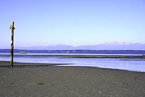
Admiralty Inlet is a narrow waterway, called a strait, located in the state of Washington. It connects the Strait of Juan de Fuca to Puget Sound. You can find it between Whidbey Island and the northeastern part of the Olympic Peninsula. It's a very important passage for ships!
Contents
Where is Admiralty Inlet?
Admiralty Inlet is seen as the northern part of Puget Sound's main area. Its northern edge is a line between Point Wilson and Point Partridge. It stretches south to the end of Whidbey Island and Point No Point on the Kitsap Peninsula. Here, it connects with the central part of Puget Sound.
Facts About the Inlet
Admiralty Inlet covers about 437 square kilometers (169 square miles). It holds about 15,200 cubic meters (536,800 cubic feet) of water. The shoreline is 171 kilometers (106 miles) long. The average depth is 35 meters (115 feet).
Water Flow and Tides
Even though it's only about 6 kilometers (4 miles) wide at its narrowest point, almost all the ocean water flows through it. This happens during the daily tidal changes into and out of Puget Sound. The water currents can be very strong, reaching speeds of six knots (about 11 kilometers or 7 miles per hour). This happens especially northeast of Point Wilson.
Why is Admiralty Inlet Important?
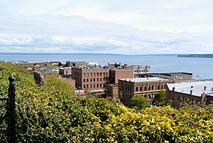
All large ships must travel through Admiralty Inlet to enter or leave Puget Sound. Only very small boats can use Deception Pass or Swinomish Channel. This made Port Townsend a very important port early on. It was the official entry point for trade in the Puget Sound area.
Protecting Puget Sound
Because of its importance, the U.S. government decided to build forts around Admiralty Inlet in the late 1890s. These forts were Fort Worden, Fort Casey, and Fort Flagler. They formed a "Triangle of Fire" to protect Puget Sound from any enemy ships.
Who Discovered the Inlet?
The first Europeans to find and map Admiralty Inlet were the Spanish in 1790. This was during an expedition led by Manuel Quimper. Quimper's pilot, Juan Carrasco, spotted the inlet. He thought it was a bay and named it Ensenada de Caamaño. This was in honor of a Spanish naval officer, Jacinto Caamaño.
Two years later, George Vancouver gave Admiralty Inlet its current name. He named it after his commanders, the Board of Admiralty. The Spanish name, Caamaño, was later given to Camano Island.
Admiralty Inlet Today
Today, a lot of ships use Admiralty Inlet. Many cargo ships travel through it to reach big ports like Seattle and Tacoma. Also, United States Navy vessels use it to get to naval bases in Puget Sound.
Ferry Services
The Washington State Ferries also cross the inlet. The ferry route between Keystone and Port Townsend is part of State Route 20. It helps connect people and goods across the water.
Tidal Power Project
There was a plan to build a tidal power project here. This project would have used the strong tidal currents to create electricity. However, the project was stopped. It was too expensive to monitor and protect the wildlife in the area.
See Also
 | Bayard Rustin |
 | Jeannette Carter |
 | Jeremiah A. Brown |

