Camano Island facts for kids
Quick facts for kids
Camano Island, Washington
|
|
|---|---|

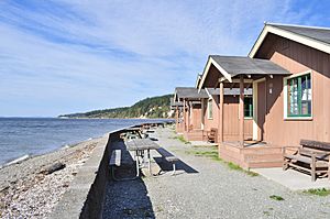
The island's western beach at Cama Beach State Park
|
|

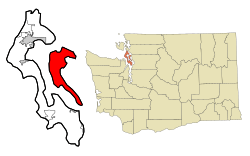
Location within Island County and Washington
|
|
| Country | United States |
| State | Washington |
| County | Island |
| Waterbody | Puget Sound |
| Named for | Jacinto Caamaño |
| Area | |
| • Total | 94.9 sq mi (245.9 km2) |
| • Land | 39.8 sq mi (103.0 km2) |
| • Water | 55.2 sq mi (142.9 km2) |
| Dimensions | |
| • Length | 15.6 mi (25.1 km) |
| • Width | 0.75–6.6 mi (1.21–10.62 km) |
| Elevation | 52 ft (16 m) |
| Population
(2020)
|
|
| • Total | 17,356 |
| • Density | 436.31/sq mi (168.59/km2) |
| Time zone | UTC-8 (Pacific (PST)) |
| • Summer (DST) | UTC-7 (PDT) |
| ZIP code |
98282
|
| FIPS code | 53-09365 |
| GNIS feature ID | 1503722 |
Camano Island /kəˈmeɪnoʊ/ is a large island in Puget Sound, Washington. It is part of Island County, Washington. The island sits between Whidbey Island and the mainland. You can reach it by road using State Route 532. This road crosses the Camano Gateway Bridge to the city of Stanwood.
The island covers about 39.77 square miles (103.0 square kilometers). This makes it one of the largest islands in Washington state. In 2010, about 15,661 people lived there all year. During summer, the population grows to over 17,000. This is because many people have vacation homes on the island. Camano Island is not an official city. It shares services like its school district and post office with nearby Stanwood.
Camano Island is also home to two state parks. These are Cama Beach and Camano Island State Park. There are also several county and local parks to explore.
Contents
What's in a Name?
The native Lushootseed language had names for Camano Island. One recorded name was ʔəw̓alus.
The island's English name comes from an 18th-century Spanish explorer. His name was Jacinto Caamaño. Later, an American explorer named Charles Wilkes called it Macdonough Island. He wanted to honor Thomas Macdonough, a hero from the War of 1812. But in 1847, a British mapmaker named Henry Kellett changed it back to Camano. This was the name the Spanish explorer Francisco de Eliza had first given to a nearby area.
For a time after 1855, the island was known as Perry Island. It was also called Crow Island in the early 1900s.
Island History
Early Days and Indigenous Peoples
Before American settlers arrived, Kikiallus and Snohomish tribes lived on Camano Island. The Kikiallus lived in the north, and the Snohomish in the south. Other tribes also used the island. It might have been a "free-use" area for many groups.
Archaeologists found old village items at Cama Beach. These items were about 1,600 years old. Around 1820, a huge landslide happened at Camano Head. It destroyed a Snohomish village and caused a large wave. This wave affected other villages, killing many people. After this, the Camano Head site was no longer a village.
In 1855, the Indigenous peoples signed the Treaty of Point Elliott. They gave control of their lands, including Camano Island, to the United States.
Settlers and Sawmills
White settlers began arriving in the 1850s. Camano Island became part of Island County in 1853. The first main settlement was Utsalady. Sawmills were built there to cut down trees. Thomas Cranney built the first sawmill in 1858. A school district started in 1862 for 17 students.
In 1877, the Puget Mill Company took over Cranney's sawmill. They made it much bigger. By 1891, Utsalady had stores, hotels, and a telegraph line. Chinese and Norwegian immigrants worked at the mill. However, some Chinese workers were later forced to leave the area. The sawmill closed in 1893, but other smaller mills opened.
The 20th Century and Growth
In the early 1900s, Camano Island became popular for farming and vacation homes. This was after most of the old forests were cut down. A bridge was built in 1909, connecting the island to Stanwood.
Resort areas like Cama Beach opened in the 1920s and 1930s. During Prohibition, the island was used by rumrunners to bring in illegal alcohol. An oyster farm started in 1930, helping the island during the Great Depression.
In 1943, land was sold for permanent homes. In 1950, a new bridge connected the island to Stanwood. Roads were also improved. A new state park opened in 1949. Local residents helped clear the land for the park. In the 1950s, the island got its own post office, fire department, and telephone service. More people moved to the island in the 1960s and 1970s. This led to new planning offices and a small county courthouse.
Island Geography
Camano Island is in the Puget Sound. It is separated from the mainland by Port Susan and Davis Slough. To its west is the Saratoga Passage, which separates it from Whidbey Island. The island is about 55 miles (88 km) north of Seattle. It is 15.6 miles (25.1 km) long and 0.75 to 6.6 miles (1.21 to 10.62 km) wide. It has about 52 miles (84 km) of shoreline.
Most of the shoreline around the island is privately owned. The island is home to many native and migrating birds. These include bald eagles and herons. You can also see migrating gray whales in March and April. They travel through the Saratoga Passage.
During the Last Ice Age, a thick sheet of ice covered the island. As the ice melted, it shaped the island. It also left behind deposits of glacial till.
Island Communities
Camano Island has several small communities:
- Utsalady
- Terry's Corner (with a new town center)
- Buena Vista
- Madrona Beach
- Sunset Beach
- Juniper Beach
- Lona Beach
- Rockaway Beach
- Maple Grove Beach
- Livingston Bay
- Iverson Beach
- Tillicum Beach
- Tyee Beach
- Camaloch
Parks and Fun Places
Camano Island has two state parks: Camano Island State Park and Cama Beach State Park. Both are on the west side of the island. Camano Island State Park opened in 1949. It has 6,700 feet (2,000 m) of shoreline, camping, and hiking trails. Cama Beach State Park opened in 2008. It used to be a beach resort and now has restored cabins and trails.
The island also has 13 local parks. Island County maintains them. Camano Ridge is the largest park. It has 400 acres (160 ha) of forest and hiking trails. Iverson Preserve is in the north. It is a 120-acre (49 ha) beach and estuary for fishing and boating. Barnum Point County Park opened in 2019. It has 167 acres (68 ha) of waterfront space.
Island Population
| Estimated population | ||
|---|---|---|
| Year | Pop. | ±% p.a. |
| 1860 | 58 | — |
| 1870 | 157 | +10.47% |
| 1880 | 186 | +1.71% |
| 1895 | 200 | +0.48% |
| 1900 | 460 | +18.13% |
| 1910 | 678 | +3.96% |
| 1920 | 910 | +2.99% |
| 1930 | 679 | −2.89% |
| 1940 | 876 | +2.58% |
| 1950 | 1,160 | +2.85% |
| 1960 | 1,395 | +1.86% |
| 1970 | 2,600 | +6.42% |
| 1980 | 5,080 | +6.93% |
| 1990 | 7,329 | +3.73% |
| 2000 | 13,347 | +6.18% |
| 2010 | 15,661 | +1.61% |
| 2020 | 17,356 | +1.03% |
| Source: Kimball & Dean (1994) United States Census Bureau |
||
Camano Island has many seasonal residents. These are people who live there part-time, especially in summer. This makes the summer population around 17,000. Many retirees also moved to the island starting in the mid-1900s. Camano is known as one of the wealthier areas in Washington state.
Island Culture
Fun Events on Camano Island
- The Port Susan Snow Goose & Birding Festival (February)
- The Camano Island Mother's Day Art Studio Tour (May)
- The Spring Art Show (June)
- Art by the Bay, The Stanwood–Camano Festival of Art and Music (July)
- The Stanwood Camano Community Fair (August)
- The Harvest Jubilee (September)
Famous People from Camano Island
- Mark W. Clark, a U.S. Army general
- William Corson, an actor
- Jack Gunter, an artist
- Colton Harris-Moore, known as the "Barefoot Bandit"
- Mary Margaret Haugen, a state senator
- Dave Hayes, a state legislator
- Caitlin Kinnunen, an actress
- Thomas T. Minor, a former mayor of Seattle
- Robert Neale, an ace pilot
- Pearl Anderson Wanamaker, a state legislator
- Laurie Z, a musician
- Alfred Zeisler, a film producer and director
Getting Around and Services
Transportation
State Route 532 connects Camano Island to mainland Washington. It goes from the north end of the island to Stanwood. This route uses two bridges over the Davis Slough and Stillaguamish River. Other roads on the island connect to different neighborhoods and parks. Island Transit offers free bus services. These buses connect Camano Island to Stanwood. From Stanwood, you can connect to other cities like Mount Vernon and Everett.
In the past, ferries connected the island to Coupeville and Everett. These routes are no longer active. There have been talks about a new ferry for people only, connecting Camano and Whidbey Island.
Utilities
The Snohomish County Public Utility District provides electricity to Camano Island. Power comes from two high-voltage lines that cross from Stanwood. Tap water on the island comes from groundwater wells. These wells are managed by local groups and small companies.
See also
 In Spanish: Isla Caamaño para niños
 | James Van Der Zee |
 | Alma Thomas |
 | Ellis Wilson |
 | Margaret Taylor-Burroughs |

