Stillaguamish River facts for kids
Quick facts for kids Stillaguamish River |
|
|---|---|

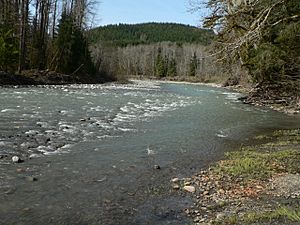
The South Fork of the Stillaguamish River near Verlot
|
|
|
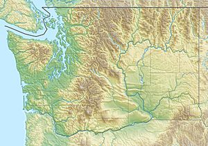
Location of the mouth of the Stillaguamish River in Washington
|
|
| Country | United States |
| State | Washington |
| Physical characteristics | |
| Main source | North Cascades 48°12′14″N 122°7′38″W / 48.20389°N 122.12722°W |
| River mouth | Puget Sound Port Susan 0 m (0 ft) 48°14′18″N 122°22′38″W / 48.23833°N 122.37722°W |
| Length | 67 mi (108 km) |
| Basin features | |
| Basin size | 700 sq mi (1,800 km2) |
The Stillaguamish River is a river located in northwest Washington in the United States. It is mostly made up of two main parts: the North Fork Stillaguamish and the South Fork Stillaguamish.
The North Fork is longer, stretching about 45 miles (72 km). The South Fork is about 30 miles (48 km) long. These two parts come together near the town of Arlington. From there, the main Stillaguamish River flows for another 22 miles (35 km) until it reaches Puget Sound. The area of land that drains into this river is called its watershed. This watershed covers part of the Cascade Range mountains, just north of Seattle.
Contents
River's Journey: Where It Flows
The Stillaguamish River begins when its North and South Forks meet. Both of these forks start high up in the Cascade Range mountains.
North Fork Stillaguamish
The North Fork starts as several small streams in a quiet part of Skagit County. This is near a place called Finney Peak. It's about 10 miles (16 km) north of Darrington. As it flows, many smaller creeks join it. The river then moves south, then west, through the hills along the border of Skagit and Snohomish counties. Important streams that flow into the North Fork include the Boulder River and Deer Creek.
South Fork Stillaguamish
The South Fork starts on the northern sides of Del Campo Peak and Morning Star Peak. These peaks are in the middle of Snohomish County, about 20 miles (32 km) south of Darrington. This fork flows west and northwest. It passes by towns like Silverton, Verlot, and Granite Falls.
Where the Forks Meet
The North and South Forks finally join together at Arlington. This town is in the northwestern part of Snohomish County. After they combine, the river flows west. It then empties into the northern part of Port Susan, which is an arm of Puget Sound. This happens near the town of Stanwood, about 10 miles (16 km) west of Arlington. Between the North and South Forks, there's a special area called the Boulder River Wilderness. It's part of the Mount Baker-Snoqualmie National Forest.
River Life: Fish and Wildlife
The Stillaguamish River and all the smaller streams that feed into it are very important for salmon. Many different types of salmon and trout use these waters to lay their eggs, a process called spawning.
- Chinook salmon
- Coho salmon
- Chum salmon
- Pink salmon
- Sockeye salmon
- Steelhead trout
- Sea-run cutthroat trout
- Bull trout
These fish are a key part of the river's natural environment.
River Levels: How Water Changes
The water level of the North Fork of the Stillaguamish River is watched closely. Sensors operated by the United States Geological Survey (USGS) measure how high the water is. The river's level can change a lot, sometimes by as much as 13 feet (4.0 m). The water level can rise and fall very quickly. When the North Fork floods, it usually lasts for about eight hours. In fact, three of the five highest flood levels ever recorded for the North Fork have happened since 2009.
River's Past: A Brief History
The Stillaguamish River has been known by several different names over time. The USGS lists some of these older names, which include:
- Tuxpam River
- Stoh-luk-whahmpsh River
- Stillaquamish River
- Steilaguamish River
- Stalukahamish River
And other similar spellings.
A significant event in the river's history was the 2014 Oso landslide. This large landslide happened on the North Fork of the Stillaguamish River.
 | William L. Dawson |
 | W. E. B. Du Bois |
 | Harry Belafonte |


