Darrington, Washington facts for kids
Quick facts for kids
Darrington, Washington
|
|
|---|---|
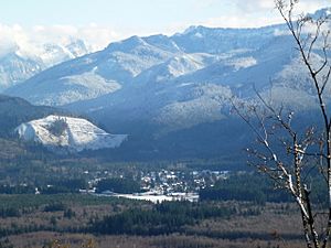
Distant view of Darrington from the northwest
|
|
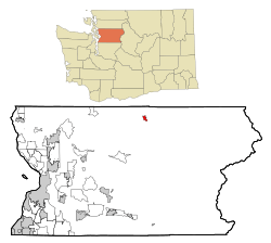
Location of Darrington, Washington
|
|
| Country | United States |
| State | Washington |
| County | Snohomish |
| Founded | 1891 |
| Incorporated | October 15, 1945 |
| Government | |
| • Type | Mayor–council |
| Area | |
| • Total | 1.75 sq mi (4.54 km2) |
| • Land | 1.73 sq mi (4.47 km2) |
| • Water | 0.03 sq mi (0.07 km2) |
| Elevation | 558 ft (170 m) |
| Population
(2020)
|
|
| • Total | 1,462 |
| • Estimate
(2022)
|
1,461 |
| • Density | 835.43/sq mi (322.03/km2) |
| Time zone | UTC-8 (Pacific (PST)) |
| • Summer (DST) | UTC-7 (PDT) |
| ZIP code |
98241
|
| Area code | 360 |
| FIPS code | 53-16690 |
| GNIS feature ID | 2412405 |
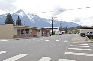
Darrington is a small town in Snohomish County, Washington, United States. It sits in a beautiful mountain valley within the North Cascades, where the Sauk and North Fork Stillaguamish rivers meet.
The town is connected to other areas by State Route 530. This road follows the rivers towards Arlington, which is about 30 miles (48 km) to the west. It also connects to Rockport. In 2010, Darrington had a population of 1,347 people.
People from outside the area first settled here in 1891. This was a traditional spot for the Sauk-Suiattle tribe. In the 1880s, gold seekers came looking for minerals. However, the logging industry soon became the most important business in Darrington for many years. The Northern Pacific Railway built a train line to the town in 1901, which helped Darrington grow.
During the Great Depression, a special work program called the Civilian Conservation Corps (CCC) set up a camp in Darrington. They helped improve roads, trails, and ways to fight fires in the nearby Mount Baker National Forest. Many families from the Appalachian region, especially from North Carolina, moved to Darrington. Their culture is still a big part of the town, seen in its yearly bluegrass festival and rodeo.
Darrington officially became a town in 1945. It is run by a mayor and council. The town's economy has changed from mainly logging to more tourism. People now visit for outdoor activities like hiking, mountain climbing, and fishing, thanks to its closeness to the Mount Baker–Snoqualmie National Forest. Darrington is about 554 feet (169 m) above sea level. It gets a lot more rain and snow than other parts of Washington.
Contents
Exploring Darrington's Past
Early Days and Native American History
The valleys around the Stillaguamish and Sauk rivers were home to different Native American groups for a very long time. These included the Stillaguamish, Sauk-Suiattle, and Upper Skagit tribes. The Sauk-Suiattle tribe had a village and burial ground near where Darrington is today. The Skagit tribe used the land between the Stillaguamish and Sauk rivers to carry their canoes overland. This path was also used by travelers from Eastern Washington going to the Puget Sound coast.
Early explorers and surveyors called the area "Burn" or "Sauk Portage." In 1870, railroad surveyors came to Darrington while planning a train route through the Cascades. They eventually chose a different path to the south. Early settlers called the North Stillaguamish Valley "Starve Out" because conditions were tough. The Sauk-Suiattle tribe later hired surveyors to mark their land claims on the east side of the Sauk River. These lands are now their Indian reservation.
In 1889, gold and other valuable minerals were found near Monte Cristo. This brought many miners to the North Cascades. A 45-mile (72 km) wagon road was built in 1891 along the Sauk River. This road connected Monte Cristo to Sauk Prairie, where Darrington is now. The Sauk Prairie was a popular overnight camping spot for miners.
How Darrington Started

The camping spot at Sauk Prairie grew into a settlement known as "The Portage." It developed around homes built between 1888 and 1891. In July 1891, the first residents voted on a name for their new town. The vote was tied between "Portage" (or "Norma") and "Darrington." Darrington was the maiden name of a settler's mother. Some stories say the name was supposed to be "Barrington" but was changed by mistake or by the townspeople. By the late 1890s, Darrington had a school, a general store, a hotel, and a post office.
Residents wanted a train line from Arlington to Darrington. They offered a deal to ship 75 percent of the area's minerals by train. The railroad agreed and started building in 1900. The first train arrived in Darrington in 1901.
After the railroad was built, many sawmills and other timber businesses started. Mining became less important as most of the original miners left for the Klondike gold rush in the late 1890s. By 1906, Darrington had over a hundred residents. The U.S. Lumber Company was the biggest employer in the early 1910s.
In 1910, a difficult situation arose when U.S. Lumber hired Japanese workers. Some local white men caused trouble, forcing the Japanese workers to leave town. After a week, and with some official involvement, 20 Japanese workers were allowed to return to the mill.
Growing Up in the Early 1900s
Darrington grew a lot in the early 1920s. New sawmills brought more people and businesses. The road along the North Fork Stillaguamish River (now part of State Route 530) was improved. The town got a fire department, a water supply, and electricity. In 1923, Darrington got its first movie theater. A high school opened in 1925, and a proper jail replaced an old train car.
During the Great Depression, lumber prices dropped. Many sawmills closed, and most workers lost their jobs in late 1930. The town also faced outbreaks of illness and winter storms. To help, the Civilian Conservation Corps (CCC) opened Camp Darrington on May 20, 1933. This camp provided jobs for up to 200 men.
Camp Darrington workers mainly fought wildfires and built roads and trails in the Mount Baker National Forest. They also helped build the Mountain Loop Highway. This highway connected ranger stations and opened up the mountains for logging and fun activities. The camp also brought the first families from the Appalachian region of North Carolina to Darrington. These families eventually made up most of the town's population.
Becoming a Town and Changes in Logging
Darrington had 600 residents in 1945 and officially became a town on October 15, 1945. The town celebrated by starting an annual summer festival called the Timberbowl. This festival ran until 1967. A two-story town hall was built in 1947, which included offices and a public library. In 1952, a community center was built for events and sports. A new high school and municipal airport opened in 1958.
In the 1960s, large railroad companies with timber lands started to leave. Smaller, independent loggers took over, salvaging wood for paper mills. A big mining project planned for Miners Ridge was stopped by environmental groups and politicians. Passenger train service to Darrington ended in the 1960s. The train line was eventually closed in 1990 and turned into a rail trail for recreation.
The timber industry faced challenges from new rules to protect mountain habitats and endangered species. Summit Timber, the largest sawmill in Darrington, adapted by processing wood from private and state lands. Even with these changes, many logging jobs were lost. This led to protests in the 1990s.
Tourism and Modern Darrington
The town government worked to bring in tourism to help Darrington's economy. They created new festivals and promoted the existing bluegrass festival and rodeo. Darrington also became a place where people live and commute to work in nearby cities like Everett and Marysville.
In the early 2000s, Darrington tried to become a year-round tourist spot. However, plans for a racetrack and swimming center didn't happen. Several big floods in the late 1990s and early 2000s damaged properties. A flood in 2003 washed out part of the Mountain Loop Highway. This road was not fixed until 2008, which cost Darrington a lot of tourist money.
In 2011, Darrington's main lumber mill laid off 67 workers due to economic problems. The town government, with a small budget, received state grants to fix its water system and streets.
On March 22, 2014, a terrible mudslide happened near Oso, about 12 miles (19 km) west of Darrington. It destroyed many homes and part of State Route 530, cutting off the road to Arlington for two months. This mudslide killed 43 people. Darrington became a main center for disaster response workers and supplies. The community center was used as a shelter, and the rodeo grounds became an animal shelter.
State Route 530 was partly reopened by early June 2014, and a new permanent road opened in September. The state government and other groups created a $65 million plan to help the economy recover.
Darrington's Location and Environment
Where is Darrington?

Darrington is in the northeastern part of Snohomish County in Western Washington. It's just south of the Skagit County border. The town is about 28 miles (45 km) east of Arlington and 74 miles (119 km) northeast of Seattle.
The town sits on a flat area between the North Fork Stillaguamish River to the west and the Sauk River to the east. This flat area is about 5 miles (8 km) long and 1.5 miles (2.4 km) wide. It's about 554 feet (169 m) above sea level, in a valley surrounded by the Cascade Mountains. One of these mountains is the 6,852-foot (2,088 m) Whitehorse Mountain.
The land here was formed by mud and rock flows from past eruptions of Glacier Peak, a volcano about 25 miles (40 km) to the southeast. The area is still in the volcano's mudslide danger zone. It also lies on a fault line that had a big earthquake less than 500 years ago. The soil in Darrington is mostly made of sand and gravel from glaciers. It also contains various minerals like gold, silver, and copper.
Weather in Darrington
Darrington's weather is similar to other areas in the Puget Sound region and the Cascades foothills. It has dry summers and mild, rainy winters. The ocean helps keep temperatures from getting too extreme. Temperatures in Darrington are usually about 10°F (5.5°C) different from coastal cities like Everett. Winters are colder and summers are warmer.
Most of the rain falls during winter and early spring. Darrington gets about 152 days of rain each year, totaling about 79.35 inches (201.5 cm) on average. This is much more than areas in the lowlands of Snohomish County. Darrington also gets a lot more snowfall because it's in the mountains. It averages 10 to 15 days of snow, with about 39 inches (99 cm) annually since 1911.
July is the warmest month, with average high temperatures of 77.5°F (25.3°C). January is the coolest, with an average high of 40.8°F (4.9°C). The hottest temperature ever recorded was 107°F (41.7°C) in July 2007. The coldest was -14°F (-25.6°C) in January 1950.
| Climate data for Darrington, Washington | |||||||||||||
|---|---|---|---|---|---|---|---|---|---|---|---|---|---|
| Month | Jan | Feb | Mar | Apr | May | Jun | Jul | Aug | Sep | Oct | Nov | Dec | Year |
| Record high °F (°C) | 74 (23) |
70 (21) |
82 (28) |
91 (33) |
103 (39) |
105 (41) |
107 (42) |
105 (41) |
104 (40) |
94 (34) |
77 (25) |
65 (18) |
107 (42) |
| Mean daily maximum °F (°C) | 40.0 (4.4) |
45.9 (7.7) |
51.1 (10.6) |
57.5 (14.2) |
65.3 (18.5) |
70.9 (21.6) |
78.6 (25.9) |
78.0 (25.6) |
71.1 (21.7) |
59.3 (15.2) |
46.8 (8.2) |
39.8 (4.3) |
58.7 (14.8) |
| Mean daily minimum °F (°C) | 29.2 (−1.6) |
30.6 (−0.8) |
33.8 (1.0) |
36.9 (2.7) |
43.4 (6.3) |
48.5 (9.2) |
52.0 (11.1) |
51.8 (11.0) |
46.1 (7.8) |
40.1 (4.5) |
33.7 (0.9) |
29.7 (−1.3) |
39.7 (4.2) |
| Record low °F (°C) | −14 (−26) |
−11 (−24) |
0 (−18) |
20 (−7) |
20 (−7) |
31 (−1) |
30 (−1) |
24 (−4) |
24 (−4) |
16 (−9) |
−4 (−20) |
−10 (−23) |
−14 (−26) |
| Average precipitation inches (mm) | 11.84 (301) |
8.73 (222) |
8.44 (214) |
5.16 (131) |
3.60 (91) |
2.83 (72) |
1.43 (36) |
1.63 (41) |
3.62 (92) |
7.39 (188) |
11.84 (301) |
12.85 (326) |
79.36 (2,015) |
| Average snowfall inches (cm) | 10.7 (27) |
7.0 (18) |
3.3 (8.4) |
0.3 (0.76) |
0 (0) |
0 (0) |
0 (0) |
0 (0) |
0 (0) |
0.1 (0.25) |
2.8 (7.1) |
9.6 (24) |
33.8 (85.51) |
| Average precipitation days | 17 | 14 | 16 | 13 | 12 | 11 | 6 | 7 | 9 | 13 | 16 | 17 | 151 |
| Source: Western Regional Climate Center | |||||||||||||
Darrington's Economy and People
What Jobs Are in Darrington?
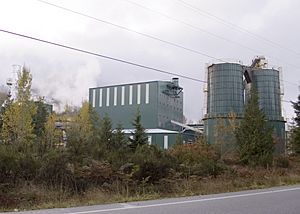
Logging is still Darrington's biggest industry. There are several small companies and the Hampton sawmill, which is the town's largest employer with 160 jobs. Hampton bought the old sawmill in 2002 and reopened it in 2003 after big renovations. The sawmill mainly processes wood from nearby state and local lands.
Other important industries in Darrington include tourism and outdoor activities. There are also jobs in education for the Darrington School District and in managing forests. The town has a grocery store, a bakery, several restaurants, a bookstore, and a microbrewery. The Sauk-Suiattle Indian Tribe used to have a small casino and bingo hall that employed 50 people, but it closed in 2020.
In 2015, about 1,138 people in Darrington had jobs. The most common jobs were in manufacturing (23.8 percent), followed by education and health services (17.6 percent), and retail (13.7 percent). About 9.9 percent of Darrington residents work in town. Many people commute to other cities for work, like Everett (13 percent) and Seattle (6.4 percent). The average trip to work for residents is about 36.5 minutes.
Who Lives in Darrington?
| Historical population | |||
|---|---|---|---|
| Census | Pop. | %± | |
| 1950 | 921 | — | |
| 1960 | 1,272 | 38.1% | |
| 1970 | 1,094 | −14.0% | |
| 1980 | 1,064 | −2.7% | |
| 1990 | 1,042 | −2.1% | |
| 2000 | 1,136 | 9.0% | |
| 2010 | 1,347 | 18.6% | |
| 2020 | 1,462 | 8.5% | |
| U.S. Decennial Census | |||
Darrington is the third-smallest town in Snohomish County. In the 2020 census, it had 1,462 people. In the early 1900s, during the peak of logging, Darrington's population was much larger, estimated at 3,500 to 4,000 people. Many immigrants from Scandinavia and Western Europe came to work in logging.
After World War II, many families from the Appalachian region of North Carolina moved to Darrington. Their families still live in the area and have influenced the town's traditions and culture. Since the 1960s, the town's population has stayed fairly steady. Most homes in Darrington are single-family houses.
How Darrington is Governed
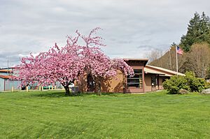
Darrington is a town run by a mayor and council. It's one of only two towns in Snohomish County. The five town council members and the mayor are elected for four-year terms. The current mayor, Dan Rankin, was first elected in 2011.
The town government is in charge of public safety, public works, and parks. It also runs a public cemetery and the town's municipal airport. The mayor and town council choose a clerk treasurer and the heads of different town departments.
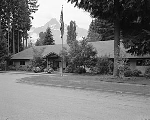
As of 2016, the town government had seven employees and a budget of $3 million. Darrington has its own fire department with two stations. However, it uses the Snohomish County Sheriff for police and emergency services. The town also has a public library branch, which is part of the Sno-Isle Libraries system. This library is located in the town hall building. Darrington residents do not get mail delivered to their homes; they use the local post office.
Fun and Culture in Darrington
Community Spirit
Darrington is known for being a close-knit community. This is partly because it's a bit isolated. Families who moved from North Carolina after World War II have greatly shaped the town's traditions. People in Darrington sometimes say "going down below" when they leave town for trips. The community often comes together for events like memorial dinners and fundraisers. Darrington also has a strong tradition of volunteerism, where people help out instead of relying on official town services.
Events and Festivals
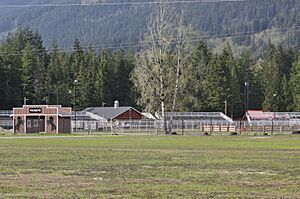
Darrington has a community events complex and park about 3 miles (4.8 km) west of town. This is where several yearly events take place.
- Darrington Timberbowl Rodeo: This rodeo started in 1964 and usually attracts over a thousand people. It happens for two days in late June. The rodeo was canceled in 2013 because the seating was unsafe, but repairs allowed it to start again in 2014. The rodeo is named after an older festival called the Timberbowl, which ran from 1946 to 1967. That festival included logging competitions and a town parade.
- Darrington Bluegrass Festival: This Bluegrass festival takes place for three days every July. It was started in 1977 by descendants of the Appalachian families who moved to the area. The festival draws about 10,000 people, including visitors who camp nearby and join in jam sessions. Famous Bluegrass groups have performed at Darrington's Whitehorse Mountain Amphitheater.
- Summer Meltdown: From 2006 to 2019, the amphitheater also hosted the Summer Meltdown music festival in early August. This four-day event brought in many different musical acts and about 4,000 visitors. Both the Bluegrass and Summer Meltdown festivals were canceled in 2020 due to the COVID-19 pandemic.
The town also has other yearly events, like Darrington Day in late May, a Fourth of July parade, and a street fair in July.
Local News
Darrington doesn't have its own local newspaper. News about the town is covered by The Herald, a daily newspaper from Everett, and the weekly Arlington Times. In the past, Darrington had its own newspapers, like The Wrangler (1907-1915) and The Darrington News (1947-1949).
Parks and Outdoor Fun
Darrington is surrounded by the Mount Baker–Snoqualmie National Forest. It's also the main office for the Darrington Ranger District, which is part of the U.S. Forest Service. This area has three special wilderness areas: Glacier Peak, Henry M. Jackson, and Boulder River. There are over 300 miles (480 km) of trails for hiking, mountain biking, and horseback riding.
Darrington has several campgrounds, places for recreation by the road, fishing spots, and whitewater rafting courses on the Sauk and Suiattle rivers. The Mountain Loop Highway connects Darrington to many scenic areas, including places for birdwatching and the Pacific Crest Trail.
The town government also takes care of several small parks in Darrington, covering 24 acres (9.7 ha). Old School Park has a gazebo, a playground, a skate park, and a pump track for bikes. Harold Engles Park has a disc golf course. Nels Bruseth Memorial Garden has historical displays and a rhododendron garden.
Snohomish County also runs Whitehorse Community Park, which has baseball and softball fields on 80 acres (32 ha) north of town. Darrington is the only town in Washington state with a permanent archery range. This range hosts events organized by the National Field Archery Association. The town also has a community center built in 1954, used as a gym and gathering place.
Historic Places
The town has a small historical society that keeps old photos and documents. The Darrington Ranger District has four buildings listed on the National Register of Historic Places (NRHP). These include the ranger station in Darrington and fire lookouts on Three Fingers, Miners Ridge, and Green Mountain.
Famous People from Darrington
- Bob Barker, a well-known former game show host of The Price Is Right, was born in Darrington.
- Nels Bruseth, a forest ranger, artist, and naturalist.
Education in Darrington
The Darrington School District runs two public schools in town. In the 2016–17 school year, 414 students attended these schools. The district employs 31 teachers and administrators, plus 50 other staff members. It mainly serves Darrington and areas east of Oso, as well as parts of Skagit County near the Sauk-Suiattle Reservation.
The town's elementary school, for kindergarten through eighth grade, opened in 1990. It shares a campus with the high school. The school mascot is the Darrington Loggers, named after the town's main industry. Loggers teams have won state championships in various sports over the years.
Getting Around and Services
Transportation
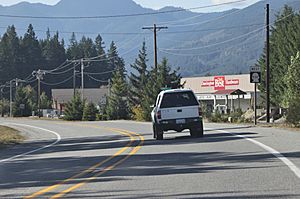
Darrington is located along State Route 530. This highway goes about 28 miles (45 km) west to Arlington and north to State Route 20 at Rockport. About 3,300 vehicles use the highway west of town each day, and 2,300 vehicles use it north of town.
Darrington also has a third road connection through the Mountain Loop Highway. This is a scenic backcountry road that goes 54 miles (87 km) south through the Cascades and west to Granite Falls. It's closed in the winter and not suitable for large trucks, partly because 14 miles (23 km) of it are dirt and gravel.
Community Transit, the public transportation agency for Snohomish County, serves the area. Route 230 connects Darrington to Oso, Arlington, and a transit center in Smokey Point twice a day during busy times. The agency also expanded its Zip Shuttle service to Darrington in December 2024. The Sauk-Suiattle Indian Tribe runs a bus route connecting Darrington, its reservation, and Concrete. This route started in 2016 and has six round trips daily.
The Whitehorse Trail is a recreational trail for hikers, cyclists, and horseback riders. It's being built by the county government to connect Darrington with Arlington. It follows the old Northern Pacific train route. The town government also runs a small airport, Darrington Municipal Airport, which has one paved runway for small planes.
Utilities and Services
Electric power for Darrington comes from the Snohomish County Public Utility District (PUD). The Hampton mill has a small plant that makes electricity by burning wood from the sawmill. This 7 MW plant was installed in 2006. The town does not have natural gas service. Many homes use wood-burning stoves for heat.
Ziply Fiber is the main company providing Internet and telephone service to Darrington. In 2022, the state government gave a $16.5 million grant to improve broadband and fiber service in northern Snohomish County, including Darrington. New fiber-optic lines are expected to be completed by 2025. A local non-profit internet provider also started in 2017 to help with broadband access.
The town government provides water from two wells to its residents. Darrington does not have a town-wide sewer system. Instead, homes use septic tanks. The town has thought about installing a sewer system several times, but the high cost has stopped these plans. Trash and recycling collection is handled by Waste Management.
Health Care
Darrington's closest general hospital is the Cascade Valley Hospital in Arlington. The town has a medical clinic run by Skagit Regional Health, which has one doctor. The clinic started in 1958. Sometimes, Darrington has gone years without a doctor. The town's only pharmacy closed in 2023. The nearest pharmacy is now in Arlington, which is a 56-mile (90 km) round trip.
See also
 In Spanish: Darrington (Washington) para niños
 | Sharif Bey |
 | Hale Woodruff |
 | Richmond Barthé |
 | Purvis Young |


