Yakima County, Washington facts for kids
Quick facts for kids
Yakima County
|
|
|---|---|
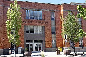
Yakima County Courthouse
|
|
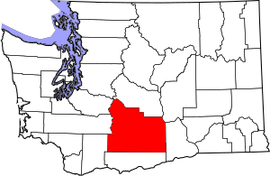
Location within the U.S. state of Washington
|
|
 Washington's location within the U.S. |
|
| Country | |
| State | |
| Founded | January 21, 1865 |
| Named for | Yakama Nation |
| Seat | Yakima |
| Largest city | Yakima |
| Area | |
| • Total | 4,311 sq mi (11,170 km2) |
| • Land | 4,295 sq mi (11,120 km2) |
| • Water | 16 sq mi (40 km2) 0.4%% |
| Population
(2020)
|
|
| • Total | 256,728 |
| • Estimate
(2023)
|
256,643 |
| • Density | 58/sq mi (22/km2) |
| Time zone | UTC−8 (Pacific) |
| • Summer (DST) | UTC−7 (PDT) |
| Congressional district | 4th |
Yakima County is a special area called a county in the state of Washington. It's located in the United States. In 2020, about 256,728 people lived there. The main city and where the county government is located is Yakima.
Yakima County was created in January 1865. It was named after the Yakama tribe, who are Native American people. Yakima County is also part of the Yakima, WA Metropolitan Statistical Area. In 2020, it was the county in Washington with the most people of Hispanic or Latino background.
Contents
Discover Yakima County
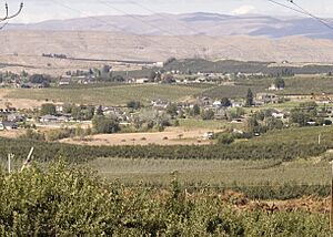
Yakima County is a vibrant place with a rich history and diverse communities. It's known for its beautiful landscapes and important agricultural areas.
A Look at Yakima County's Past
The land that is now Yakima County was once part of a large area called the Oregon Country. In the early 1800s, both Canadian fur traders and American settlers came here. They were looking for land to farm and for minerals.
Because two countries wanted control, the Treaty of 1818 said they would share the land. Later, in 1843, a temporary government was set up. This government eventually divided the area into large counties.
How Yakima County Was Formed
In 1853, the Washington Territory was created as its own governing area. Over time, new counties were formed from the original large ones. Yakima County was officially created on January 21, 1865. It took over the area that was previously called Ferguson County.
Since then, the borders of Yakima County have changed a couple of times. In 1883, some land was used to create Kittitas County. In 1905, more land was used to help create Benton County.
The Yakama Nation's Story
The Yakama Indian Reservation was created in 1855. However, some tribes felt they were not fully included in the agreement. This led to conflicts and a war called the Yakima War, which ended in 1858. It took about 20 years for the reservation to be fully set up.
The Yakama Reservation is very large. It covers about 1,573 square miles (4,074 square kilometers). This is about 36% of Yakima County's total area. In 2000, about 31,799 people lived on the reservation. The largest city on the reservation is Toppenish.
Exploring Yakima County's Geography
Yakima County is a very large area. It covers about 4,311 square miles (11,165 square kilometers). Most of this is land, with only a small amount of water. It is the second-largest county in Washington by land area.
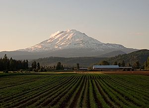
The weather in Yakima County can be tricky to predict. This is because of the mountains that surround it. The county's area is bigger than the states of Delaware and Rhode Island combined! The highest point in the county is Mount Adams. It is the second-tallest mountain in Washington state.
Important Geographic Features
- Mount Adams, 12,281 feet (3,743 meters) tall
- Gilbert Peak, 8,184 feet (2,494 meters) tall
- Mount Aix, 7,766 feet (2,367 meters) tall
- Tieton Peak, 7,768 feet (2,368 meters) tall
- Cascade Mountains
- Rattlesnake Hills
- Horse Heaven Hills
Major Rivers Flowing Through
Protected Natural Areas
- Wenatchee National Forest (part)
- Gifford Pinchot National Forest (part)
- Snoqualmie National Forest (part)
- Goat Rocks Wilderness
- Mount Adams Wilderness (part)
- Norse Peak Wilderness (part)
- William O. Douglas Wilderness
- Toppenish National Wildlife Refuge
Main Roads and Highways
 Interstate 82
 U.S. Route 12
 U.S. Route 97
Neighboring Counties
- Pierce County - to the northwest
- Lewis County - to the west
- Skamania County - to the southwest
- Kittitas County - to the north
- Klickitat County - to the south
- Grant County - to the northeast
- Benton County - to the east
People and Population
| Historical population | |||
|---|---|---|---|
| Census | Pop. | %± | |
| 1870 | 432 | — | |
| 1880 | 2,811 | 550.7% | |
| 1890 | 4,429 | 57.6% | |
| 1900 | 13,462 | 204.0% | |
| 1910 | 41,709 | 209.8% | |
| 1920 | 63,710 | 52.7% | |
| 1930 | 77,402 | 21.5% | |
| 1940 | 99,019 | 27.9% | |
| 1950 | 135,723 | 37.1% | |
| 1960 | 145,112 | 6.9% | |
| 1970 | 144,971 | −0.1% | |
| 1980 | 172,508 | 19.0% | |
| 1990 | 188,823 | 9.5% | |
| 2000 | 222,581 | 17.9% | |
| 2010 | 243,231 | 9.3% | |
| 2020 | 256,728 | 5.5% | |
| 2023 (est.) | 256,643 | 5.5% | |
| U.S. Decennial Census 1790–1960 1900–1990 1990–2000 2010–2020 |
|||
In 2010, about 243,231 people lived in Yakima County. The population density was about 56.6 people per square mile. Many different groups of people live here. About 45% of the population identified as Hispanic or Latino in 2010.
The average age of people in the county was about 32.2 years old. Many households had children under 18 living with them.
Yakima County's Economy
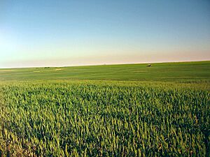
Agriculture is a very important part of Yakima County's economy. For example, a lot of land is used to grow potatoes. The northeastern part of the county is also home to the U.S. Army's Yakima Training Center.
Washington's Wine Regions
Washington state is famous for making wine. It's the second-biggest wine producer in the United States, after California. The Yakima Valley AVA (American Viticultural Area) was created in 1983. This area is known for its old farms.
The Yakima Valley AVA produces more than 40% of all the wine made in Washington state. It's part of a larger area called the Columbia Valley AVA. Inside the Yakima Valley AVA, there are three smaller wine regions. These are Red Mountain AVA, Snipes Mountain AVA, and Rattlesnake Hills AVA. Each of these areas has special conditions for growing grapes.
Communities in Yakima County
Yakima County has many different cities, towns, and smaller communities.
Cities
Towns
Census-Designated Places
These are areas that are like towns but are not officially incorporated as cities.
Unincorporated Communities
These are small communities that are not officially part of any city or town.
See also
 In Spanish: Condado de Yakima para niños
 | Stephanie Wilson |
 | Charles Bolden |
 | Ronald McNair |
 | Frederick D. Gregory |


