
Sunnyside, Washington facts for kids
Quick facts for kids
Sunnyside
|
|
|---|---|

Edison Avenue
|
|

Location of Sunnyside, Washington
|
|
| Country | United States |
| State | Washington |
| County | Yakima |
| Incorporated | September 16, 1902 |
| Government | |
| • Type | Council–manager |
| Area | |
| • Total | 7.53 sq mi (19.49 km2) |
| • Land | 7.53 sq mi (19.49 km2) |
| • Water | 0.00 sq mi (0.00 km2) |
| Elevation | 745 ft (227 m) |
| Population
(2020)
|
|
| • Total | 16,375 |
| • Estimate
(2022)
|
16,296 |
| • Density | 2,232.03/sq mi (861.84/km2) |
| Time zone | UTC−8 (Pacific (PST)) |
| • Summer (DST) | UTC−7 (PDT) |
| ZIP code |
98944
|
| Area code | 509 |
| FIPS code | 53-68750 |
| GNIS feature ID | 1531913 |
Sunnyside is a city located in Yakima County, Washington, in the United States. In 2020, about 16,375 people lived there. This makes it the second-largest city in Yakima County.
Contents
History of Sunnyside
For a long time, the area where Sunnyside is now was home to a group of people called the "Taptat-ħlama." They hunted and fished along the Yakima River.
Later, in 1855, many tribes in the region moved to the Yakama Indian Reservation.
How Sunnyside Started
The modern town of Sunnyside was founded in 1893 by Walter Granger. A merchant named W. H. Cline gave the town its name. Granger helped build the Sunnyside Canal. This canal was meant to bring water from the Yakima River to help grow crops in the area.
However, a financial crisis in 1893, called the Panic of 1893, caused Granger to lose control of the canal. The town's population dropped to only seven families. By the end of 1901, the population grew to over 300 people. The town had a bank, stores, hotels, a newspaper called the Sunnyside Sun, and churches.
On September 16, 1902, the people of Sunnyside voted to officially become a town. There were 314 residents at that time. The first mayor of Sunnyside was James Henderson, who was a druggist.
The Dunkards Arrive
Many people called "Dunkards" moved to Sunnyside from South Dakota. They were part of the German Baptist Progressive Brethren church. They wanted to create a Christian Cooperative Colony. They bought the entire town site and helped start the first bank and a telephone system.
The Dunkards had special rules for land they sold. They did not allow alcohol, dancing, or gambling. Because of this, old maps of Washington sometimes showed Sunnyside with a cross or halo symbol.
In the 1930s, many people who had to leave their homes because of the Dust Bowl also moved to Sunnyside.
City Improvements
In 1917, Mayor William Bright "Billy" Cloud led a project to pave the dirt streets of Sunnyside. The streets had become very muddy because of years of irrigation. This project cost about $62,629.45.
In 1948, Sunnyside was the first city in Washington to use a council–manager government system. In this system, elected city council members make decisions. A professional city manager, hired by the council, handles the daily running of the city. The manager gives advice, manages employees, and prepares the city's budget.
In 1979, Sunnyside was named an All-America City. This award recognizes communities that work together to solve local problems.
Geography of Sunnyside
Sunnyside is located at 46°19′15″N 120°0′44″W / 46.32083°N 120.01222°W.
The United States Census Bureau says the city covers about 6.63 square miles (17.17 square kilometers) of land. There is no water area within the city limits.
Sunnyside is about 180 miles away from major cities like Seattle, Spokane, and Portland.
Climate in Sunnyside
Sunnyside has a cold desert climate. This means it is generally dry with hot summers and cold winters.
Population and People
| Historical population | |||
|---|---|---|---|
| Census | Pop. | %± | |
| 1910 | 1,379 | — | |
| 1920 | 1,809 | 31.2% | |
| 1930 | 2,113 | 16.8% | |
| 1940 | 2,368 | 12.1% | |
| 1950 | 4,194 | 77.1% | |
| 1960 | 6,208 | 48.0% | |
| 1970 | 6,751 | 8.7% | |
| 1980 | 9,225 | 36.6% | |
| 1990 | 11,238 | 21.8% | |
| 2000 | 13,905 | 23.7% | |
| 2010 | 15,858 | 14.0% | |
| 2020 | 16,375 | 3.3% | |
| 2022 (est.) | 16,296 | 2.8% | |
| U.S. Decennial Census 2020 Census |
|||
Sunnyside's Population in 2010
According to the 2010 census, there were 15,858 people living in Sunnyside. There were 4,332 households and 3,428 families. The city had about 2,392 people per square mile (924 per square kilometer).
About 82.2% of the population identified as Hispanic or Latino. The rest of the population included people who identified as White, African American, Native American, Asian, or a mix of races.
Many households (57.8%) had children under 18 living with them. The average household had 3.60 people, and the average family had 4.02 people.
The average age of people in Sunnyside was 25 years old. About 38.5% of residents were under 18.
Fun Things to Do and See
Lighted Farm Implement Parade
The Lighted Farm Implement Parade started in 1989. It is known as a top lighted parade in the Northwest. It usually happens in early December. In this parade, farm machines like combines and tractors are decorated with many colorful lights. In 2006, over 70 decorated machines were in the parade. The A&E network once called it one of the "Top 10" parades of its kind in the United States.
Darigold Cheese Factory
The Darigold Dairy Fair used to make 150 million pounds of cheese each year. It was famous for its bright colors and circus-like decorations. These included two cows swinging on a trapeze! The Dairy Fair Store closed in 2012.
Sunnyside Historical Museum
The Sunnyside Historical Museum is located downtown. It shows old items and papers that tell about daily life in Sunnyside's early years. The building was given to the city by Robert and Martha McIntosh. The Sunnyside Memorial Cemetery, founded by the Ball Family, is north of town.
Schools and Libraries
Many of the first school buildings in Sunnyside have been replaced with newer, bigger ones. One old building still in use is the Lincoln School Building. It was built in 1927. It is now used for the school district's offices.
Sunnyside High School was named a School of Distinction in 2015 and 2016. This award goes to the top 5% of Washington schools that have greatly improved in reading, math, and graduation rates.
Sunnyside Public Library
Sunnyside has one public library. The first public library, a Carnegie Library, was built in 1911. The current library building opened in 1964. It is the second-largest library in the Yakima Valley Libraries system. It also has one of the biggest collections of Spanish language books in the area.
Famous People from Sunnyside
- Bonnie J. Dunbar, a NASA astronaut
- Jake Kupp, an NFL football player
- Scott Linehan, an NFL coach
- Scott Meyer, a web comic author
- Dan Newhouse, a U.S. representative
- Irv Newhouse, a state lawmaker
- Jim Pomeroy, a professional motocross racer
- Jens Pulver, a boxer and mixed martial arts champion
- Margaret Rayburn, a teacher and state representative
- Earl Smith, a baseball player
- Rob Thomas, a TV writer
- Zach Top, a country music singer
Images for kids
-
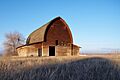
Iconic barn in Sunnyside
-
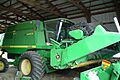
A 9410 John Deere Combine harvester typical of a parade entrant
-
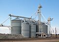
Silos at a grain elevator facility on the east side of Sunnyside


See also
 In Spanish: Sunnyside (Washington) para niños
