Yakima River facts for kids
Quick facts for kids Yakima River |
|
|---|---|

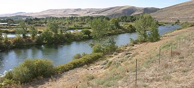
State Route 10 winds past the Yakima River near the town of Thorp.
|
|

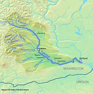
Map of the Yakima River watershed
|
|
| Country | United States |
| State | Washington |
| Cities | Cle Elum, Ellensburg, Yakima, Sunnyside, Richland |
| Physical characteristics | |
| Main source | Keechelus Lake Kittitas County, Washington 2,520 ft (770 m) 47°19′20″N 121°20′21″W / 47.32222°N 121.33917°W |
| River mouth | Columbia River at Lake Wallula Richland, Benton County, Washington 344 ft (105 m) 46°15′10″N 119°13′51″W / 46.25278°N 119.23083°W |
| Length | 214 mi (344 km) |
| Discharge (location 2) |
|
| Discharge (location 3) |
|
| Discharge (location 4) |
|
| Basin features | |
| Basin size | 6,150 sq mi (15,900 km2) |
| Tributaries |
|
The Yakima River is a long river in Washington state. It flows into the Columbia River. The river is named after the Yakama people, who are the native people of this area. It is about 214 miles (344 km) long. This makes it the longest river that stays completely within Washington state.
Contents
Where the Yakima River Flows
The Yakima River starts high up in the Cascade Range mountains. It begins at Keechelus Lake near Snoqualmie Pass. From there, the river flows through towns like Easton and Ellensburg. It then passes by the city of Yakima. Finally, it reaches Richland and flows into the Columbia River. This meeting point creates the Yakima River Delta.
How the River's Path Changed
Millions of years ago, the Yakima River flowed differently. About 9 million years ago, it went south from near Vantage. It then turned west towards the ocean. This path went through Badger Canyon, west of Kennewick.
Around 15,000 years ago, huge floods changed the land. These were called the Missoula Floods. They caused a lot of water to flow down the Columbia River. A narrow spot called Wallula Gap slowed the water down. This caused water to back up into the Yakima Valley. The floods left thick layers of dirt and rocks. These deposits changed the ground level in Badger Canyon. Because of this, the Yakima River found a new way to flow. It now enters the Columbia River near Richland.
The first Western explorers to see the river were Lewis and Clark. This was around October 17, 1805. They stopped where the Yakima and Columbia rivers meet. They did not travel up the Yakima River. Local Native Americans called the river "Tap Teel" back then. People have lived in this area for a very long time.
Fun Things to Do on the Yakima River
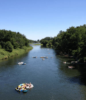
The Yakima River is a great place for outdoor fun. Many people enjoy rafting and kayaking here. It's also a popular spot for fishing. The best times for these activities are in the summer. The river has rapids that are usually easy to medium difficulty.
Near the city of Richland, where the Yakima River meets the Columbia, there are hiking trails. The area has a dry climate with over 300 sunny days a year. This makes it a popular place for visitors from Seattle, which is about two hours away.
The Yakima Valley
The Yakima River Basin is a large area in south-central Washington State. It covers about 6,150 square miles (15,900 km2). Mountains surround it on the west and north. Hills are on the east and south. This area is divided into two main parts: the Upper Yakima and the Lower Yakima. The Naches River joining the Yakima River marks the dividing line.
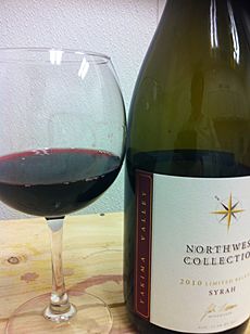
The Yakima River is very important for farming. It provides irrigation water for the dry but rich land. Farming is a big part of the local economy. About 1,000 square miles (2,600 km2) of land is used for farming. Farmers grow things like apples, cherries, grapes, and hops. A large amount of Washington's apples and cherries come from this valley. Most of the hops grown in the United States (about 75%) also come from here. In recent years, the wine industry has grown a lot. The Yakima Valley AVA is a special area known for its wines.
Large parts of the valley are owned by the government and the Yakama Nation. The United States Forest Service manages a lot of land. The Yakama Nation also owns a large amount of land in the basin. These areas are used for recreation, wildlife, and cultural activities.
The biggest cities in the valley are Yakima and the Tri-Cities area. More people have been moving to these areas.

Besides farming, other important parts of the economy include timber (wood) processing and raising cattle. Outdoor recreation is also very popular. Because there are fewer trees being cut down now, outdoor activities have become even more important for the economy.
How the River Has Been Changed
People have changed the Yakima River and its smaller streams a lot. This was done to help with farming. There are many dams and canals for irrigation. Water used for irrigation sometimes flows back into the river.
Because of the irrigation system, the river's water levels change a lot. Sometimes there is less water than there used to be. Other times, there is more. The United States Geological Survey (USGS) measures the river's flow. The highest average water flow is measured near Union Gap. Downriver from there, the average flow is actually less. This shows how much the irrigation system affects the river.
 | Sharif Bey |
 | Hale Woodruff |
 | Richmond Barthé |
 | Purvis Young |


