
Richland, Washington facts for kids
Quick facts for kids
Richland, Washington
|
||
|---|---|---|
| City of Richland | ||

View over downtown Richland in 2018
|
||
|
||
| Nickname(s):
The Windy City, City Of the Bombers, Atomic City
|
||

Location of Richland, Washington
|
||
| Country | United States | |
| State | Washington | |
| County | Benton | |
| Incorporated | April 28, 1910 | |
| Re-incorporated | December 10, 1958 | |
| Government | ||
| • Type | Council–manager government | |
| Area | ||
| • City | 42.62 sq mi (110.38 km2) | |
| • Land | 39.22 sq mi (101.59 km2) | |
| • Water | 3.39 sq mi (8.79 km2) | |
| Elevation | 384 ft (117 m) | |
| Population
(2020)
|
||
| • City | 60,560 | |
| • Estimate
(2023)
|
63,757 | |
| • Rank | US: 667th WA: 22nd |
|
| • Density | 1,345.5/sq mi (519.5/km2) | |
| • Urban | 232,954 (US: 171st) | |
| • Metro | 303,501 (US: 164th) | |
| • CSA | 357,146 (US: 103rd) | |
| • Tri-Cities | 215,024 | |
| Time zone | UTC−8 (Pacific (PST)) | |
| • Summer (DST) | UTC−7 (PDT) | |
| ZIP codes |
99352, 99353, 99354
|
|
| Area code(s) | 509 | |
| FIPS code | 53-58235 | |
| GNIS feature ID | 1513395 | |
| Website | Ci.Richland.WA.US | |

Richland is a city in Benton County, Washington, United States. It's located in southeastern Washington where the Yakima and Columbia Rivers meet. In 2020, about 60,560 people lived there.
Richland is part of the Tri-Cities area, along with Pasco and Kennewick.
The town started in 1905 and became an official city in 1910. In 1943, the U.S. Army bought the city and nearby areas to build the Hanford nuclear site. This site was a big part of the Manhattan Project during World War II. Richland quickly grew into a town for Hanford workers, with 25,000 people by the end of the war. The city was controlled by Hanford until it became an independent city again in 1958.
Contents
History of Richland
For many centuries, a village called Chemna stood at the mouth of the Yakima River. Today, this spot is known as Columbia Point. From this village, the Wanapum, Yakama, and Walla Walla people caught salmon from the Yakima River. Captain William Clark of the Lewis and Clark Expedition visited this area on October 17, 1805.
How Richland Began
In 1904 and 1905, W.R. Amon and his son Howard bought about 2,300 acres (9.3 sq km) of land. They planned to build a town on the north side of the Yakima River. In 1905, postal officials approved the name Richland for the new town. It was named after Nelson Rich, who was a state lawmaker and land developer. The town was officially recorded in 1906 at the Benton County Courthouse. Richland became a city on April 28, 1910.
Richland grew faster after a permanent bridge opened over the Yakima River in 1907. A highway to Kennewick was built in 1926. Before that, a cable ferry carried people across the Columbia River to Pasco from 1894 until 1931, when a modern bridge replaced it.
Richland During World War II
.jpg)
Richland was a small farming town until World War II. In 1943, the U.S. Army bought a huge amount of land – about 1,660 square kilometers (640 sq mi) – along the Columbia River. This land was for the Manhattan Project, a secret effort to build the first atomic bomb.
On March 6, 1943, more than 300 people living in Richland, and in the towns of White Bluffs and Hanford (which no longer exist), had to leave their homes. The government took their properties for the war effort.
The army turned Richland into a "bedroom community" for workers at the nearby Hanford Engineering Works (now called the Hanford site). The population jumped from 300 people in mid-1943 to 25,000 by the end of World War II in August 1945.
The government owned all the land and buildings. Homes were given to families, and single people lived in apartments or barracks. The government provided everything, from free bus rides to light bulbs. They even planted trees in people's yards! Much of the city was planned by architect Gustav Albin Pherson.
Homes were given out based on family size. There were different house designs, each known by a letter of the alphabet, like "alphabet houses." Many streets in Richland are named after famous engineers, like George Washington Way (named after the first president, who was a surveyor) and Stevens Drive (named after John Frank Stevens, chief engineer of the Panama Canal).
The Cold War Era
After World War II ended, the Hanford workers' camp, located north of Richland, was closed. Many workers moved away, but some moved to Richland, helping the city keep its population. Management of the Hanford site and Richland was then given to General Electric.
In 1947, the Cold War began due to fears about the Soviet Union. The U.S. started to produce more plutonium. When the Soviet Union tested its first nuclear weapon in 1949, the U.S. nuclear program became even more active. Another growth period started in 1950 because of the Korean War. Richland's population grew to 27,000 people by 1952. Many of these new residents lived in trailers in what is now north Richland.
In 2005, many houses built during this time were added to the National Register of Historic Places. This area is now called the Gold Coast Historic District.
Becoming a Private City
In 1954, Harold Orlando Monson became the first mayor of Richland. He worked to get more rights for citizens in military cities, like the right to own their own homes. In 1955, the U.S. Congress passed a law to transfer Richland to local control within five years.
The federal government gave up its land in 1957 and sold the city's homes to residents. The last home was sold on May 16, 1960. People living in duplexes could buy their building. Others could buy land in a new area of north Richland.
Richland officially became a first-class city again on December 10, 1958. One of the first new things for the city was an expanded public library. Even though the city became independent, it still relied on the Hanford facility for jobs, as Hanford continued to produce materials for weapons during the Cold War.
After the Production Boom

The last production reactor at Hanford shut down in 1987. After this, the area focused on cleaning up the environment and developing new technologies. Today, many Richland residents work at the Hanford site on environmental cleanup projects.
The sports teams at Richland High School are called the Bombers, and their logo includes a mushroom cloud. Some streets built after 1958 are named after U.S. Army generals like Patton Street and MacArthur Street. Others have nuclear themes, such as Einstein Avenue and Curie Street.
The Reach Museum in Richland tells the story of the area's history, nature, and science. It replaced the CREHST museum in 2014.
Washington State University, Tri-Cities was started in north Richland in 1989. Richland is also home to Kadlec Regional Medical Center. Columbia Basin College has a Medical Training Center near Kadlec.
Economy of Richland
Technology and Research
After World War II, Richland remained a key place for nuclear energy and related technology research.
The Pacific Northwest National Laboratory (PNNL) has been in Richland since 1965. One of the two Laser Interferometer Gravitational-Wave Observatory sites is just north of Richland. Many smaller high-tech businesses and experts have also grown around the Richland Technology Center.
Largest Cold Storage Facility
Richland is home to the largest cold-storage building on Earth. It is also one of the largest buildings by volume in the world.
Major Employers
Many people in Richland work for companies involved with the Hanford site or technology. Here are some of the top employers:
- Battelle Memorial Institute, which runs PNNL
- Bechtel National Inc., building a plant to turn waste into glass
- Washington River Protection Solutions, managing nuclear waste tanks
- Washington Closure Hanford, cleaning up waste and taking down old buildings
- Hanford Mission Integrated Solutions, providing services for the whole Hanford site
- Central Plateau Cleanup Company, cleaning up facilities on the site's Central Plateau
- EnergySolutions, providing services to the U.S. government
- Energy Northwest, which generates nuclear power nearby
- Framatome, which makes nuclear fuel
- The U.S. Department of Energy, which runs the Hanford Site
Agriculture in Richland
Farming is very important in the Richland area. The Tri-Cities area grows excellent produce. Richland has a major food processor, Lamb Weston, which processes potatoes and other foods.
Making wine has also become a big industry in the area. Richland is in the middle of a wine-growing region that produces wines known around the world. This area is a great place for wine tours. The Columbia Valley wine region around Richland has over 7,000 hectares (17,000 acres) of wine grapes.
Top Employers in Richland
Here are the top employers in Richland, based on a 2021 report:
| # | Employer | # of employees |
|---|---|---|
| 1 | Battelle / Pacific Northwest National Laboratory | 4,500 |
| 2 | Kadlec Regional Medical Center | 3,532 |
| 3 | Bechtel National | 2,943 |
| 4 | Washington River Protection Solutions | 2,129 |
| 5 | Hanford Mission Integration Solutions | 1,902 |
| 6 | Central Plateau Cleanup Company | 1,682 |
| 7 | Richland School District | 1,500 |
| 8 | Energy Northwest | 1,100 |
| 9 | Lamb Weston | 750 |
| 10 | Framatome / Areva | 700 |
Education in Richland
The Richland School District serves Richland and West Richland. It has ten elementary schools, four middle schools, and three high schools.
Columbia Basin College, which is mainly in Pasco, has a small campus in Richland.
Washington State University, Tri-Cities was founded in North Richland in 1989. It is located on the west bank of the Columbia River. The university offers many different degree programs. It started accepting freshmen and sophomores in the fall of 2007.
Fun Things to Do in Richland
Golf Courses
There are three 18-hole golf courses and one 9-hole course in the Richland area.
Outdoor Adventures
Richland has many parks, especially along the Columbia and Yakima Rivers. These rivers are great for boating, water skiing, fishing, kayaking, and hunting waterfowl.
Richland is part of a bike trail system called The Sacagawea Heritage Trail. This trail is a beautiful 23-mile (37 km) loop along the Columbia River. It goes through Kennewick, Richland, and Pasco. You can ride on both sides of the river, and three bridges connect the trails.
Richland is in a dry, shrub-steppe area, but it has many interesting natural spots:
- The Yakima River delta and wetlands are in Richland. They are home to many birds and animals. This area has more trees than the usual dry landscape.
- The Badger Mountain Centennial Preserve protects Badger Mountain on the edge of Richland. From here, you can see great views of the Tri-Cities and the Columbia and Yakima rivers. A group called Friends of Badger Mountain helped protect this area. In 2005, they built a 2-kilometer (1.2 mi) trail to the top.
- The Arid Lands Ecology Reserve is west of Richland on the Hanford Reservation. It's the last large area of untouched shrub-steppe habitat in the Pacific Northwest. It has been closed to the public since the 1940s, which has helped keep it natural. It is used for environmental research and as a wildlife reserve.
- North of Richland is the Hanford Reach. This is the last free-flowing part of the Columbia River in the U.S. It's a great place for sightseeing and salmon fishing. The Hanford Reach is part of the Hanford Reach National Monument, created in 2000.

Sports Teams
Local sports teams include the Tri-City Americans WHL ice hockey team, which plays in Kennewick. The Tri-City Dust Devils Single-A baseball team (linked with the Los Angeles Angels) plays in Pasco.
Washington State University Tri-Cities also has several club sports teams, like rugby, volleyball, and men's and women's soccer.
Geography of Richland
Richland is located at 46°16′47″N 119°16′53″W / 46.27972°N 119.28139°W.
The city covers a total area of about 39.11 square miles (101.3 sq km). Of this, 35.72 square miles (92.5 sq km) is land, and 3.39 square miles (8.8 sq km) is water. The elevation at the airport is about 120 meters (384 ft).
Richland Wye
Richland Wye (46°14′12″N 119°13′59″W / 46.2368015°N 119.2330713°W) is a small community within the eastern part of Richland. It's also where you can find the only bridge that goes to Bateman Island over the Columbia River.
Climate in Richland
Richland gets about 7 inches (178 mm) of rain each year. This gives it a dry, desert-like climate with a shrub-steppe environment. Summers are hot with occasional thunderstorms. Winters are milder than other parts of Eastern Washington, and snow falls only sometimes.
During the 2021 Western North America heat wave, Richland recorded a temperature of 118°F (48°C). This tied the highest temperature ever recorded in Washington. Nearby, the Hanford Site recorded an even higher temperature of 120°F (49°C), which is the new state record.
| Climate data for Richland, Washington, 1991–2020 normals, extremes 1944–present | |||||||||||||
|---|---|---|---|---|---|---|---|---|---|---|---|---|---|
| Month | Jan | Feb | Mar | Apr | May | Jun | Jul | Aug | Sep | Oct | Nov | Dec | Year |
| Record high °F (°C) | 71 (22) |
73 (23) |
82 (28) |
92 (33) |
105 (41) |
118 (48) |
113 (45) |
113 (45) |
106 (41) |
93 (34) |
78 (26) |
69 (21) |
118 (48) |
| Mean maximum °F (°C) | 57.6 (14.2) |
60.4 (15.8) |
70.0 (21.1) |
79.9 (26.6) |
89.3 (31.8) |
95.2 (35.1) |
101.5 (38.6) |
99.9 (37.7) |
91.5 (33.1) |
78.6 (25.9) |
66.0 (18.9) |
58.2 (14.6) |
102.4 (39.1) |
| Mean daily maximum °F (°C) | 40.6 (4.8) |
47.5 (8.6) |
57.1 (13.9) |
65.1 (18.4) |
73.9 (23.3) |
80.2 (26.8) |
89.3 (31.8) |
88.1 (31.2) |
78.9 (26.1) |
64.3 (17.9) |
49.0 (9.4) |
39.9 (4.4) |
64.5 (18.1) |
| Daily mean °F (°C) | 34.7 (1.5) |
38.8 (3.8) |
46.1 (7.8) |
53.0 (11.7) |
61.1 (16.2) |
67.3 (19.6) |
74.7 (23.7) |
73.6 (23.1) |
65.2 (18.4) |
53.0 (11.7) |
41.3 (5.2) |
34.1 (1.2) |
53.6 (12.0) |
| Mean daily minimum °F (°C) | 28.8 (−1.8) |
30.1 (−1.1) |
35.1 (1.7) |
41.0 (5.0) |
48.3 (9.1) |
54.4 (12.4) |
60.0 (15.6) |
59.0 (15.0) |
51.4 (10.8) |
41.7 (5.4) |
33.6 (0.9) |
28.4 (−2.0) |
42.7 (5.9) |
| Mean minimum °F (°C) | 13.0 (−10.6) |
16.8 (−8.4) |
24.3 (−4.3) |
30.7 (−0.7) |
37.5 (3.1) |
46.1 (7.8) |
52.0 (11.1) |
50.7 (10.4) |
40.9 (4.9) |
28.3 (−2.1) |
19.9 (−6.7) |
14.6 (−9.7) |
7.9 (−13.4) |
| Record low °F (°C) | −21 (−29) |
−22 (−30) |
7 (−14) |
23 (−5) |
30 (−1) |
38 (3) |
41 (5) |
39 (4) |
31 (−1) |
13 (−11) |
−6 (−21) |
−10 (−23) |
−22 (−30) |
| Average precipitation inches (mm) | 1.04 (26) |
0.67 (17) |
0.64 (16) |
0.62 (16) |
0.63 (16) |
0.56 (14) |
0.23 (5.8) |
0.13 (3.3) |
0.29 (7.4) |
0.54 (14) |
0.87 (22) |
1.07 (27) |
7.29 (184.5) |
| Average snowfall inches (cm) | 1.9 (4.8) |
1.9 (4.8) |
0.2 (0.51) |
0.0 (0.0) |
0.0 (0.0) |
0.0 (0.0) |
0.0 (0.0) |
0.0 (0.0) |
0.0 (0.0) |
trace | 0.1 (0.25) |
2.3 (5.8) |
6.4 (16.16) |
| Average precipitation days (≥ 0.01 in) | 11.8 | 8.7 | 8.1 | 7.1 | 7.1 | 4.7 | 2.2 | 2.1 | 3.1 | 6.7 | 10.3 | 11.9 | 83.8 |
| Average snowy days (≥ 0.1 in) | 1.5 | 0.9 | 0.3 | 0.0 | 0.0 | 0.0 | 0.0 | 0.0 | 0.0 | 0.0 | 0.4 | 1.9 | 5.0 |
| Source 1: NOAA (snow/snow days 1981–2010) | |||||||||||||
| Source 2: National Weather Service | |||||||||||||
Population of Richland
| Historical population | |||
|---|---|---|---|
| Census | Pop. | %± | |
| 1910 | 350 | — | |
| 1920 | 279 | −20.3% | |
| 1930 | 208 | −25.4% | |
| 1940 | 247 | 18.8% | |
| 1950 | 21,809 | 8,729.6% | |
| 1960 | 23,548 | 8.0% | |
| 1970 | 26,290 | 11.6% | |
| 1980 | 33,578 | 27.7% | |
| 1990 | 32,315 | −3.8% | |
| 2000 | 38,708 | 19.8% | |
| 2010 | 48,058 | 24.2% | |
| 2020 | 60,560 | 26.0% | |
| 2023 (est.) | 63,757 | 32.7% | |
| U.S. Decennial Census | |||
Richland is a wealthy area in Washington state. Based on how much money people earn per person, Richland ranks 83rd out of 522 areas in Washington. This is the highest rank in Benton County.
2010 Census Information
In 2010, Richland had 48,058 people living in 19,707 households. About 12,974 of these were families. The city had about 1,345 people per square mile (520 per sq km). There were 20,876 housing units.
Most people in Richland were White (87.0%). Other groups included African American (1.4%), Native American (0.8%), and Asian (4.7%). About 7.8% of the population was Hispanic or Latino.
In 31.0% of households, there were children under 18. About 51.6% were married couples. The average household had 2.42 people, and the average family had 2.97 people.
The average age in Richland was 39.4 years. About 24.2% of residents were under 18, and 14.6% were 65 or older. The population was 49.0% male and 51.0% female.
Getting Around Richland
Richland has its own Richland Airport. The larger Tri-Cities Airport is in nearby Pasco. Both airports only have flights within the U.S. Pasco also has an Amtrak train station, where the Empire Builder train stops on its way from Portland to Chicago.
Ben Franklin Transit provides bus service within Richland and the wider Tri-Cities area.
Interstate 82 runs west of Richland, connecting to Yakima, Washington and Interstate 90 to the north. To the south, it connects to Hermiston, Oregon and Interstate 84. Interstate 182 is the main highway that connects Richland, Kennewick, and Pasco.
Famous People from Richland
Many notable people have connections to Richland:
- James (Jim) F. Albaugh – Former Executive Vice President at The Boeing Company.
- Stu Barnes – Former NHL hockey player and coach; co-owner of the Tri-City Americans.
- Kayla Barron – NASA astronaut.
- Beefy – Nerdcore artist.
- Tyler Brayton – Former National Football League defensive end.
- Travis Buck – Former Major League Baseball outfielder.
- Orson Scott Card – Science fiction writer.
- Gene Conley – Major League Basketball and Baseball player.
- Larry Coryell – Jazz guitarist.
- Santino Fontana – Broadway and film actor, Tony Award winner.
- Liz Heaston – First female to score points in a college football game.
- Ty Jones – Former NHL player.
- Kurt Kafentzis – Former NFL defensive back.
- Mark Kafentzis – Former NFL defensive back.
- Olaf Kölzig – Retired NHL goaltender; co-owner of the Tri-City Americans.
- James N. Mattis – Former United States Secretary of Defense; General, U.S. Marine Corps.
- Mike McCormack – Former U.S. Representative.
- Jimmy McLarnin – Irish boxer, two-time world champion.
- Nate Mendel – Bassist for Sunny Day Real Estate and Foo Fighters.
- Michael Peterson – Country western singer.
- Jason Repko – Former Major League Baseball outfielder.
- Kathryn Ruemmler – Former White House Counsel to President Barack Obama.
- Leon Rice – Basketball coach.
- Hope Solo – United States women's national soccer team goalkeeper, Olympic gold medalist.
- Sharon Tate – Actress, Miss Richland 1959.
- John Archibald Wheeler – theoretical physicist.
- Rachel Willis-Sørensen – American opera singer.
Sister City
Richland has one sister city:
 Hsinchu, Taiwan
Images for kids
-
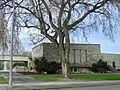
The former Richland City Hall, which has now been demolished
See also
 In Spanish: Richland (Washington) para niños
