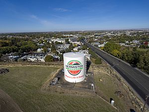
Hermiston, Oregon facts for kids
Quick facts for kids
Hermiston, Oregon
|
|
|---|---|
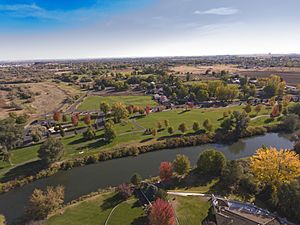
Riverfront Park & Umatilla River
|
|
| Etymology: Hermiston, Edinburgh (district of capital of Scotland) | |
| Motto(s):
"Where life is sweet."
|
|
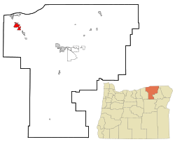
Location in Oregon
|
|
| Country | United States |
| State | Oregon |
| County | Umatilla |
| Incorporated | 1907 |
| Government | |
| • Type | Council-Manager |
| Area | |
| • City | 8.43 sq mi (21.83 km2) |
| • Land | 8.43 sq mi (21.83 km2) |
| • Water | 0.00 sq mi (0.00 km2) |
| Elevation | 482 ft (147 m) |
| Population
(2020)
|
|
| • City | 19,696 |
| • Density | 2,296.12/sq mi (886.50/km2) |
| • Metro | 92,261 |
| Demonym(s) | Hermistonian |
| Time zone | UTC-8 (Pacific) |
| • Summer (DST) | UTC-7 (Pacific) |
| ZIP code |
97838
|
| Area code(s) | 541 |
| FIPS code | 41-33700 |
| GNIS feature ID | 2410748 |
| Website | hermiston.or.us |
Hermiston is a city in Umatilla County, Oregon, United States. It's the biggest city in Eastern Oregon, with a population of over 20,000 people. Hermiston is also the largest and fastest-growing city in the Hermiston-Pendleton Micropolitan Statistical Area, which is one of Oregon's largest city areas.
The city is located close to where two major highways, I-82 and I-84, meet. It's also just 7 miles south of the Columbia River, the border with Washington, and McNary Dam. Because of its great location, fast internet connections, and low electricity costs, Hermiston has become an important place for shipping goods and for data centers (places that store lots of computer data).
Contents
History of Hermiston
Early Settlers and Rival Towns
Long ago, the Umatilla, Cayuse, Walla Walla, and Columbia Native American tribes lived in this area for thousands of years. The first European settlers arrived in 1847.
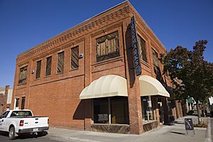
Hermiston's early days were a bit tricky because two groups, The Maxwell Land & Irrigation Company and Skinner & Newport, both wanted to build their own town of Hermiston in the same spot! They both wanted to be right in the middle of the farming area, next to the main train line. Maxwell got the train station on the west side of the tracks. But Skinner & Newport quickly planned their own Hermiston town right across the tracks in November 1904, just two days before Maxwell Company did.
Since neither side would give up, two separate business areas grew on each side of the tracks. Hermiston Avenue was on the west, and East Main Street was on the east. They even built their streets a bit off-center so they wouldn't line up! Each side had its own bank, hotel, and shops. In the end, East Main Street became the more successful area.
On July 10, 1907, Hermiston officially became a city. The original train station was called Maxwell. Later, an early settler named Colonel J. F. McNaught renamed the city Hermiston. He got the name from an unfinished book called Weir of Hermiston by Robert Louis Stevenson.
Growth and Development
Farming with irrigation (bringing water to crops) started in the Hermiston area around 1908. This happened after the U.S. Bureau of Reclamation finished the Cold Springs Reservoir.
Hermiston grew slowly until World War II. When the Umatilla Army Depot was built, many people moved to Hermiston. The population jumped from 803 people in 1940 to 3,804 in 1950!
The city continued to grow steadily. In the 1970s, cheap electricity and new ways of watering crops (called center-pivot irrigation) led to a huge increase in potato farming. Big companies like Lamb-Weston and Simplot built factories to make frozen potato products. This brought many jobs, and Hermiston's population nearly doubled again, from 4,893 in 1970 to 9,408 by 1980.
In the 1990s, more big employers came to Hermiston. These included the Two Rivers Correctional Institution (a prison), a Wal-Mart Distribution Center (a huge warehouse), and an expansion of the Union Pacific Hinkle Rail Yard. The Umatilla Army Depot also started getting rid of chemical weapons during this time.
Since 2000, Hermiston has kept growing and its economy has become more diverse. The population reached 19,354 by the 2020 Census. Hermiston is now a central place for businesses and services in the region.
The city is also famous for its delicious Watermelons, which are a big part of its local identity!
Economy
Shopping and Services
Hermiston is a main shopping and service center for much of western Umatilla County, as well as Morrow and parts of Gilliam counties. People from these areas often travel to Hermiston to buy things they need every week. About 46,000 people lived in Hermiston's local shopping area in 2010.
Even though Hermiston has a good local market, many people still go to the Tri-Cities in Washington for things they buy less often. The Tri-Cities area is about 30 minutes north of Hermiston and has a much larger population.
Local Workforce
Hermiston has the largest workforce in Eastern Oregon within a 30-mile radius. In 2018, over 135,503 people worked within this area. This is much more than other nearby cities. Hermiston businesses also benefit from being close to the Tri-Cities in Washington, which is only about 30-35 minutes away. This makes it easier for families where both parents work to find jobs.
Top Employers in Hermiston
Here are some of the biggest employers in Hermiston, based on a 2022 report:
| # | Employer | # of Employees |
|---|---|---|
| 1 | Amazon Web Services | 2,058 |
| 2 | Wal-Mart Distribution Center | 1,050 |
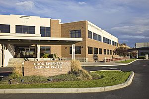
| 3 | Good Shepherd Healthcare System | 767 |
| 4 | First Coast Security | 750 |
| 5 | Lamb Weston - Hermiston | 625 |
| 6 | Hermiston School District | 623 |
| 7 | Two Rivers Correctional Institution | 440 |
| 8 | Wal-Mart Supercenter | 356 |
| 9 | Union Pacific Railroad | 300 |
| 10 | Marlette Homes | 250 |
Parks and Recreation
The City of Hermiston Parks Department takes care of 15 parks, 15 landscaped areas, and over 100 acres for everyone to enjoy. They also have plans for 50 more acres to be developed in the future.
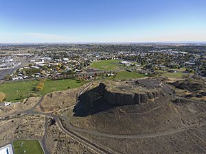
Some recent cool additions include Riverfront Park, the Oxbow Trail, and new parts of the Hermiston Family Aquatic Center. Riverfront Park is 16 acres of open grassy space along the Umatilla River. It has almost a mile of paved walking paths, picnic spots, restrooms, and places to fish.
The Oxbow Trail is a 1.8-mile paved walking path that was added in 2015. It connects Riverfront Park to the north side of town, near Good Shepherd Medical Center. This trail goes through a protected wetland area and also connects to Harrison Park.
Geography and Climate
Hermiston's Location
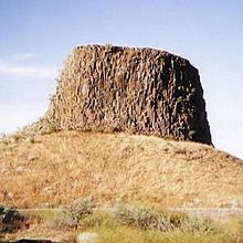
Hermiston covers an area of about 7.81 square miles, all of it land.
It's located in a great spot in the Pacific Northwest, close to many big cities:
- Tri-Cities, Washington - 30 to 45 miles away
- Portland, Oregon - 181 miles away
- Seattle, Washington - 259 miles away
- Spokane, Washington - 204 miles away
- Boise, Idaho - 259 miles away
- Salt Lake City, Utah - 587 miles away
- Missoula, Montana - 367 miles away
Hermiston's population has grown a lot recently because it's close to these major cities and sits along two important highways.
Weather in Hermiston
Hermiston has a steppe climate, which means it has hot, dry summers. Daytime temperatures can be very high, but they cool down a lot at night. Winters are usually cold and bring a few snowstorms each year, but not a lot of snow piles up.
On June 29, 2021, Hermiston recorded a temperature of 118°F (48°C). This was almost the highest temperature ever recorded in Oregon!
| Climate data for (Hermiston Municipal Airport), Oregon, 1991–2020 normals, extremes 1898, 1998–present | |||||||||||||
|---|---|---|---|---|---|---|---|---|---|---|---|---|---|
| Month | Jan | Feb | Mar | Apr | May | Jun | Jul | Aug | Sep | Oct | Nov | Dec | Year |
| Record high °F (°C) | 68 (20) |
71 (22) |
79 (26) |
90 (32) |
100 (38) |
118 (48) |
119 (48) |
110 (43) |
100 (38) |
88 (31) |
78 (26) |
72 (22) |
119 (48) |
| Mean maximum °F (°C) | 59.5 (15.3) |
61.7 (16.5) |
70.0 (21.1) |
81.3 (27.4) |
93.2 (34.0) |
99.1 (37.3) |
104.9 (40.5) |
102.8 (39.3) |
93.3 (34.1) |
79.2 (26.2) |
69.3 (20.7) |
61.3 (16.3) |
106.2 (41.2) |
| Mean daily maximum °F (°C) | 43.3 (6.3) |
49.4 (9.7) |
59.1 (15.1) |
66.6 (19.2) |
76.2 (24.6) |
82.2 (27.9) |
92.7 (33.7) |
91.0 (32.8) |
81.2 (27.3) |
66.5 (19.2) |
50.7 (10.4) |
42.1 (5.6) |
66.8 (19.3) |
| Daily mean °F (°C) | 36.0 (2.2) |
39.3 (4.1) |
46.4 (8.0) |
52.8 (11.6) |
61.2 (16.2) |
67.6 (19.8) |
75.6 (24.2) |
73.9 (23.3) |
64.6 (18.1) |
52.7 (11.5) |
41.5 (5.3) |
35.2 (1.8) |
53.9 (12.2) |
| Mean daily minimum °F (°C) | 28.7 (−1.8) |
29.2 (−1.6) |
33.7 (0.9) |
38.9 (3.8) |
46.3 (7.9) |
53.0 (11.7) |
58.6 (14.8) |
56.8 (13.8) |
47.9 (8.8) |
39.0 (3.9) |
32.3 (0.2) |
28.2 (−2.1) |
41.1 (5.1) |
| Mean minimum °F (°C) | 10.8 (−11.8) |
12.3 (−10.9) |
18.1 (−7.7) |
24.8 (−4.0) |
31.5 (−0.3) |
41.6 (5.3) |
45.3 (7.4) |
44.5 (6.9) |
34.7 (1.5) |
22.6 (−5.2) |
13.8 (−10.1) |
7.8 (−13.4) |
−1.0 (−18.3) |
| Record low °F (°C) | −12 (−24) |
−1 (−18) |
0 (−18) |
16 (−9) |
24 (−4) |
38 (3) |
38 (3) |
38 (3) |
26 (−3) |
7 (−14) |
−8 (−22) |
−16 (−27) |
−16 (−27) |
| Average precipitation inches (mm) | 1.14 (29) |
0.86 (22) |
0.77 (20) |
0.78 (20) |
0.83 (21) |
0.64 (16) |
0.12 (3.0) |
0.17 (4.3) |
0.33 (8.4) |
0.80 (20) |
1.05 (27) |
1.12 (28) |
8.61 (219) |
| Average precipitation days (≥ 0.01 in) | 9.5 | 8.4 | 8.3 | 6.5 | 7.7 | 5.3 | 1.5 | 1.9 | 2.8 | 7.5 | 10.3 | 10.5 | 80.2 |
| Source 1: NOAA | |||||||||||||
| Source 2: National Weather Service (mean maxima/minima 2006–2020) | |||||||||||||
Population Information
| Historical population | |||
|---|---|---|---|
| Census | Pop. | %± | |
| 1910 | 647 | — | |
| 1920 | 647 | 0.0% | |
| 1930 | 608 | −6.0% | |
| 1940 | 803 | 32.1% | |
| 1950 | 3,804 | 373.7% | |
| 1960 | 4,402 | 15.7% | |
| 1970 | 4,893 | 11.2% | |
| 1980 | 9,408 | 92.3% | |
| 1990 | 10,040 | 6.7% | |
| 2000 | 13,154 | 31.0% | |
| 2010 | 16,745 | 27.3% | |
| 2020 | 19,354 | 15.6% | |
| Sources: | |||
Recent Population Estimates
Portland State University's Population Research Center (PRC) makes the official yearly population estimates for cities and counties in Oregon. Their 2023 estimate for Hermiston was 20,322 people. These estimates are usually more accurate than the U.S. Census Bureau's yearly numbers.
2020 Census Results
According to the U.S. 2020 census, 19,354 people lived in Hermiston. This was a big jump of 2,609 residents since the 2010 Census. Hermiston's steady growth is unusual for smaller towns across the U.S.
The census also showed that:
- 56% of the people were White.
- 0.6% were African American.
- 1.5% were Native American.
- 1.4% were Asian.
- 0.3% were Pacific Islander.
- 22.6% were from other races.
- 17% identified as more than one race.
- 44.2% of the population was Hispanic or Latino.
2010 Census Details
In the census of 2010, there were 16,745 people living in Hermiston. There were 6,050 households, and 4,184 of those were families. The average number of people in a household was 2.74, and the average family size was 3.28.
- 42.0% of households had children under 18 living with them.
- 47.9% were married couples.
- 14.5% had a female head of household with no husband present.
- 6.8% had a male head of household with no wife present.
- 30.8% were not families.
- 25.8% of all households had only one person living there.
- 9.9% had someone living alone who was 65 years old or older.
The average age in the city was 30.9 years.
- 31.7% of residents were under 18.
- 9.2% were between 18 and 24.
- 27.3% were from 25 to 44.
- 20.8% were from 45 to 64.
- 11% were 65 years or older.
The city's population was 49.4% male and 50.6% female.
Education
Schools for Kids (K-12)
The Hermiston School District is the biggest school district in Eastern Oregon. In the 2020–21 school year, it had 5,508 students. The district has one high school, Hermiston High School, with 1,703 students. Because it's a large school, it can offer many different classes and programs for all students. The district also has two middle schools and six elementary schools. There are also two private schools in Hermiston.
People in the Hermiston School District really support education, as the number of students keeps growing. Voters approved a $69.9 million bond in 2008 and another $82.7 million bond in 2019 to help build and improve schools. The 2019 bond added a new elementary school and rebuilt the 57-year-old Rocky Heights Elementary School to be larger. It also added space for 200 more students at Hermiston High School.
Here's a list of the Hermiston School District's main buildings and when they were built or rebuilt:
| School | Construction Year |
|---|---|
| Loma Vista Elementary | 2022 |
| Rocky Heights Elementary (Rebuild) | 2022 |
| Armand Larive Middle | 2011 |
| Sunset Elementary | 2011 |
| West Park Elementary | 2010 |
| Desert View Elementary | 2001 |
| Sandstone Middle | 1995 |
| Hermiston High | 1992/2001 |
| Highland Hills Elementary | 1980 |
High School Sports
Hermiston High School plays sports at the 3A level in the Washington Interscholastic Activities Association. This means they compete against schools in Washington state. This was approved in 2017 because there aren't many other large high schools in Eastern Oregon for Hermiston to compete against. For example, the next largest high school in Eastern Oregon, Pendleton, only had 815 students compared to Hermiston's 1,703. Being part of the Washington league lets Hermiston High School play against schools from Kennewick, Richland, Pasco, and Walla Walla, Washington, which means less travel time for games.
College Education
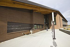
Blue Mountain Community College has a campus in Hermiston. Eastern Oregon University also offers college and graduate-level classes at the Eastern Oregon Higher Education Center in Hermiston.
Transportation
Highways and Roads
Hermiston is located almost exactly in the center of the Pacific Northwest, where several major interstate highways meet. This means drivers can easily reach all four major cities in the Northwest in just a few hours. Portland is less than 3 hours to the west. Drivers can also get to Spokane in less than 3 hours to the northeast. Both Seattle and Boise are about 4 hours away.
Highways that serve Hermiston include:
- Interstate 84 and U.S. Route 30, which run east–west.
- U.S. Route 395, which runs north–south.
- Interstate 82, which starts near Hermiston and goes north to Ellensburg, Washington.
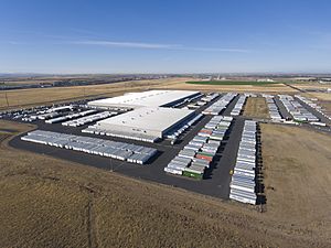
Important transportation businesses in Hermiston include Wal-Mart's Northwest Distribution Center. Also, both FedEx and United Parcel Service (UPS) have large shipping centers in Hermiston.
Train Services
Hermiston is on the main train line of the Union Pacific Railroad. This line was first built through the area in the 1870s. Train facilities near Hermiston include the Hinkle Locomotive Service and Repair Facility, where trains are fixed, and a "hump yard" for sorting train cars.
Airports
The Hermiston Municipal Airport is owned by the city. It's used by private planes, corporate jets, planes for farming, and cargo planes. There are no regular passenger flights from Hermiston.
The Tri-Cities Airport is about 40 minutes north of Hermiston. It offers commercial flights to many cities like Seattle, Salt Lake City, Denver, and San Francisco. In 2014, the airport started a $42 million project to make its terminal twice as big because more and more people were flying from there.
Media
Radio Stations
- KOHU 1360 AM (Country music)
- KQFM 93.7 FM (Adult Contemporary music)
- KLKY 96.1 FM (Classic Rock) - This station is based in Stanfield, Oregon.
- KZLY 99.5 FM (Spanish language)
- KGTS 91.3 FM (Christian music)
- KOLH 105.9 FM (Catholic - EWTN Radio)
Newspapers
- The Hermiston Herald (published every Wednesday)
- East Oregonian (This is a newspaper from Pendleton that also covers news in Hermiston. It's published Tuesday through Saturday.)
Notable People from Hermiston
- Tucker Bounds, a professional in public relations.
- Bucky Jacobsen, a baseball player.
- Chuck Norris, a politician.
- Shoni Schimmel, a basketball player.
- Jim Stuart, a football player.
- Jared Zabransky, a football player.
Annual Events
- Hermiston Raceway/Super Oval: This is a 3/8-mile paved oval track for stock car races. Races happen almost every Saturday from late April through the end of September.
- Farm City Pro Rodeo: A yearly rodeo held in August.
- Umatilla County Fair: A county fair that takes place every year.
See also
 In Spanish: Hermiston para niños
 | Delilah Pierce |
 | Gordon Parks |
 | Augusta Savage |
 | Charles Ethan Porter |


