Umatilla County, Oregon facts for kids
Quick facts for kids
Umatilla County
|
|
|---|---|
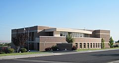
Stafford Hansell Government Center in Hermiston
|
|
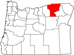
Location within the U.S. state of Oregon
|
|
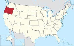 Oregon's location within the U.S. |
|
| Country | |
| State | |
| Founded | September 27, 1862 |
| Named for | Umatilla River |
| Seat | Pendleton |
| Largest city | Hermiston |
| Area | |
| • Total | 3,231 sq mi (8,370 km2) |
| • Land | 3,216 sq mi (8,330 km2) |
| • Water | 16 sq mi (40 km2) 0.5%% |
| Population
(2020)
|
|
| • Total | 80,075 |
| • Estimate
(2023)
|
80,053 |
| • Density | 20/sq mi (9/km2) |
| Time zone | UTC−8 (Pacific) |
| • Summer (DST) | UTC−7 (PDT) |
| Congressional district | 2nd |
Umatilla County is one of the 36 counties in the U.S. state of Oregon. A county is like a large district within a state. It helps organize local government and services.
About 80,000 people live here, making it the 14th largest county in Oregon. It is also the biggest county in Eastern Oregon. The city of Hermiston is the largest city in Umatilla County. However, Pendleton is the county seat, which means it's where the main county government offices are located. The county is named after the Umatilla River.
Contents
History of Umatilla County
Umatilla County was created a long time ago, on September 27, 1862. It was formed from a part of Wasco County. Over the years, its borders changed a bit as new counties like Grant and Morrow were formed.
When the county was first created, a place called Marshall Station was chosen as the temporary county seat. Later, in 1865, people voted to make Umatilla City (now just Umatilla) the official county seat. But as more people started farming wheat in the northern and eastern parts of the county, the population shifted. So, in 1868, the county seat was moved again to Pendleton, where it remains today.
The Umatilla Indian Reservation was set up in 1855 by a special agreement called the Treaty of Walla Walla. This reservation is home to the Umatillas, Walla Wallas, and Cayuse tribes. It is located just southeast of Pendleton.
In 2004, a large wireless internet network called EZ Wireless opened in Hermiston. It was one of the biggest Wi-Fi networks in the United States at the time. It was first created to help police, firefighters, and emergency medical workers communicate quickly. This was especially important near a special facility where the U.S. Army stored certain materials. Parts of this network can also be used by the public for free.
Geography of Umatilla County
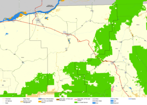
Umatilla County covers a total area of about 3,231 square miles. Most of this area is land, with only a small part being water. The county borders the Columbia River, which separates it from the state of Washington.
Neighboring Counties
Umatilla County shares its borders with several other counties:
- Benton County, Washington (to the north)
- Walla Walla County, Washington (to the north)
- Columbia County, Washington (to the northeast)
- Wallowa County (to the east)
- Union County (to the east)
- Grant County (to the south)
- Morrow County (to the west)
Special Protected Areas
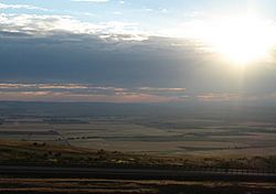
Some parts of Umatilla County are protected areas, meaning they are set aside for nature and wildlife. These include:
- Cold Springs National Wildlife Refuge
- McKay Creek National Wildlife Refuge
- Part of the Umatilla National Forest
- Part of the Whitman National Forest
People of Umatilla County (Demographics)
| Historical population | |||
|---|---|---|---|
| Census | Pop. | %± | |
| 1870 | 2,916 | — | |
| 1880 | 9,607 | 229.5% | |
| 1890 | 13,381 | 39.3% | |
| 1900 | 18,049 | 34.9% | |
| 1910 | 20,309 | 12.5% | |
| 1920 | 25,946 | 27.8% | |
| 1930 | 24,399 | −6.0% | |
| 1940 | 26,030 | 6.7% | |
| 1950 | 41,703 | 60.2% | |
| 1960 | 44,352 | 6.4% | |
| 1970 | 44,923 | 1.3% | |
| 1980 | 58,861 | 31.0% | |
| 1990 | 59,249 | 0.7% | |
| 2000 | 70,548 | 19.1% | |
| 2010 | 75,889 | 7.6% | |
| 2020 | 80,075 | 5.5% | |
| 2023 (est.) | 80,053 | 5.5% | |
| U.S. Decennial Census 1790–1960 1900–1990 1990–2000 2010–2020 |
|||
In 2010, about 75,889 people lived in Umatilla County. This means there were about 23.6 people living in each square mile. Most people (79.1%) were White. Other groups included American Indian (3.5%), Asian (0.9%), and Black or African American (0.8%). About 23.9% of the population were of Hispanic or Latino background.
The average age of people in the county was 35.7 years old. About 36.4% of households had children under 18 living with them.
Household Incomes in 2021
The economy in the western part of Umatilla County has grown a lot. This has made Hermiston a city with higher average household incomes than Pendleton. Here's how the median (middle) household incomes looked in 2021 for some cities:
| Rank | City | Median Income | % Change from 2010 |
|---|---|---|---|
| 1 | Hermiston | $60,971 | +46.5% |
| 2 | Pendleton | $58,093 | +27.8% |
| 3 | Umatilla | $51,790 | +25.1% |
| 4 | Milton-Freewater | $48,250 | +43.3% |
Economy of Umatilla County
The economy of Umatilla County has changed over time. In 1862, the discovery of gold brought miners and people raising livestock to the area. When the railroad arrived in 1881, it helped develop dry-land wheat farming.
Today, getting water for irrigation (watering crops) is very important for the economy. In the Hermiston area, farmers grow many different crops like potatoes, onions, and corn. The county also benefits from low-cost electricity and good access to highways. This has helped major companies like amazon.com, Walmart, FedEx, and UPS build large facilities in Hermiston. These facilities are important for storing and shipping goods.
Communities in Umatilla County
Umatilla County has three main areas, each with its own economy and culture. These are the West End, the Pendleton area, and the Milton-Freewater area. Even though they share some economic connections, they are quite far apart, making them distinct communities.
The West End includes cities like Hermiston, Umatilla, Stanfield, and Echo. The Pendleton area includes Pendleton, Pilot Rock, Adams, and Athena. The Milton-Freewater area is closely connected to the Walla Walla, Washington area.
There has been a friendly rivalry between the West End and the Pendleton area for a long time. They often compete over economic opportunities and public resources. The West End, led by Hermiston, is now almost twice as big as the Pendleton area and is expected to grow even more.
Cities in Umatilla County
Census-Designated Places
These are areas that are like towns but are not officially incorporated as cities.
- Cayuse
- Gopher Flats
- Green Meadows
- Kirkpatrick
- McKay
- Meacham
- Mission
- Riverside
- Tutuilla
- Umapine
Unincorporated Communities
These are smaller communities that are not part of any city or census-designated place.
- Bingham Springs
- Blakeley
- Bucks Corners
- Cobb
- Cold Springs
- Cold Springs Junction
- Crockett
- Ferndale
- Gibbon
- Hidaway Springs
- Hinkle
- Holdman
- Lehman Springs
- McNary
- Myrick
- Nolin
- Nye
- Power City
- Rieth
- Sunnyside
- Tollgate
- Westland
Former Communities
These are places that used to be communities but are no longer active.
- Fulton
- Ordnance
- Pine Grove
- Riverview
Education in Umatilla County
Children in Umatilla County attend schools in various school districts. Here are some of them:
- Athena-Weston School District 29J
- Echo School District 5
- Helix School District 1
- Hermiston School District 8
- Milton-Freewater School District 7
- Pendleton School District 16
- Pilot Rock School District 2
- Stanfield School District 61
- Ukiah School District 80
- Umatilla School District 6
See also
 In Spanish: Condado de Umatilla para niños
 | John T. Biggers |
 | Thomas Blackshear |
 | Mark Bradford |
 | Beverly Buchanan |


