Morrow County, Oregon facts for kids
Quick facts for kids
Morrow County
|
|
|---|---|

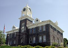
Morrow County Courthouse in Heppner
|
|

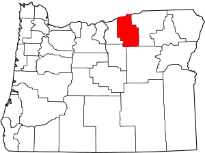
Location within the U.S. state of Oregon
|
|
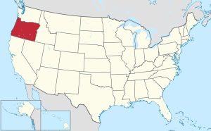
 Oregon's location within the U.S. |
|
| Country | |
| State | |
| Founded | February 16, 1885 |
| Named for | Jackson L. Morrow |
| Seat | Heppner |
| Largest city | Boardman |
| Area | |
| • Total | 2,049 sq mi (5,310 km2) |
| • Land | 2,032 sq mi (5,260 km2) |
| • Water | 17 sq mi (40 km2) 0.8%% |
| Population
(2020)
|
|
| • Total | 12,186 |
| • Estimate
(2023)
|
12,302 |
| • Density | 5.9473/sq mi (2.2963/km2) |
| Time zone | UTC−8 (Pacific) |
| • Summer (DST) | UTC−7 (PDT) |
| Congressional district | 2nd |
Morrow County is one of the 36 counties in the U.S. state of Oregon. In 2020, about 12,186 people lived there. The main town, or county seat, is Heppner.
The county got its name from Jackson L. Morrow. He was one of the first people to settle in the area. He also helped create the county when he was a member of the state government. Part of the Umatilla Chemical Depot and the Naval Weapons Systems Training Facility Boardman are located in Morrow County. The county is also part of the Pendleton-Hermiston area. It is found on the south side of the Columbia River in Eastern Oregon.
Contents
History of Morrow County
Morrow County was formed in 1885. It was created from parts of Umatilla County and Wasco County. The county is named after Jackson L. Morrow, who was a state representative. He worked to make the county official.
Heppner was chosen as the temporary county seat when the county was new. Later, in 1887, people voted to make Heppner the permanent county seat. It won against Lexington by a small number of votes.
Geography of Morrow County
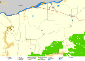
Morrow County is in the eastern part of Oregon. It shares borders with Grant, Gilliam, and Umatilla counties. The Columbia River forms the northern border of the county.
Most of Morrow County is flat and dry. However, the southern part has a section of the Blue Mountains. This makes that area quite hilly and mountainous. The highest point in the county is Black Mountain. It is part of the Umatilla National Forest and stands about 5,923 feet (1,805 meters) tall. Rivers flow from these mountains into the Columbia River.
The United States Census Bureau says the county covers about 2,049 square miles (5,307 square kilometers). Most of this, 2,032 square miles (5,263 square kilometers), is land. The remaining 17 square miles (44 square kilometers) is water.
Neighboring Counties
- Gilliam County - to the west
- Wheeler County - to the southwest
- Grant County - to the south
- Umatilla County - to the east
- Benton County, Washington - to the north
- Klickitat County, Washington - to the northwest
Protected Natural Areas
- Umatilla National Forest (part of it)
- Umatilla National Wildlife Refuge (part of it)
Population in Morrow County
| Historical population | |||
|---|---|---|---|
| Census | Pop. | %± | |
| 1890 | 4,205 | — | |
| 1900 | 4,151 | −1.3% | |
| 1910 | 4,357 | 5.0% | |
| 1920 | 5,617 | 28.9% | |
| 1930 | 4,941 | −12.0% | |
| 1940 | 4,337 | −12.2% | |
| 1950 | 4,783 | 10.3% | |
| 1960 | 4,871 | 1.8% | |
| 1970 | 4,465 | −8.3% | |
| 1980 | 7,519 | 68.4% | |
| 1990 | 7,625 | 1.4% | |
| 2000 | 10,995 | 44.2% | |
| 2010 | 11,173 | 1.6% | |
| 2020 | 12,186 | 9.1% | |
| 2023 (est.) | 12,302 | 10.1% | |
| U.S. Decennial Census 1790–1960 1900–1990 1990–2000 2010–2020 |
|||
In 2010, the census showed that 11,173 people lived in Morrow County. There were 3,916 households, which are groups of people living together. About 2,953 of these were families. On average, there were about 5.5 people per square mile.
Most people in the county were white (77.7%). About 16.9% were from other races, and 2.6% were from two or more races. People of Hispanic or Latino background made up 31.3% of the population. Many people had German, English, or Irish family roots.
About 37.7% of households had children under 18 living with them. The average household had 2.85 people, and the average family had 3.25 people. The average age of people in the county was 36.5 years old.
The average income for a household was about $43,902 per year. For families, it was about $49,868 per year. About 15.3% of all people in the county lived below the poverty line. This included 21.7% of children under 18.
Economy of Morrow County
The main ways people make a living in Morrow County today are through farming and growing food. Other important jobs include working with wood, raising animals, and tourism. The Columbia River also provides many jobs related to shipping and trade. The Port of Morrow was started in 1957. It is located on the Columbia River near the city of Boardman.

Long ago, cattle ranchers found lots of rye grass along the creeks. They brought their herds to eat these natural grasses. For many years, ranching was the most important business in the county. But as more people settled there, the open grazing lands became smaller. This led to less ranching and more farming.
When train lines were built into the county in 1883, it became easier to sell crops. This helped wheat farming grow. Later, new ways of watering crops, like center pivot irrigation, helped the local economy even more.
There are also two power plants at the Port of Morrow that use natural gas. These are called Coyote Springs I and Coyote Springs II. In 2022, the company Amazon announced plans to build several large data centers in Morrow County. This project is expected to cost a lot of money and bring new jobs.
Transportation
Airports
- Boardman Airport
- Lexington Airport
Major Roads
Communities
Cities
Unincorporated Communities
Former Communities
See also
 In Spanish: Condado de Morrow (Oregón) para niños
 | Janet Taylor Pickett |
 | Synthia Saint James |
 | Howardena Pindell |
 | Faith Ringgold |


