
Ruggs, Oregon facts for kids
Quick facts for kids
Ruggs, Oregon
|
|
|---|---|

Grain elevator along Oregon Route 206 in Ruggs
|
|

Ruggs, Oregon
Location in Oregon

Ruggs, Oregon
Location in the United States
|
|
| Country | United States |
| State | Oregon |
| County | Morrow |
| Elevation | 2,136 ft (651 m) |
| Time zone | UTC-8 (Pacific (PST)) |
| • Summer (DST) | UTC-7 (PDT) |
| ZIP code |
97836
|
| Area code(s) | 458 and 541 |
| GNIS feature ID | 1126358 |
Ruggs is a small, unincorporated community in Morrow County, Oregon, United States. It's not a city or town with its own government. Ruggs is located where several roads meet, including Oregon Route 206 and Oregon Route 207. The community is named after Edward E. Rugg Jr., whose family were important farmers and ranchers in the area starting in the early 1900s. Sometimes, people call it "Ruggs Junction" or "Ruggs District."
Contents
History of Ruggs
How the Land Was Formed
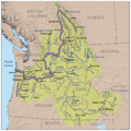
The land around Ruggs has a cool history! It's part of the Columbia Basin. This area was shaped by huge glacial floods long ago. These floods left behind special soils and rugged hills made of basalt rock. Basalt is a type of rock formed from lava flows. The Columbia River Basalt Group lava flows created the bedrock under the canyons and plateaus here.
Ruggs is also where two different natural areas meet: the Columbia Basin and the Blue Mountain regions. The Columbia Basin is mostly hilly land that slopes upwards. The Blue Mountain area has higher elevations.
Native American Life
For over 10,000 years, Native American tribes lived and traveled through the area around Ruggs. They moved between the Columbia Gorge and the Blue Mountains depending on the season. Local records show that Native Americans and settlers met in the late 1800s. One famous visitor was Chief Joseph of the Nez Perce tribe. Another group, known as the Columbia River Renegades, also visited often. They fished for salmon and hunted animals like elk and bear in the Blue Mountains during summer.
Early Settlers Arrive
The first European-American families, the Rhea and Wright families, settled in this area in the 1860s and 1870s. They lived along Rhea Creek. In 1872, a store was set up by Daniel Taylor Spencer, but it later moved to a nearby town called Heppner. Other settlers, like Orin E. Farnsworth, also arrived around this time.
The Rugg Family Story
The community of Ruggs is named after Edward E. Rugg, Jr., who was born in Iowa in 1880.
From North Dakota to Oregon
Edward E. Rugg Sr., Edward Jr.'s father, was a well-known farmer in North Dakota. His family moved to Oregon in 1911, first settling near Hood River. They later bought more land. By the end of 1913, the Rugg family made their final move to Heppner, Oregon.
Making a Mark in Oregon
In 1914, the Rugg family became very active in farming and ranching southwest of Heppner. They helped start and lead many important groups in Morrow County. These groups supported farming, ranching, and community efforts, like the Morrow County Farm Bureau and the Morrow County Woolgrowers’ Association. They played a big part in the area's growth.
Geography of Ruggs
Ruggs is about 7 miles (11 km) east of Eightmile and 11 miles (18 km) southwest of Heppner. It's located in eastern Oregon, in a dry area called the Columbia Plateau. This region has a lot of sagebrush and grasslands. The ground here is made of basalt rock, which can be up to two miles thick!
Farmers often grow winter wheat or alfalfa in areas with thick soil. In more rugged places, you'll find rangeland where animals graze. The amount of rain here is usually between 9 and 15 inches per year, and it rains more in higher areas.
Ruggs is located along Rhea Creek, which flows into Willow Creek. These creeks eventually join the Columbia River.
Education in Ruggs
Records show that a school called the Golden West School existed in Ruggs as early as 1926. It was located near the Rhea Creek Grange Hall, a community building.
Fun Things to Do in Ruggs
Hunting Adventures
If you like hunting, Ruggs is known for Ruggs Ranch. This outfitter helps people go hunting for wild birds and big game animals.
Bird Watching
Ruggs was once the center of an annual event called the Ruggs-Hardman Christmas Bird Count. This count started in 1967 and was run by local high school students. It was similar to the National Audubon Society's Christmas Bird Count. In 1978, people counted over 3,300 different birds within 17 miles of Ruggs!
Farming and Animals
The large grain elevator you see in pictures of Ruggs has been there since 1930. That's when the Morrow County Grain Growers group was formed to help sell wheat grown by local farmers. They built grain elevators in Ruggs and other nearby towns to store the wheat. Ruggs also has a unique claim to fame: it was home to Oregon's very first buffalo herd, owned by Harold and Mary Wright! They also kept llamas.
Images for kids
-
Map showing the Columbia Basin.

