
Gilliam County, Oregon facts for kids
Quick facts for kids
Gilliam County
|
|
|---|---|

Gilliam County Courthouse in Condon
|
|

Location within the U.S. state of Oregon
|
|
 Oregon's location within the U.S. |
|
| Country | |
| State | |
| Founded | February 25, 1885 |
| Named for | Cornelius Gilliam |
| Seat | Condon |
| Largest city | Condon |
| Area | |
| • Total | 1,223 sq mi (3,170 km2) |
| • Land | 1,205 sq mi (3,120 km2) |
| • Water | 18 sq mi (50 km2) 1.5%% |
| Population
(2020)
|
|
| • Total | 1,995 |
| • Estimate
(2023)
|
2,026 |
| • Density | 1.6312/sq mi (0.6298/km2) |
| Congressional district | 2nd |
Gilliam County is one of the 36 counties in the U.S. state of Oregon. It is located in the northern part of the state. In 2020, about 1,995 people lived here. This makes it the third smallest county in Oregon by population. The main town and county seat is Condon. The county was created in 1885. It is named after Cornelius Gilliam, a colonel who led a group of settlers in Oregon's early days.
Contents
History of Gilliam County
_(gilDA0177).jpg)
The Oregon government created Gilliam County on February 25, 1885. It was formed from the eastern part of Wasco County. People living there felt they were too far from their county seat in The Dalles.
The first county seat for Gilliam County was a place called Alkali, which is now Arlington. Voters then decided where the permanent county seat should be. After a few votes, they chose Condon in 1890. Early settlers knew Condon as "Summit Springs."
Even after choosing Condon, it took a while to build a courthouse. The county government worked out of a small two-room house until 1903. That's when they finally built a courthouse. Sadly, this building burned down in 1954. A new courthouse was built the very next year, which is the one still used today.
Wind Power in Gilliam County
A very large wind farm called Shepherds Flat Wind Farm was built near Arlington. Construction started in 2009. This wind farm uses many wind turbines to make electricity. It helps supply power to homes and businesses in Southern California. In 2011, Google invested $100 million in this project. The wind farm brings about $16 million to Oregon's economy each year.
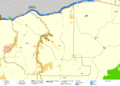
Geography and Location

Gilliam County is in the central northern part of Oregon. It is located east of the Cascade Range mountains. The John Day River forms its western border. The Columbia River forms its northern border.
Most of the county is flat land. However, there are also many canyons. These canyons were formed by streams flowing from the Blue Mountains.
The United States Census Bureau says the county covers about 1,223 square miles (3,168 square kilometers). Most of this area, about 1,205 square miles (3,121 square kilometers), is land. The rest, about 18 square miles (47 square kilometers), is water.
Neighboring Counties
Gilliam County shares borders with several other counties:
- Klickitat County, Washington - to the north
- Morrow County - to the east
- Wheeler County - to the south
- Wasco County - to the southwest
- Sherman County - to the west
Population and People
| Historical population | |||
|---|---|---|---|
| Census | Pop. | %± | |
| 1890 | 3,600 | — | |
| 1900 | 3,201 | −11.1% | |
| 1910 | 3,701 | 15.6% | |
| 1920 | 3,960 | 7.0% | |
| 1930 | 3,467 | −12.4% | |
| 1940 | 2,844 | −18.0% | |
| 1950 | 2,817 | −0.9% | |
| 1960 | 3,069 | 8.9% | |
| 1970 | 2,342 | −23.7% | |
| 1980 | 2,057 | −12.2% | |
| 1990 | 1,717 | −16.5% | |
| 2000 | 1,915 | 11.5% | |
| 2010 | 1,871 | −2.3% | |
| 2020 | 1,995 | 6.6% | |
| 2023 (est.) | 2,026 | 8.3% | |
| U.S. Decennial Census 1790–1960 1900–1990 1990–2000 2010–2020 |
|||
What the 2010 Census Showed
In 2010, there were 1,871 people living in Gilliam County. These people lived in 864 households. About 508 of these were families. The county had about 1.6 people per square mile.
Most people in the county were white (95.2%). Other groups included American Indian, Pacific Islander, Asian, and African American people. About 4.7% of the population was of Hispanic or Latino background.
The average age of people in the county was 49.7 years old. About 22.5% of households had children under 18 living with them. The average household had 2.14 people.
Towns and Communities
Cities in Gilliam County
Smaller Communities
Past Communities
- Ajax
- Barnett
- Blalock
- Gwendolen
- Heppner Junction
- Montague
- Quinton
- Rhea
- Shutler
Economy and Jobs

Gilliam County is known for its farming. It is in the middle of the Columbia River Plateau, which is a big area for growing wheat. The main jobs here are in agriculture. Farmers grow wheat and barley, and they raise beef cattle. Farms in Gilliam County are very large, often around 4,200 acres (17 square kilometers) on average.
The biggest employers in the county are two companies that manage waste. They run large landfills for trash disposal. These companies pay a fee for every ton of waste. This money helps Gilliam County pay for many things. It even helps pay the first $500 of property taxes for its residents. For almost half the people in the county, this covers their entire tax bill!
Other important industries include hunting, fishing, and tourism. Transportation also helps the local economy. Two major rivers, the John Day and Columbia, flow through the area. Interstate 84 also crosses the county. Oregon Route 19 connects the main towns from north to south. It also provides access to the John Day Valley.
Images for kids
-

Gilliam County Courthouse in Condon
-

Old grain elevator in Gwendolen, in Gilliam County.
-
Map of Gilliam County
-

The view westward of a wheat field off Highway 19.
See also
 In Spanish: Condado de Gilliam para niños
