Umapine, Oregon facts for kids
Umapine is a small community in Umatilla County, Oregon, United States. It is located about two miles from the border with Washington. In 2010, about 315 people lived there.
The area around Umapine is mostly farmland. Farmers grow crops like wheat and hay. There are also apple orchards and a growing number of vineyards. Some of the main places in Umapine include Tate's Umapine Market, The Umapine Creamery, and the Waterhole Tavern.
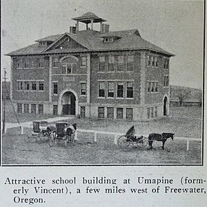
For many years, Umapine had its own school. This school taught students from kindergarten all the way through twelfth grade. The school's mascot was the Umapine Chiefs. About 100 students went to the school each year.
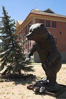
The school building was sold in the early 1990s. An artist bought it and started a bronze art business there. After the artist passed away, the old school building was no longer used. It is a large brick building with three stories.
Contents
Places to Visit in Umapine
Umapine has a few local spots. Tate's Mercantile and the Waterhole are two restaurants. Tate's is in an old building that used to be a post office and creamery from the 1900s. The Waterhole has been around since the 1940s in different forms.
The Umapine Creamery is a newer business. It is a family-run dairy that sells cheese. Their cheese is sold in many places across the Walla Walla Valley. A tall, dark blue water tower is also a well-known landmark in Umapine. Pilots flying overhead often use it as a guide.
Community Life in Umapine
The people in Umapine often get together for community events. They have "Spring Cleans" to tidy up the area. They also hold Community Yard Sales. These two events happen every two years, switching back and forth.
Many artists now live in Umapine. There are also cattle farms that have been there for over a hundred years. The people living in Umapine come from different backgrounds.
Umapine's History
Umapine started as a stop for the Walla Walla Valley Railway in the early 1900s. It had a busy lumber yard and many dairy farms. The railway closed in 1942. The old railway path then became the Umapine Highway.
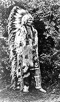
Umapine was first called Vincent, Oregon. But there was already another post office with that name in Wallowa County. So, the community decided to change the name. They chose "Umapine" to honor a respected Native American chief. Chief Umapine was either from the Cayuse or Umatilla tribes.
The Umapine post office opened in June 1916. After a few fires, it closed in December 1966. Today, Umapine uses the mailing address for Milton-Freewater.
The 1936 Earthquake
In 1936, an earthquake happened near Umapine. It was called the 1936 State Line earthquake. The ground cracked in places, with some cracks being up to 6 inches (15 cm) wide. Water even flowed out of some of these cracks. This showed a process called soil liquefaction, where the ground acts like a liquid during an earthquake. Some cracks were 8 feet (2.4 meters) deep.
People in nearby Walla Walla heard rumbling sounds just before the ground started shaking. At one point, the ground dropped by about 8 feet (2.4 meters). About 70% of the gravestones in a nearby cemetery were found to have turned clockwise.
See also
 In Spanish: Umapine para niños
 | Percy Lavon Julian |
 | Katherine Johnson |
 | George Washington Carver |
 | Annie Easley |


