Wallowa County, Oregon facts for kids
Quick facts for kids
Wallowa County
|
|
|---|---|
|
|
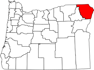
Location within the U.S. state of Oregon
|
|
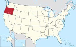 Oregon's location within the U.S. |
|
| Country | |
| State | |
| Founded | October 14, 1887 |
| Named for | Wallowa River |
| Seat | Enterprise |
| Largest city | Enterprise |
| Area | |
| • Total | 3,152 sq mi (8,160 km2) |
| • Land | 3,146 sq mi (8,150 km2) |
| • Water | 5.5 sq mi (14 km2) 0.2%% |
| Population
(2020)
|
|
| • Total | 7,391 |
| • Estimate
(2023)
|
7,674 |
| • Density | 2.2/sq mi (0.8/km2) |
| Time zone | UTC−8 (Pacific) |
| • Summer (DST) | UTC−7 (PDT) |
| Congressional district | 2nd |
Wallowa County (/wəˈlaʊwə/) is a county located in the northeastern part of Oregon. In 2020, about 7,391 people lived there. This makes it one of Oregon's least populated counties. The main town and county seat is Enterprise.
The name Wallowa likely comes from the Nez Perce language. It might mean a special structure made of stakes used for fishing. Another idea is that it means "winding water." The famous explorers Lewis and Clark wrote about the Wallowa River and called it Wil-le-wah. Wallowa County is part of a larger area known as Eastern Oregon.
Contents
History
When Was Wallowa County Formed?
The first white settlers arrived in the Wallowa Valley in 1871. They came looking for places to feed their livestock. Wallowa County was officially created on February 11, 1887. It was formed from the eastern part of Union County. The borders with Union County were changed a few times in the late 1800s and early 1900s.
The Story of Chief Joseph and the Nez Perce People
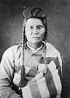
In 1877, a leader of the Nez Perce named Chief Joseph faced a difficult situation. The government wanted his people to move from the Wallowa Valley to a reservation in Idaho. Chief Joseph did not want to leave his homeland.
The U.S. Army sent soldiers to make them move. The Nez Perce fought several battles and traveled almost 2,000 miles (3,200 km). Their journey ended at Bear Paw, just before reaching the Canadian border. Chief Joseph and other leaders decided to stop fighting.
Many Nez Perce survivors were held in prison camps. Later, some moved to the Colville Reservation in Washington. Others went to the Nez Perce Reservation in Idaho. Chief Joseph visited Wallowa County one last time in 1902. He passed away two years later.
A Difficult Event in Hells Canyon
In May 1887, a very sad event happened in Hells Canyon. A group of rustlers attacked Chinese gold miners. Between 10 and 34 miners lost their lives. Only three of the seven people thought to be responsible went to trial. A jury found them not guilty in September 1888. Today, a place called Chinese Massacre Cove remembers this event. It became an official site in 2005.
The Joseph Town Bank Robbery
In 1896, the bank in the town of Joseph was robbed. There was a shootout in the streets. Sometimes, the town still has re-enactments of this historical event.
Wallowa County Courthouse
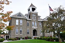
The Wallowa County Courthouse was built between 1909 and 1910. It was made from local volcanic rock called Bowlby stone. The building has a Romanesque Revival style. It also has some Queen Anne features. The courthouse was added to the National Register of Historic Places in 2000.
Today, the courthouse still holds government offices. It is surrounded by a square with trees like oak, pine, and maple. There are also rose bushes and memorials for veterans. A wooden gazebo stands in one corner of the square.
Famous Visitors to Wallowa County
Supreme Court Justice William O. Douglas was a famous summer visitor. He built a vacation cabin there in 1939.
Protecting Important Land
In 2003, a plan was made to build homes near Wallowa Lake. This land was next to the grave of Old Chief Joseph, the father of the younger Chief Joseph. Many local groups and Native American tribes did not like this plan. They wanted to protect the land. The National Park Service and the Trust for Public Land tried to buy the land, but their offers were not accepted. The debate about this land continued for many years.
Geography
Where is Wallowa County Located?
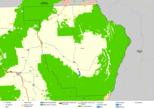
Wallowa County is in the very northeast corner of Oregon. It covers a total area of about 3,152 square miles (8,160 km²). Most of this area is land, with only a small part being water.
What Are the Main Natural Features?
Wallowa Lake and the Wallowa Mountains are big attractions for tourists. The lake was formed naturally by glaciers. It is surrounded by large hills called moraines. The weather around the lake is often cooler than nearby areas. This makes it a nice place to visit in the summer.
Other important natural features include:
Which Counties Are Nearby?
Wallowa County shares borders with several other counties:
- In Washington: Columbia County, Garfield County, Asotin County
- In Idaho: Nez Perce County, Idaho County, Adams County
- In Oregon: Baker County, Union County, Umatilla County
What Protected Areas Are in Wallowa County?
Parts of these national protected areas are found in Wallowa County:
- Nez Perce National Historical Park
- Umatilla National Forest
- Wallowa–Whitman National Forest
- Hells Canyon National Recreation Area
People and Population
| Historical population | |||
|---|---|---|---|
| Census | Pop. | %± | |
| 1890 | 3,661 | — | |
| 1900 | 5,538 | 51.3% | |
| 1910 | 8,364 | 51.0% | |
| 1920 | 9,778 | 16.9% | |
| 1930 | 7,814 | −20.1% | |
| 1940 | 7,623 | −2.4% | |
| 1950 | 7,264 | −4.7% | |
| 1960 | 7,102 | −2.2% | |
| 1970 | 6,247 | −12.0% | |
| 1980 | 7,273 | 16.4% | |
| 1990 | 6,911 | −5.0% | |
| 2000 | 7,226 | 4.6% | |
| 2010 | 7,008 | −3.0% | |
| 2020 | 7,391 | 5.5% | |
| 2023 (est.) | 7,674 | 9.5% | |
| U.S. Decennial Census 1790–1960 1900–1990 1990–2000 2010–2020 |
|||
What is the Population Like?
In 2010, about 7,008 people lived in Wallowa County. Most people (96%) were white. About 2.2% of the population was of Hispanic or Latino origin. The average age of people living there was 50.5 years old.
The average income for a household was around $41,116. About 12.9% of the population lived below the poverty line. This included 17.4% of those under 18 years old.
Communities
Cities in Wallowa County
- Enterprise (the county seat)
- Joseph
- Lostine
- Wallowa
Other Communities
- Wallowa Lake (a census-designated place)
Many smaller, unincorporated communities are also found in the county:
Economy
What Are the Main Jobs in Wallowa County?
The main industries in Wallowa County are:
- Agriculture (farming)
- Ranching (raising livestock)
- Lumber (wood production)
- Tourism (people visiting for fun)
Since 1985, several bronze foundries (places that make metal statues) have opened. These are mostly in Joseph and Enterprise. These businesses have helped the local economy. The Forest Service owns a large part of the land in the county (56%).
Transportation
Major Roads
 Oregon Route 3: Goes north into Washington.
 Oregon Route 82: Goes west to La Grande, connecting to
  Interstate 84.
Railroads
- Eagle Cap Excursion Train (a scenic train ride)
Notable People
| style="text-align: left; vertical-align: top; padding-left: 4em; " |
- Eugene Pallette
- Amos Marsh
- Frank Wayne Marsh
See also
 In Spanish: Condado de Wallowa para niños
 | Jackie Robinson |
 | Jack Johnson |
 | Althea Gibson |
 | Arthur Ashe |
 | Muhammad Ali |


