
Union County, Oregon facts for kids
Quick facts for kids
Union County
|
|
|---|---|

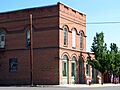
Union County Museum
|
|

Location within the U.S. state of Oregon
|
|
 Oregon's location within the U.S. |
|
| Country | |
| State | |
| Founded | October 14, 1864 |
| Named for | Union, Oregon |
| Seat | La Grande |
| Largest city | La Grande |
| Area | |
| • Total | 2,039 sq mi (5,280 km2) |
| • Land | 2,037 sq mi (5,280 km2) |
| • Water | 1.9 sq mi (5 km2) 0.1%% |
| Population
(2020)
|
|
| • Total | 26,196 |
| • Estimate
(2023)
|
25,944 |
| • Density | 13/sq mi (5/km2) |
| Time zone | UTC−8 (Pacific) |
| • Summer (DST) | UTC−7 (PDT) |
| Congressional district | 2nd |
Union County is one of the 36 counties in the state of Oregon, located in the United States. It's one of the eight counties found in eastern Oregon. In 2020, about 26,196 people lived here. The main city and county seat is La Grande. This area is also known as the La Grande micropolitan statistical area.
Contents
History of Union County
Union County gets its name from the town of Union. Long ago, this area was part of a much bigger county called Baker County. Baker County itself was once part of Wasco County.
How Union County Was Formed
In the 1860s, more and more people started moving to eastern Oregon. Because of this growth, the state decided to create new counties. In 1862, Umatilla and Baker Counties were formed from Wasco County.
As even more people settled in the Grande Ronde Valley, Baker County was split again. This led to the creation of Union County on October 14, 1864. The number of people living in the county doubled between 1880 and 1890.
Choosing a County Seat
The towns of La Grande and Union both wanted to be the county seat. A county seat is the main town where the county government offices are. They competed based on their location and how much they were growing.
For a while, the county seat moved back and forth between Union and La Grande. Finally, in 1905, La Grande became the permanent county seat. Between 1875 and 1913, the borders of Union County were slightly changed to fit better with Baker, Umatilla, and Wallowa counties.
Geography of Union County

Union County covers a total area of about 2,039 square miles. Most of this area, about 2,037 square miles, is land. Only a small part, about 1.9 square miles, is water.
A large portion of the land in Union County, about 47%, is owned by the United States Forest Service. This means there are many forests and natural areas.
Neighboring Counties
Union County shares its borders with several other counties:
- Umatilla County to the northwest
- Wallowa County to the northeast
- Baker County to the southeast
- Grant County to the southwest
People of Union County
In 2010, there were 25,748 people living in Union County. There were 10,501 households, which are groups of people living together in one home. Most people in the county were white (93.1%). Other groups included American Indian, Pacific Islander, Asian, and Black or African American. About 3.9% of the population was of Hispanic or Latino origin.
The average age of people in Union County was 40 years old. The median income for a household was $42,162. This is the middle amount of money that households earned each year. About 16.1% of all people in the county lived below the poverty line. This means they had a hard time affording basic needs.
Communities in Union County
Union County has several cities and smaller communities.
Cities
- Cove
- Elgin
- Imbler
- Island City
- La Grande (county seat)
- North Powder
- Summerville
- Union
Unincorporated Communities
These are smaller towns or areas that are not officially organized as cities.
Ghost Towns and Former Communities
These are places where people used to live, but they are now empty or no longer exist as communities.
Economy and Fun Things to Do
At first, mining was important in Union County. But most of the mines later became part of Baker County. Today, the economy still relies on natural resources. This includes farming (like wheat, fruit, and vegetables) and ranching (raising cattle and sheep). Timber (wood from trees) is also a big part of the economy.
The Elkhorn Valley Wind Farm is located on the ridges of Pyles Canyon. This wind farm uses wind turbines to create electricity. There are also plans for another wind power project called Antelope Ridge Wind Farm.
Outdoor Activities and Attractions
Union County is a great place for outdoor adventures. The nearby mountains and streams offer many activities for visitors. You can go hunting, fishing, skiing, and camping.
Some popular places to visit include:
- The Anthony Lakes area, which has a ski resort.
- The Minam River.
- Mount Emily.
- Parts of the Blue Mountains.
- The Umatilla National Forest and Wallowa–Whitman National Forest (which includes the Eagle Cap Wilderness).
- Catherine Creek State Park.
- Hilgard Junction State Recreation Area.
- Thief Valley Reservoir.
- The Cove Hot Springs Pool.
- The Hot Lake Hotel, which was built in the 1860s near natural hot springs.
- The Eagle Cap Excursion Train.

Images for kids
-
Union County Museum
See also
 In Spanish: Condado de Union (Oregón) para niños
