Ordnance, Oregon facts for kids
Quick facts for kids
Ordnance
|
|
|---|---|
 |
|
| Country | United States |
| State | Oregon |
| County | Umatilla |
| Elevation | 587 ft (179 m) |
| Time zone | UTC-8 (Pacific (PST)) |
| • Summer (DST) | UTC-7 (PDT) |
| ZIP codes |
97882
|
| Area code(s) | 541 |
| GNIS feature ID | 1136600 |
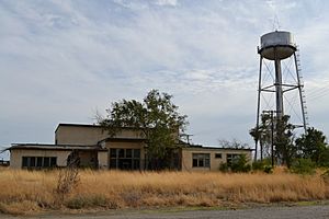
Ordnance is a fascinating ghost town located in Umatilla County, Oregon, in the United States. It's found southwest of Hermiston, right off Interstate 84 and U.S. Route 30. A ghost town is a place that used to be a busy community but is now mostly empty.
What Was Ordnance?
Ordnance was a small community that grew up around a military base. This base was very important during World War II. The town was named after the base, which handled military supplies.
How Ordnance Got Its Name
In 1941, the United States Department of War decided to build a large military base. This base was called the Umatilla Ordnance Depot. An "ordnance depot" is a place where weapons, ammunition, and other military equipment are stored.
The depot was located in northern Umatilla County. The town that grew nearby was named Ordnance because of this important military site. A post office for Ordnance was opened in 1943.
Why Ordnance Became a Ghost Town
After World War II ended, the need for military supplies decreased. The government started to reduce funding for the Umatilla Ordnance Depot. Over time, the depot became less active.
As the military funding went down, fewer people were needed to work there. By the 1960s, most people had moved away. This caused Ordnance to become a ghost town, with very few residents left.
 | William L. Dawson |
 | W. E. B. Du Bois |
 | Harry Belafonte |


